MyTopo
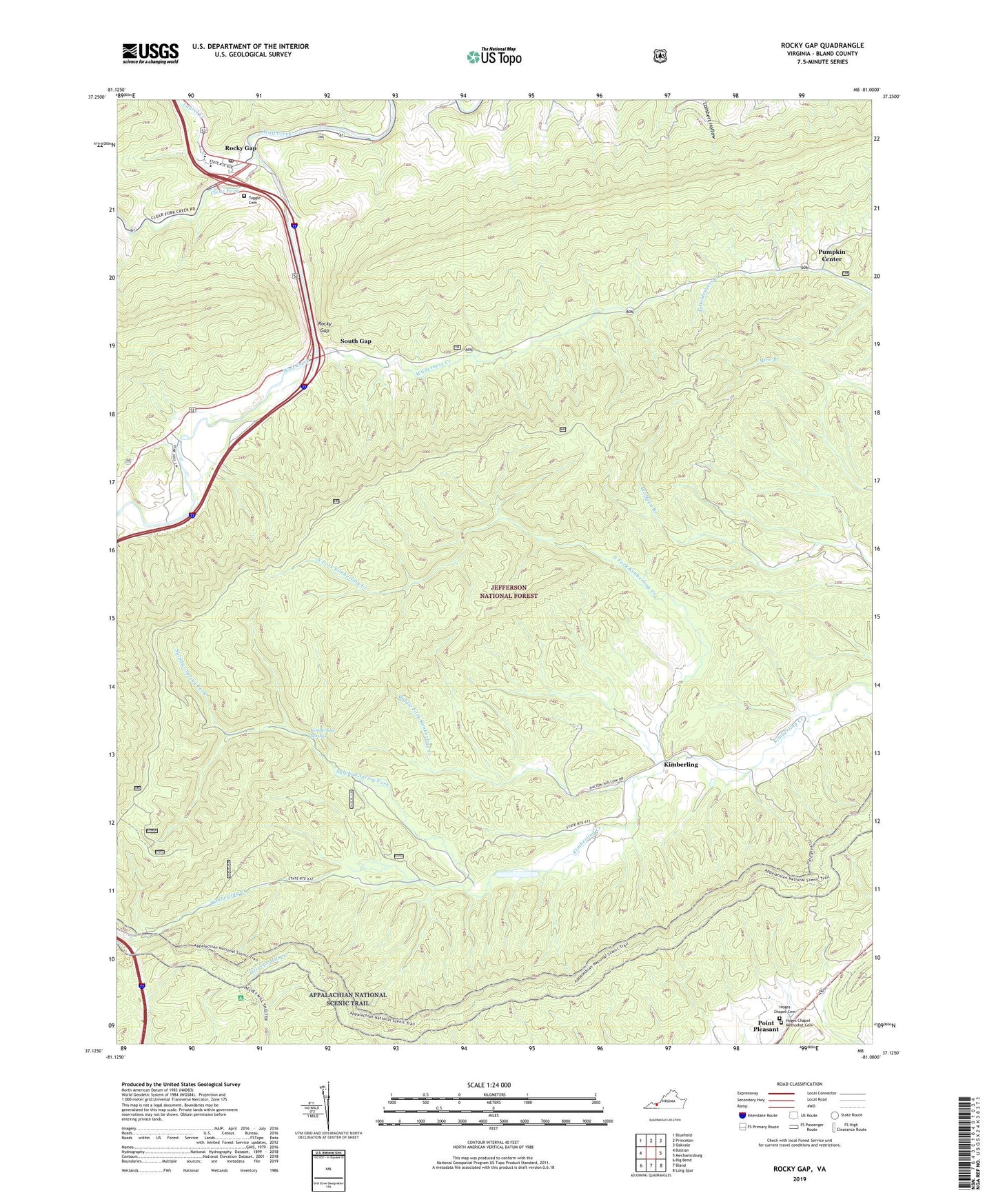
Rocky Gap Virginia US Topo Map
Couldn't load pickup availability
Also explore the Rocky Gap Forest Service Topo of this same quad for updated USFS data
2022 topographic map quadrangle Rocky Gap in the state of Virginia. Scale: 1:24000. Based on the newly updated USGS 7.5' US Topo map series, this map is in the following counties: Bland. The map contains contour data, water features, and other items you are used to seeing on USGS maps, but also has updated roads and other features. This is the next generation of topographic maps. Printed on high-quality waterproof paper with UV fade-resistant inks.
Quads adjacent to this one:
West: Bastian
Northwest: Bluefield
North: Princeton
Northeast: Oakvale
East: Mechanicsburg
Southeast: Long Spur
South: Bland
Southwest: Big Bend
This map covers the same area as the classic USGS quad with code o37081b1.
Contains the following named places: Clear Fork, Hogback, Hoges Chapel Cemetery, Hoges Chapel Methodist Cemetery, Hoges Chapel Methodist Church, Honaker Chapel, Kimberling, Kimberling Creek Wilderness, Kimberling Springs, Laurel Creek, Middle Fork Kimberling Creek, New Hope Church, North Fork Kimberling Creek, Pumpkin Center, Radford School, Rocky Gap, Rocky Gap Census Designated Place, Rocky Gap Elementary School, Rocky Gap High School, Rocky Gap Post Office, Salem Church, South Gap, Sulphur Spring Fork, Tuggle Cemetery, Wilderness Creek, ZIP Code: 24315