MyTopo
Bland Virginia US Topo Map
Couldn't load pickup availability
Also explore the Bland Forest Service Topo of this same quad for updated USFS data
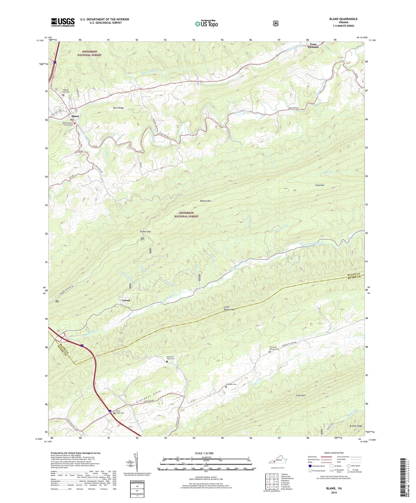
2022 topographic map quadrangle Bland in the state of Virginia. Scale: 1:24000. Based on the newly updated USGS 7.5' US Topo map series, this map is in the following counties: Bland, Wythe. The map contains contour data, water features, and other items you are used to seeing on USGS maps, but also has updated roads and other features. This is the next generation of topographic maps. Printed on high-quality waterproof paper with UV fade-resistant inks.
Quads adjacent to this one:
West: Big Bend
Northwest: Bastian
North: Rocky Gap
Northeast: Mechanicsburg
East: Long Spur
Southeast: Max Meadows
South: Wytheville
Southwest: Crockett
This map covers the same area as the classic USGS quad with code o37081a1.
Contains the following named places: Bland, Bland Census Designated Place, Bland County Courthouse, Bland County Sheriff's Office, Bland County Volunteer Fire Department, Bland County Volunteer Rescue Squad, Bland Elementary School, Bland High School, Bland Post Office, Bob King Branch, Carnot, Central Church, Church Branch, Crab Orchard Creek, Creed Branch, Crockett Cemetery, District 2, Helveys Mill Creek, Little Creek School, Long Spur, Mount View Church, Mountain View Cemetery, Newberry Chapel, Newberrys Mill, Point Pleasant, Polly Branch, Poplar Spring Branch, Saint Lukes Cemetery, Saint Lukes Church, Seddon District, Strader Church, Sunnyside School, Surrat Branch, Temple Hill Cemetery, The Brick Church, The Brick Church Cemetery, The Flatwoods, Town Creek, Town Ridge, Turkey Gap, Walker Creek Church, Walker Creek School, Waterfall Branch