MyTopo
Clayville Virginia US Topo Map
Couldn't load pickup availability
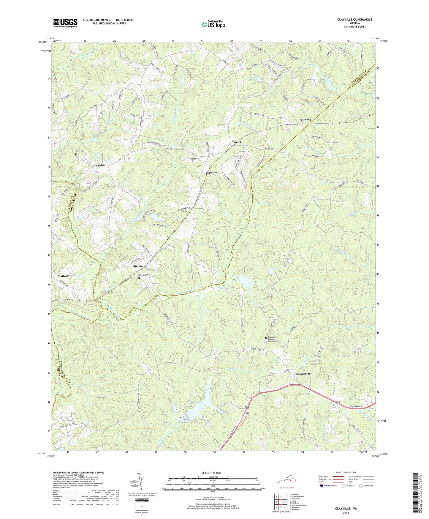
2019 topographic map quadrangle Clayville in the state of Virginia. Scale: 1:24000. Based on the newly updated USGS 7.5' US Topo map series, this map is in the following counties: Chesterfield, Powhatan, Amelia. The map contains contour data, water features, and other items you are used to seeing on USGS maps, but also has updated roads and other features. This is the next generation of topographic maps. Printed on high-quality waterproof paper with UV fade-resistant inks.
Quads adjacent to this one:
West: Chula
Northwest: Powhatan
North: Fine Creek Mills
Northeast: Midlothian
East: Hallsboro
Southeast: Winterpock
South: Mannboro
Southwest: Amelia Court House
Contains the following named places: Antioch Church, Bethel Church, Beulah Church, Beulah School, Butterwood Creek, Clayville, Crawford Dam, District 2, Dorset, Flat Creek, Genito, Genito Presbyterian Church, Goode Crossing, Goode House, Grace Cemetery, Graceland Church, Grange Hall Elementary School, Hebron Church, Liberty Cemetery, Mattoax, Moseley, Moseley Post Office, Pilkinton, Skinquarter, Skinquarter Baptist Church Cemetery, Skinquarter Church, Skinquarter Creek, Skippers Creek, Tates Dam, Tates Pond, Worsham House, ZIP Code: 23120