MyTopo
Mannboro Virginia US Topo Map
Couldn't load pickup availability
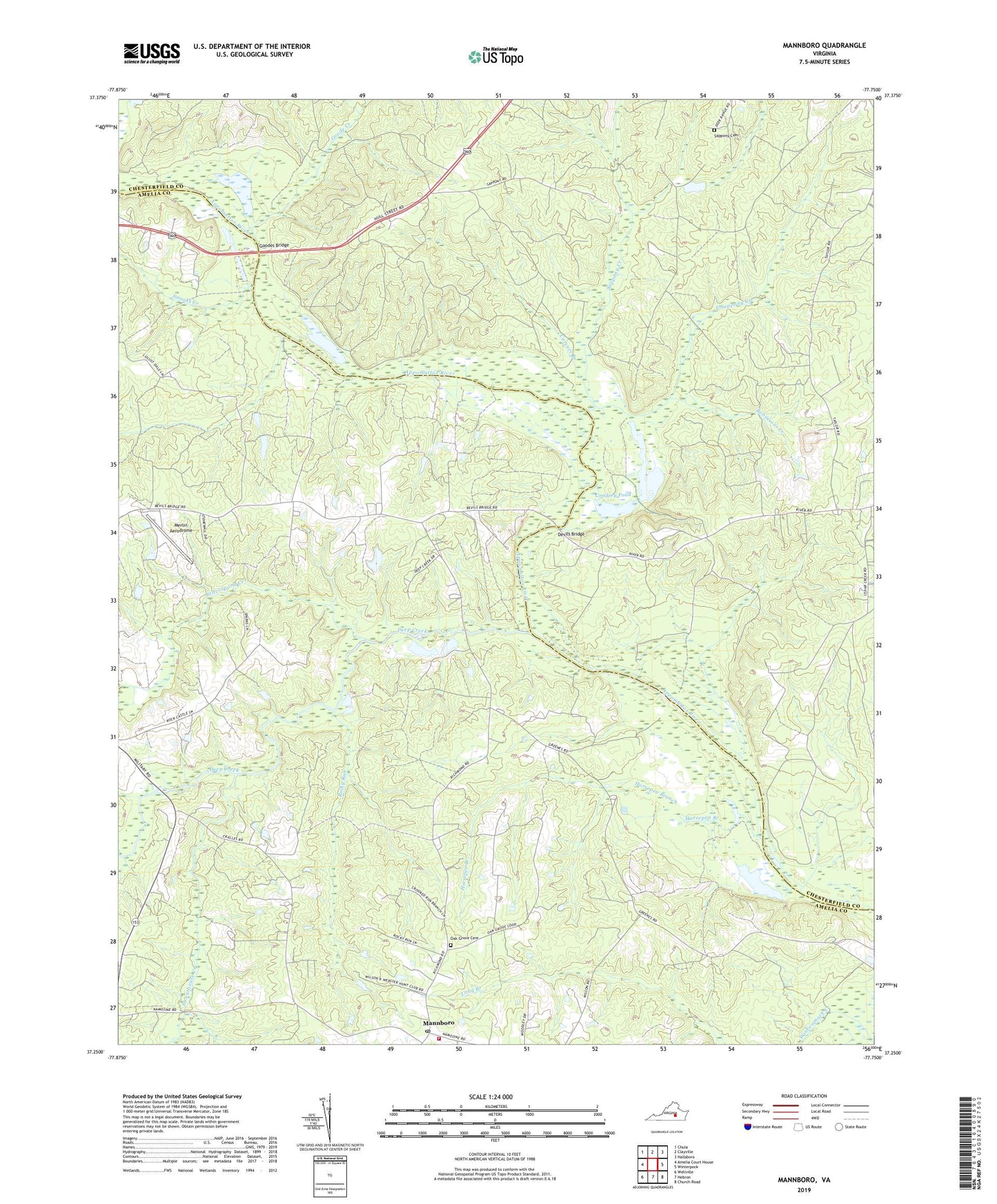
2022 topographic map quadrangle Mannboro in the state of Virginia. Scale: 1:24000. Based on the newly updated USGS 7.5' US Topo map series, this map is in the following counties: Amelia, Chesterfield. The map contains contour data, water features, and other items you are used to seeing on USGS maps, but also has updated roads and other features. This is the next generation of topographic maps. Printed on high-quality waterproof paper with UV fade-resistant inks.
Quads adjacent to this one:
West: Amelia Court House
Northwest: Chula
North: Clayville
Northeast: Hallsboro
East: Winterpock
Southeast: Church Road
South: Hebron
Southwest: Wellville
This map covers the same area as the classic USGS quad with code o37077c7.
Contains the following named places: Amelia Academy, Amelia County Volunteer Fire Department Company 2 Mannboro, Amelia Quarry, Appomattox Game Club Preserve, Beaverpond Creek, Bevils Bridge, Branchs Run Church, Carvers Branch, Condrey Dam, Condrey Pond, Deep Creek, Devils Bridge, District 5, East Sappony Creek, Eppington, Goode Creek, Goodes Bridge, Horsepen Branch, Jarratt Volunteer Fire Department, Jayarz Airport, Mannboro, Mannboro Medical Center Heliport, Mannboro Post Office, Merlin Aerodrome, Oak Grove African Methodist Episcopal Church, Oak Grove Cemetery, Oak Grove Church, Oak Grove School, Robinsons Creek, Rocky Run, Sappony Cemetery, Sappony Creek, Smacks Creek, Sweathouse Creek, Webster Hunt Club Preserve, Zoar