MyTopo
Winterpock Virginia US Topo Map
Couldn't load pickup availability
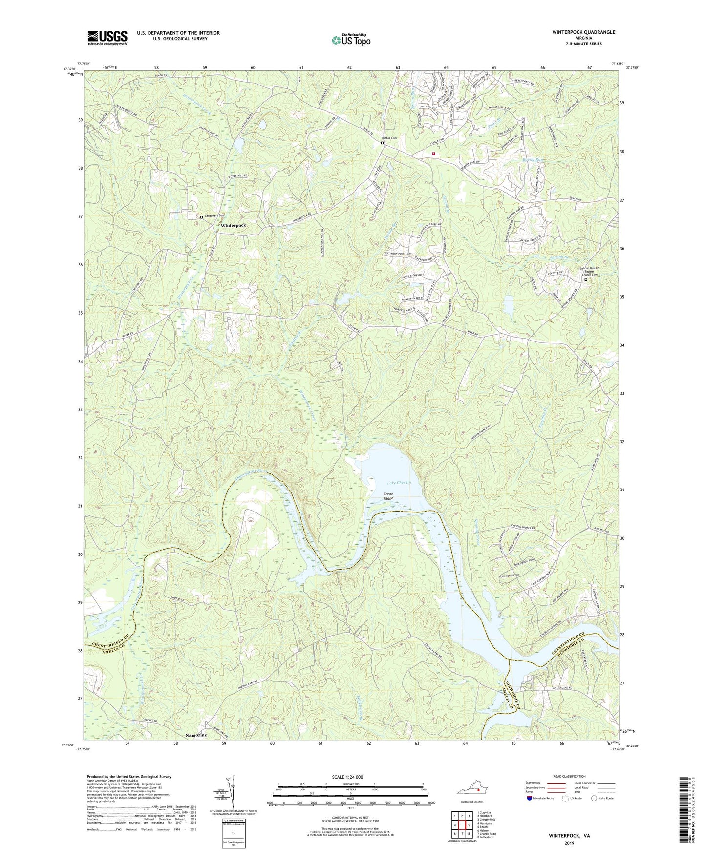
2022 topographic map quadrangle Winterpock in the state of Virginia. Scale: 1:24000. Based on the newly updated USGS 7.5' US Topo map series, this map is in the following counties: Chesterfield, Amelia, Dinwiddie. The map contains contour data, water features, and other items you are used to seeing on USGS maps, but also has updated roads and other features. This is the next generation of topographic maps. Printed on high-quality waterproof paper with UV fade-resistant inks.
Quads adjacent to this one:
West: Mannboro
Northwest: Clayville
North: Hallsboro
Northeast: Chesterfield
East: Beach
Southeast: Sutherland
South: Church Road
Southwest: Hebron
This map covers the same area as the classic USGS quad with code o37077c6.
Contains the following named places: Bethia Church, Bethia United Methodist Church Cemetery, Centenary Cemetery, Centenary Church, Chesterfield Fire and Emergency Medical Services Station 19 Winterpock, Clover Hill, Coalboro, Eppes Bridge, Eppes Falls, Forkland Tavern, Goose Island, Holly, Kcratchs Dam, Kcratchs Pond, Lake Chesdin, Lake Chesdin Golf Club, Matoaca, Matoaca District, Namozine Creek, Nooning Creek, Perdue, Second Branch Baptist Church, Second Branch Baptist Church Cemetery, Second Branch School, Sedley Baptist Church, Summit, Surline Branch, Tabernacle Church, Vest Dam, Whites Store, Winterpock, Winterpock Creek, Winterpock Elementary School, Winterpock Station Number 19, Winticomack Creek, ZIP Code: 23838