MyTopo
Hallsboro Virginia US Topo Map
Couldn't load pickup availability
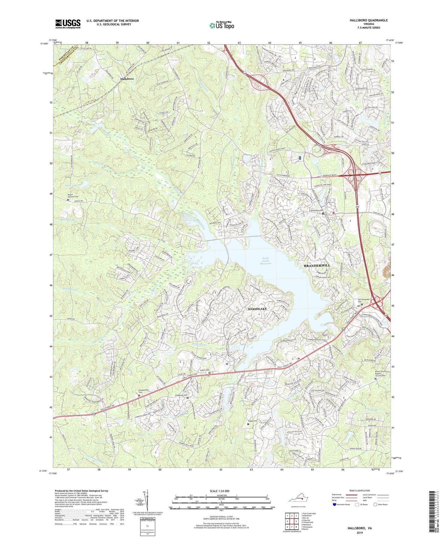
2022 topographic map quadrangle Hallsboro in the state of Virginia. Scale: 1:24000. Based on the newly updated USGS 7.5' US Topo map series, this map is in the following counties: Chesterfield, Powhatan. The map contains contour data, water features, and other items you are used to seeing on USGS maps, but also has updated roads and other features. This is the next generation of topographic maps. Printed on high-quality waterproof paper with UV fade-resistant inks.
Quads adjacent to this one:
West: Clayville
Northwest: Fine Creek Mills
North: Midlothian
Northeast: Bon Air
East: Chesterfield
Southeast: Beach
South: Winterpock
Southwest: Mannboro
This map covers the same area as the classic USGS quad with code o37077d6.
Contains the following named places: Alberta Smith Elementary School, Birkdale Golf and Country Club, Blackman Creek, Brandermill, Brandermill Census Designated Place, Brandermill Country Club, Brandermill Post Office, Brown Grove Baptist Church Cemetery, Brown Grove Church, Cheatham Cemetery, Chesterfield Cemetery, Chesterfield Church, Chesterfield County Police Department Hull Street Station, Chesterfield Fire and Emergency Medical Services Station 16 Swift Creek, Chesterfield Fire and Emergency Medical Services Station 7 Clover Hill, Clover Hill Elementary School, Clover Hill High School, Clover Hill Station Number 7, Cosby High School, Deep Creek, Dry Bridge, Dry Creek, Evergreen Elementary School, Falling Creek, Fuqua Cemetery, General Land Company Dam, Gordons Dam, Hallsboro, Horner Store, Horsepen Creek, Izaak Walton Park Dam, J B Watkins Elementary School, John Tyler Community College - Midlothian Campus, Lester Cemetery, Little Tomahawk Creek, Manchester Volunteer Rescue Squad Station 2, Midlothian Branch Chesterfield County Library, Midlothian Census Designated Place, Midlothian High School, Midlothian Quarry, Millwood School, Mount Hermon Cemetery, Mount Hermon Church, Nuttree, Oasis Sports Park Golf Course, Old Tomahawk Cemetery, Otterdale, Otterdale Branch, Palm Lake, Saint Francis Medical Center, Sheltering Arms Hospital South, Southside Speedway, Spring Run, Spring Run Elementary School, Stonehenge Golf and Country Club, Swift Creek Baptist Church, Swift Creek Elementary School, Swift Creek Middle School, Swift Creek Reservoir, Swift Creek Reservoir Dam, Swist Creek Station Number16, The Midlothian Company Dam, Tomahawk Cemetery, Tomahawk Church, Tomahawk Creek, Tuckahoe Montessori School, Turkey Creek, Waterford Shopping Center, West Branch Dry Creek, Woodlake, Woodlake Census Designated Place, Woodle Airport, Woolridge Elementary School, ZIP Codes: 23112, 23114