MyTopo
Wolf Gap West Virginia US Topo Map
Couldn't load pickup availability
Also explore the Wolf Gap Forest Service Topo of this same quad for updated USFS data
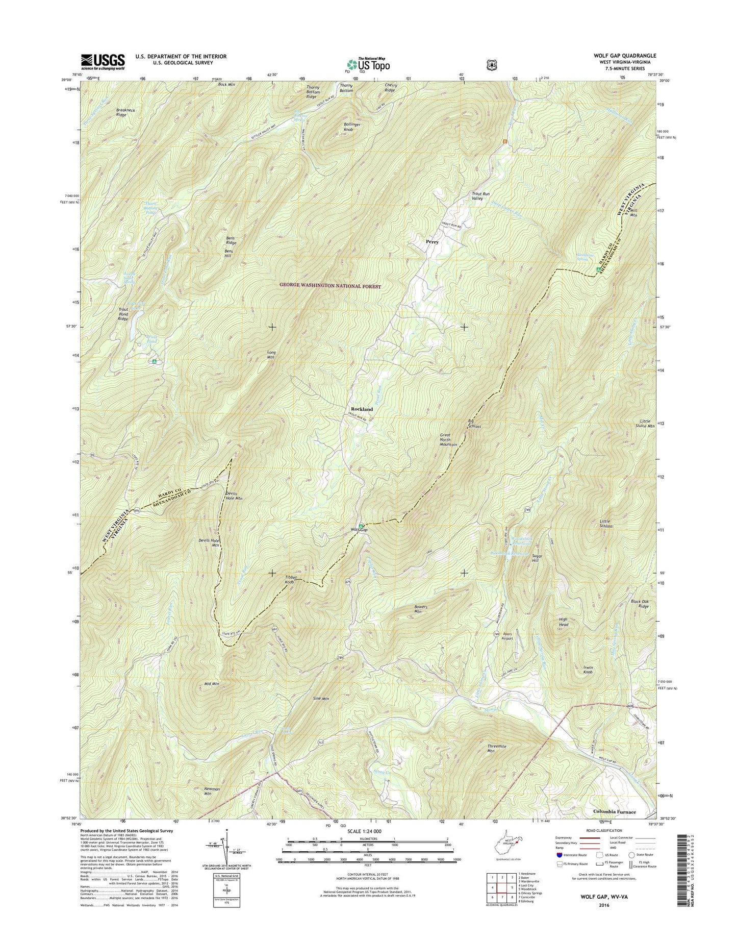
2023 topographic map quadrangle Wolf Gap in the states of West Virginia, Virginia. Scale: 1:24000. Based on the newly updated USGS 7.5' US Topo map series, this map is in the following counties: Hardy, Shenandoah. The map contains contour data, water features, and other items you are used to seeing on USGS maps, but also has updated roads and other features. This is the next generation of topographic maps. Printed on high-quality waterproof paper with UV fade-resistant inks.
Quads adjacent to this one:
West: Lost City
Northwest: Needmore
North: Baker
Northeast: Wardensville
East: Woodstock
Southeast: Edinburg
South: Conicville
Southwest: Orkney Springs
This map covers the same area as the classic USGS quad with code o38078h6.
Contains the following named places: Ayers Airport, Bens Hill, Bens Ridge, Bethlehem Church, Big Schloss, Black Oak Ridge, Bob Rawlins Spring, Bollinger Knob, Bowers Mountain, Breakneck Ridge, Camp Strawderman, Clarks Dairy Farm, Cold Spring, Columbia Furnace, Crack Whip Furnace Trail, Deep Gutter Run, Devils Hole Mountain, Halfmoon Lookout Trail, Halfmoon Run, Heishman School, High Head, Irwin Knob, Joseph Sager Spring, Liberty Furnace, Little Schloss, Little Stony Creek, Long Mountain, Markley Rocks, May Spring Run, Middle Mountain, Mill Creek, Mill Mountain, Mill Mountain Forest Service Repeater Site, Mill Mountain Trail, Mount Vernon Church, Newman Mountain, Old Iron Furnace, Perry, Poplar Run, Rockcliff Lake, Rockcliff Lake Dam, Rockland, Sandstone Spring, Sine Mountain, Spruce Run, Stony Creek Trail, Sugar Hill, Thorn Bottom Farm Pond Dam, Thorn Bottom Pond, Threemile Mountain, Tibbet Knob, Tibbet Knob Trail, Trout Pond, Trout Pond Campground, Trout Pond Recreation Area, Trout Pond Ridge, Trout Pond Run, Trout Pond Trail, Trout Run Valley, Wardensville Wildlife Management Area, Wolf Gap, Wolf Gap Recreation Area, Woodstock Dam, Woodstock Reservoir, Yellow Spring Run