MyTopo
Blackstone West Virginia US Topo Map
Couldn't load pickup availability
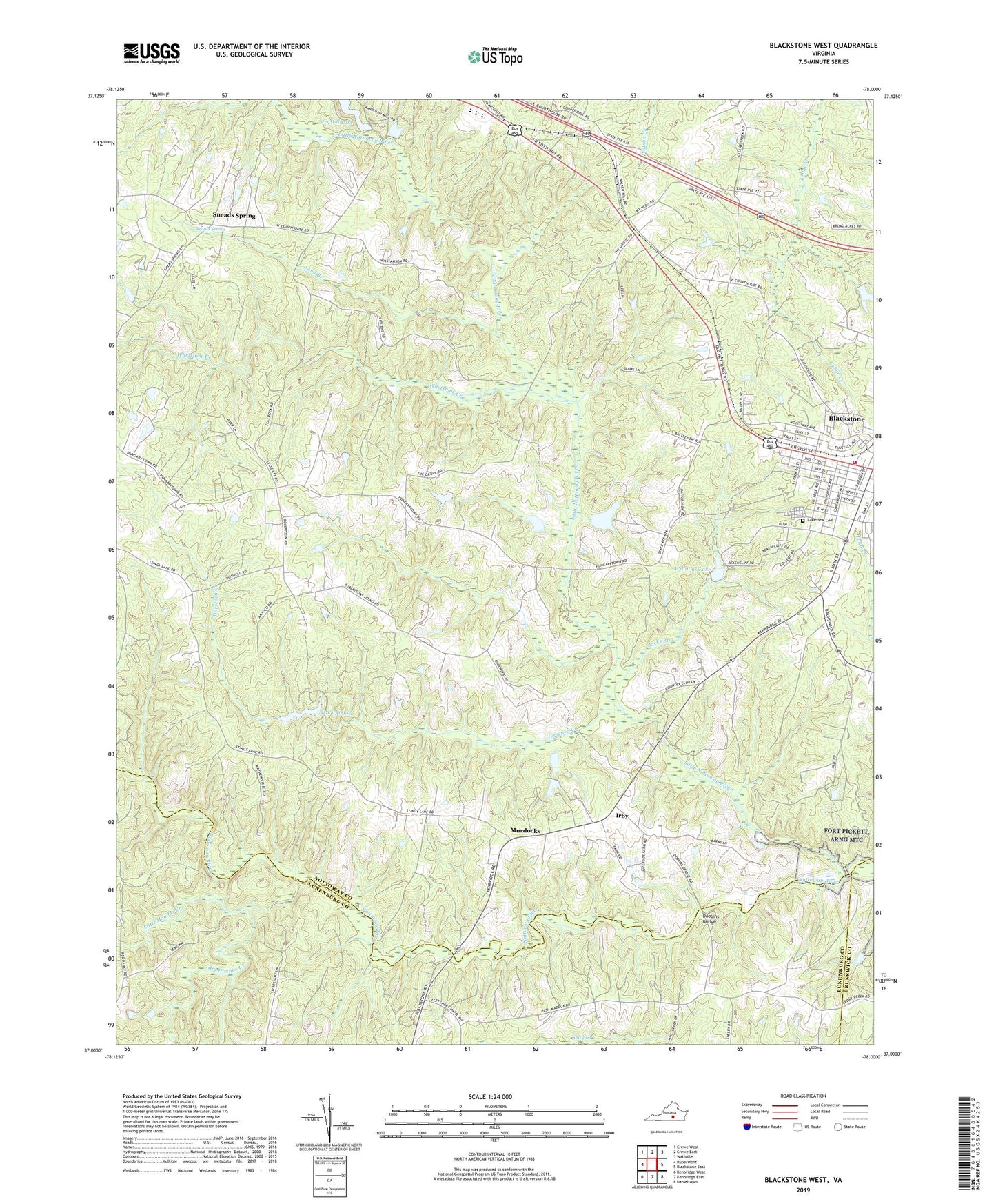
2022 topographic map quadrangle Blackstone West in the state of Virginia. Scale: 1:24000. Based on the newly updated USGS 7.5' US Topo map series, this map is in the following counties: Nottoway, Lunenburg, Brunswick. The map contains contour data, water features, and other items you are used to seeing on USGS maps, but also has updated roads and other features. This is the next generation of topographic maps. Printed on high-quality waterproof paper with UV fade-resistant inks.
Quads adjacent to this one:
West: Rubermont
Northwest: Crewe West
North: Crewe East
Northeast: Wellville
East: Blackstone East
Southeast: Danieltown
South: Kenbridge East
Southwest: Kenbridge West
This map covers the same area as the classic USGS quad with code o37078a1.
Contains the following named places: Big Hounds Creek, Blackstone College for Girls, Blackstone Historic District, Blackstone Military Academy, Blackstone Presbyterian Church, Blackstone Volunteer Fire Department, Crenshaw United Methodist Church, Crystal Dam, Dobbins Bridge, Epes Dam, Foster High School, Gravatts Dam, Horners Dam, Horsepen Creek, Hurts Dam, Irby, Jacks Branch, Lake Amtoco, Lakeview Cemetery, Little Hounds Creek, Little Nottoway River, Long Branch, Mount Gazerine Church, Mount Nebo Church, Mount Nebo School, Murdocks, New Prospect Church, Nottoway County Emergency Squad Substation, Nottoway High School, Nottoway Intermediate School, Nottoway Middle School, Prospect School, Saint Lukes Episcopal Church, Saint Phillips Church, Seventh Day Adventist Church, Shiloh Baptist Church, Sneads Spring, Southside Convalescent Home, Town of Blackstone, Walkers Dam, WBBC-AM (Blackstone), WBBC-FM (Blackstone), Whetstone Creek, Williams Dam, Williams Lake