MyTopo
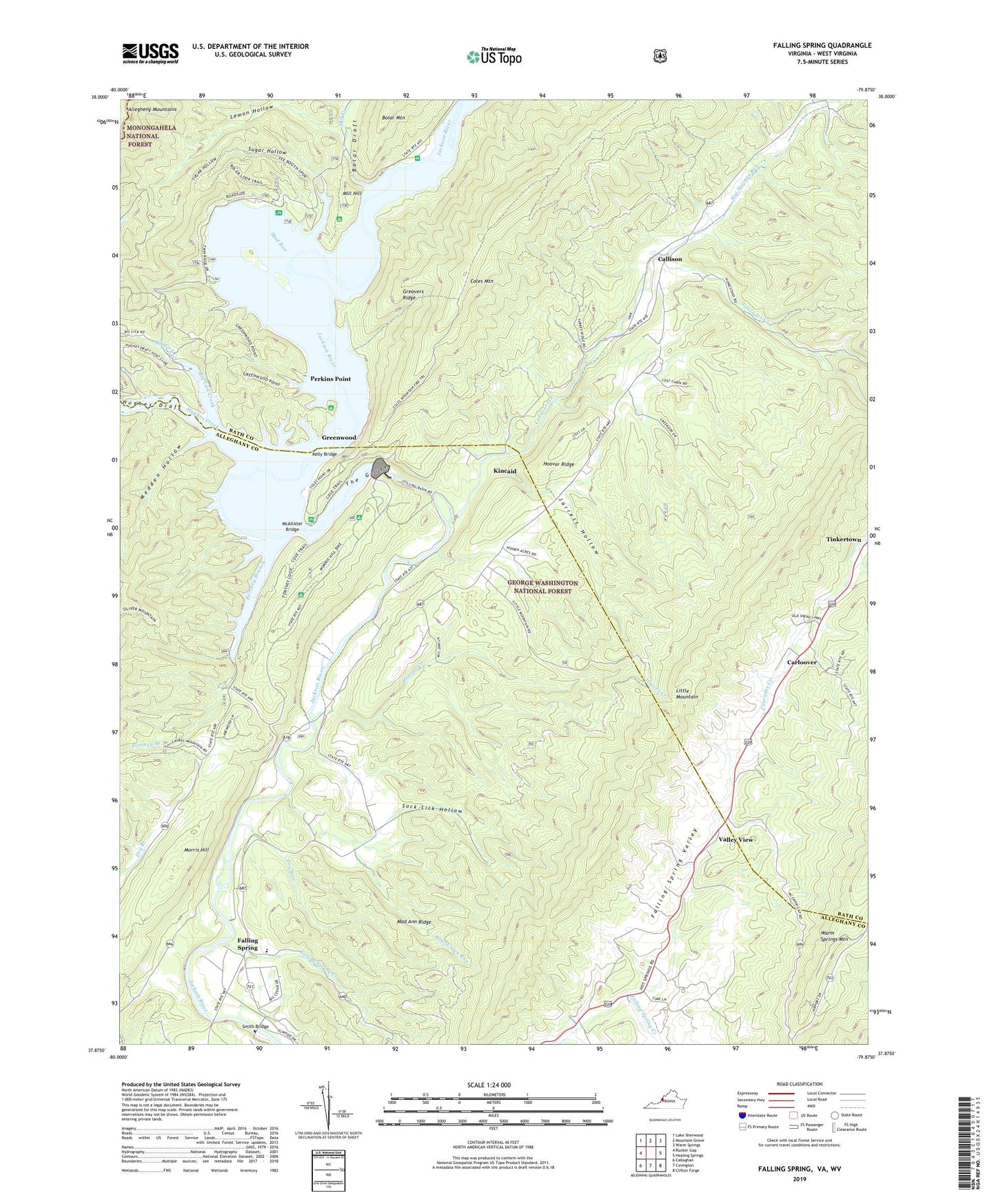
Falling Spring Virginia US Topo Map
Couldn't load pickup availability
Also explore the Falling Spring Forest Service Topo of this same quad for updated USFS data
2022 topographic map quadrangle Falling Spring in the state of Virginia. Scale: 1:24000. Based on the newly updated USGS 7.5' US Topo map series, this map is in the following counties: Alleghany, Bath, Greenbrier. The map contains contour data, water features, and other items you are used to seeing on USGS maps, but also has updated roads and other features. This is the next generation of topographic maps. Printed on high-quality waterproof paper with UV fade-resistant inks.
Quads adjacent to this one:
West: Rucker Gap
Northwest: Lake Sherwood
North: Mountain Grove
Northeast: Warm Springs
East: Healing Springs
Southeast: Clifton Forge
South: Covington
Southwest: Callaghan
Contains the following named places: Big Lick Creek, Board Tree Run, Bolar Draft, Bolar Flat Picnic Area and Launch Ramp, Bolar Mountain Campground, Callison, Camp Appalachia, Carloover, Cascades Creek, Cedar Creek, Coles Mountain, Coles Mountain Fire Trail, Coles Mountain Picnic Area, Dry Run, Emory Church, Falling Spring, Falling Spring Creek, Falling Spring Elementary School, Falling Spring Presbyterian Church, Falling Spring Valley, Fortney Boat Launch Ramp, Fortney Branch, Gathright Dam, Greavers Ridge, Greenwood, Hemlock Trail, Hoover Creek, Hoover Ridge, Hot Springs Run, Hughes Creek, Hughes Draft, Jarrett Hollow, Jenkins Ford, Kelly Bridge, Kincaid, Lake Moomaw, Lemon Hollow, Little Mountain Trail, Lodge Trail, Mad Ann Ridge, McAllister Bridge, Medden Hollow, Mill Creek, Mill Hill, Morris Hill, Morris Hill Campground, Morris Hill Picnic Area, Mud Run, Natural Well, Perkins Point, Sinking Spring Church, Smith Bridge, Suck Lick Hollow, Sugar Hollow, The Gorge, Union Chapel Presbyterian Church, Valley View, ZIP Code: 24445