MyTopo
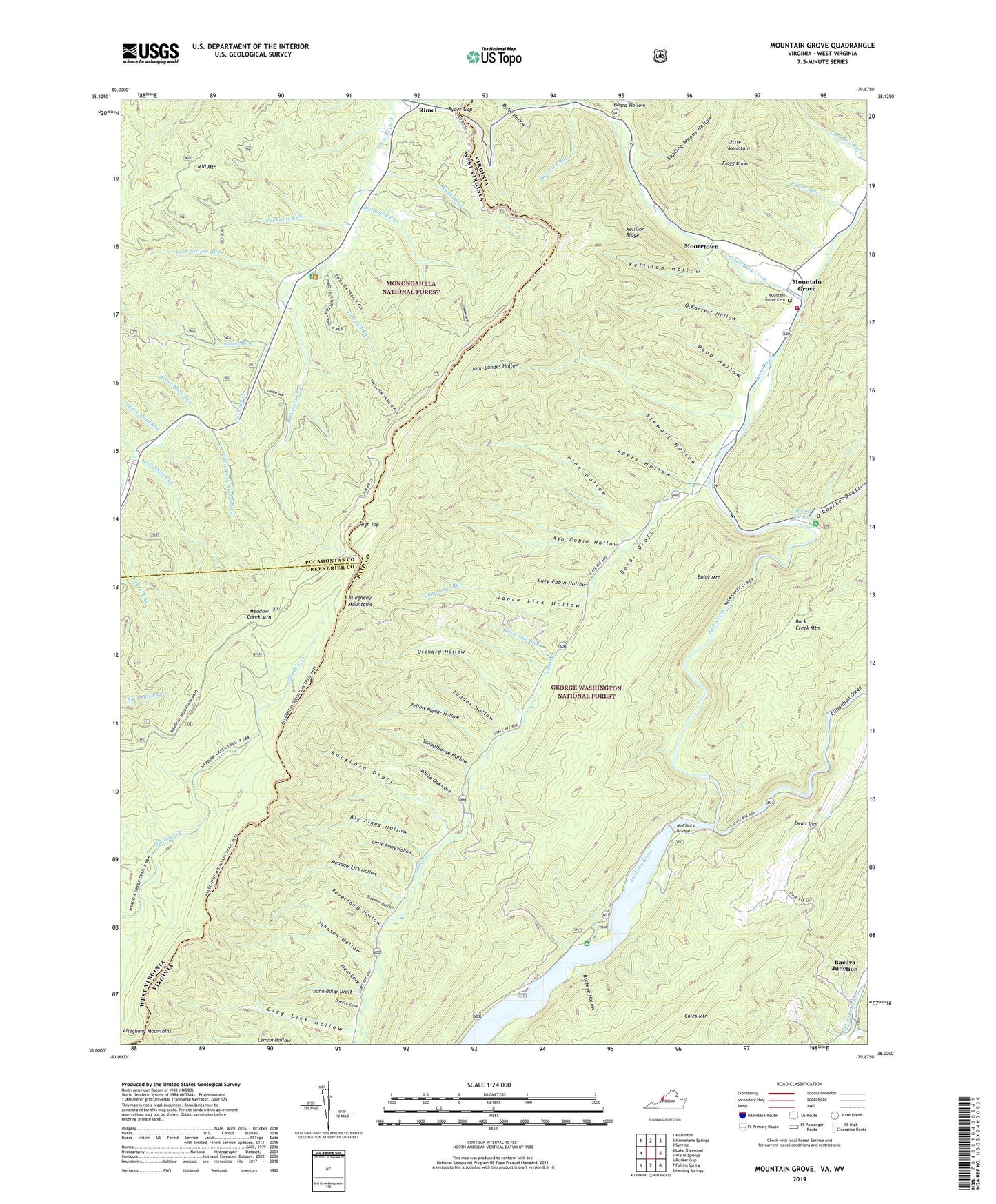
Mountain Grove Virginia US Topo Map
Couldn't load pickup availability
Also explore the Mountain Grove Forest Service Topo of this same quad for updated USFS data
2022 topographic map quadrangle Mountain Grove in the states of Virginia, West Virginia. Scale: 1:24000. Based on the newly updated USGS 7.5' US Topo map series, this map is in the following counties: Bath, Pocahontas, Greenbrier. The map contains contour data, water features, and other items you are used to seeing on USGS maps, but also has updated roads and other features. This is the next generation of topographic maps. Printed on high-quality waterproof paper with UV fade-resistant inks.
Quads adjacent to this one:
West: Lake Sherwood
Northwest: Marlinton
North: Minnehaha Springs
Northeast: Sunrise
East: Warm Springs
Southeast: Healing Springs
South: Falling Spring
Southwest: Rucker Gap
Contains the following named places: Ash Cabin Hollow, Ayers Hollow, Back Creek, Big Piney Hollow, Big Sandy Run, Big Turn Run, Blowing Springs, Blowing Springs Campground, Boiling Spring Camp, Bolar Mountain, Buckeye Hollow, Buckhorn Draft, Buckhorn Quarters, Clay Lick Hollow, Cochran Creek Church, Combs Trail, Cummings Run, Dean Spur, Divide Trail, Doelick Cove, Eden United Methodist Church, Flagg Knob, Gathright Wildlife Management Area, Hamilton Lick Run, High Top, High Top Lookout Tower, John Bolar Draft, John Landes Hollow, Johnson Hollow, Kellison Hollow, Kellison Ridge, Landes Hollow, Laurel Run, Lemon Hollow Work Camp, Little Back Creek, Little Piney Hollow, Lost Bottom Run, Lucy Cabin Hollow, McClintic Bridge, McClintic Point Primitive Campground, Meadow Creek Mountain, Meadow Lick Hollow, Meva Cove, Mooretown, Mountain Grove, Mountain Grove Cemetery, Mountain Grove Elementary School, Mountain Grove Volunteer Fire Department, Necholas Run, O'Farrell Hollow, Orchard Hollow, O'Roarke Draft, Pine Hollow, Pocahontas Picnic and Campground, Pond Hollow, Revercomb Hollow, Richardson Gorge, Rimel, Ryder Gap, Ryder Hollow, Ryder Run, Sapling Woods Hollow, Schoolhouse Hollow, Sevenmile Run, Shanklin, Snake Valley, South River Number 19 Dam, Stewart Hollow, Sugar Haul Run, Sweet Acorn Trail, TM Gathright Wildlife Management Area, Two Lick Run, Vance Lick Hollow, White Mare Run, White Oak Cove, White Oak Run, Widemouth Run, Yellow Poplar Hollow