MyTopo
Fishermans Island Virginia US Topo Map
Couldn't load pickup availability
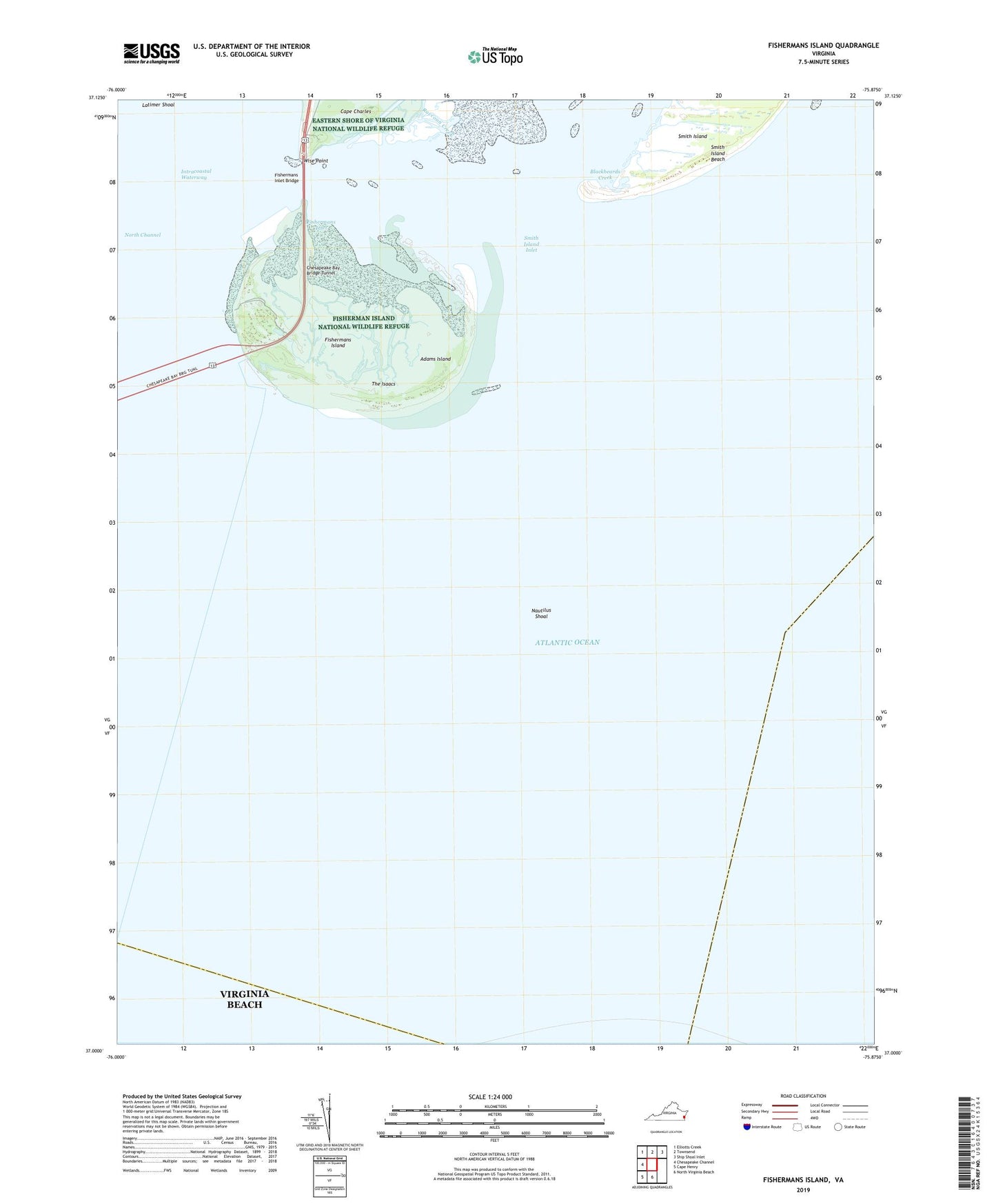
2022 topographic map quadrangle Fishermans Island in the state of Virginia. Scale: 1:24000. Based on the newly updated USGS 7.5' US Topo map series, this map is in the following counties: Northampton, Virginia Beach (city). The map contains contour data, water features, and other items you are used to seeing on USGS maps, but also has updated roads and other features. This is the next generation of topographic maps. Printed on high-quality waterproof paper with UV fade-resistant inks.
Quads adjacent to this one:
West: Chesapeake Channel
Northwest: Elliotts Creek
North: Townsend
Northeast: Ship Shoal Inlet
South: North Virginia Beach
Southwest: Cape Henry
This map covers the same area as the classic USGS quad with code o37075a8.
Contains the following named places: Adams Island, Blackbeards Creek, Cape Charles Lighthouse, Fisherman Island National Wildlife Refuge, Fishermans Inlet, Fishermans Inlet Bridge, Fishermans Island, Fishermans Island Light, Nautilus Shoal, Raccoon Creek, Smith Island Inlet, The Isaacs, Wise Point