MyTopo
Flint Hill Virginia US Topo Map
Couldn't load pickup availability
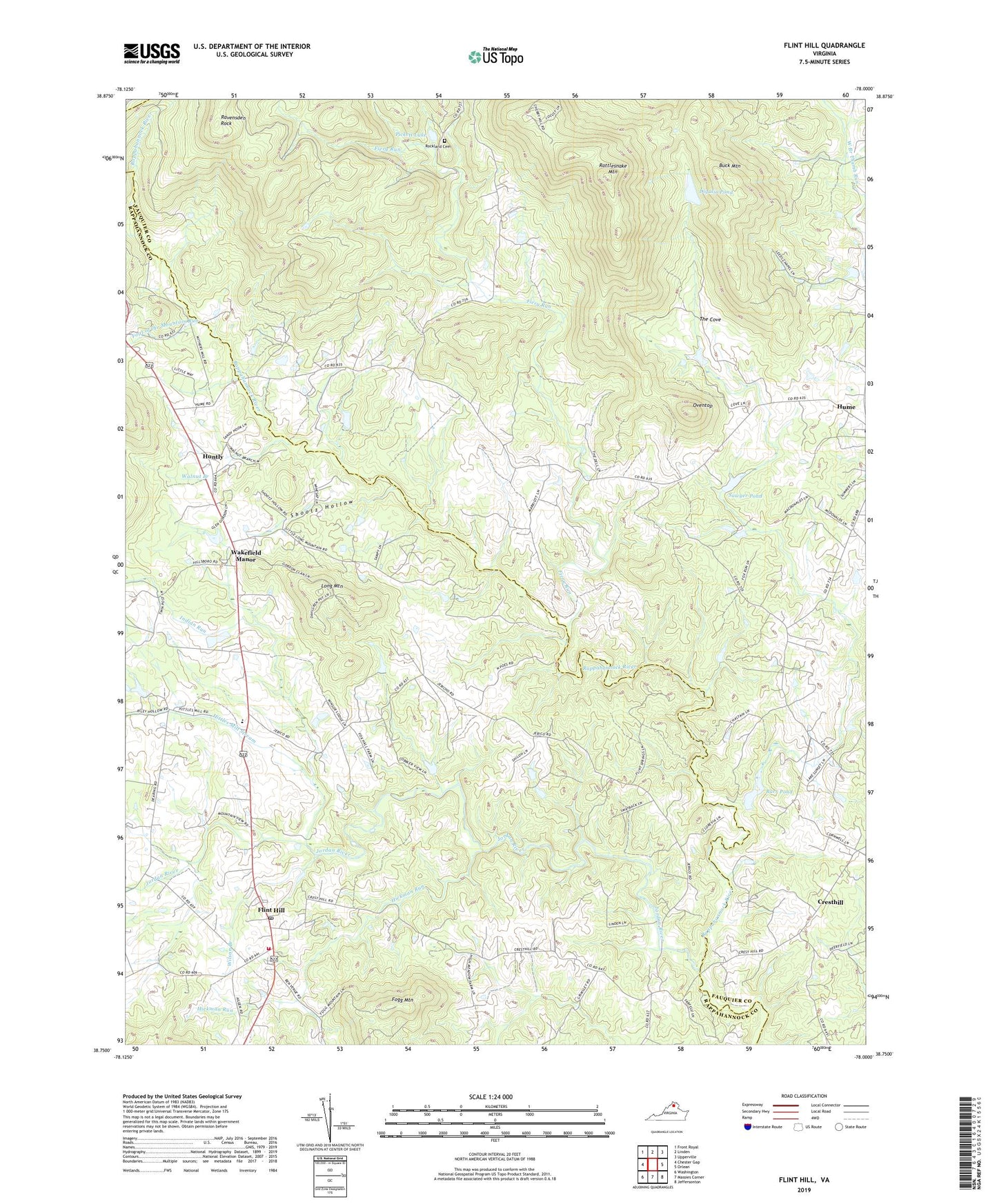
2022 topographic map quadrangle Flint Hill in the state of Virginia. Scale: 1:24000. Based on the newly updated USGS 7.5' US Topo map series, this map is in the following counties: Fauquier, Rappahannock. The map contains contour data, water features, and other items you are used to seeing on USGS maps, but also has updated roads and other features. This is the next generation of topographic maps. Printed on high-quality waterproof paper with UV fade-resistant inks.
Quads adjacent to this one:
West: Chester Gap
Northwest: Front Royal
North: Linden
Northeast: Upperville
East: Orlean
Southeast: Jeffersonton
South: Massies Corner
Southwest: Washington
This map covers the same area as the classic USGS quad with code o38078g1.
Contains the following named places: Barr Dam, Barr Pond, Black Rock Ford, Buck Mountain, Crest Hill Baptist Church, Cresthill, Cresthill School, Digulian Dam, Digulin Pond, Fiery Run, Flint Hill, Flint Hill Baptist Church, Flint Hill Census Designated Place, Flint Hill Methodist Church, Flint Hill Post Office, Flint Hill School, Flint Hill Volunteer Fire Department, Fogg Mountain, Foot of the Mountain Run, Hickman Run, Hitch, Hitch School, Hittles Mill Stream, Hume School, Huntly, Huntly School, Indian Run, Jordan River, Keysville, Long Mountain, Lottie School, Macedonia Baptist Church, Oventop, Pickett Dam, Pickett Lake, Rattlesnake Mountain, Rattlesnake Trail, Ravensden Rock, Reager, Reager School, Rock Ford, Rockland Cemetery, Rockland Church, Sawyer Dam, Sawyer Pond, Shootz Hollow, The Cove, Wakefield Country Day School, Wakefield District, Wakefield Manor, Walnut Branch, Willis Chapel, Wilson Branch, ZIP Code: 22639