MyTopo
Orlean Virginia US Topo Map
Couldn't load pickup availability
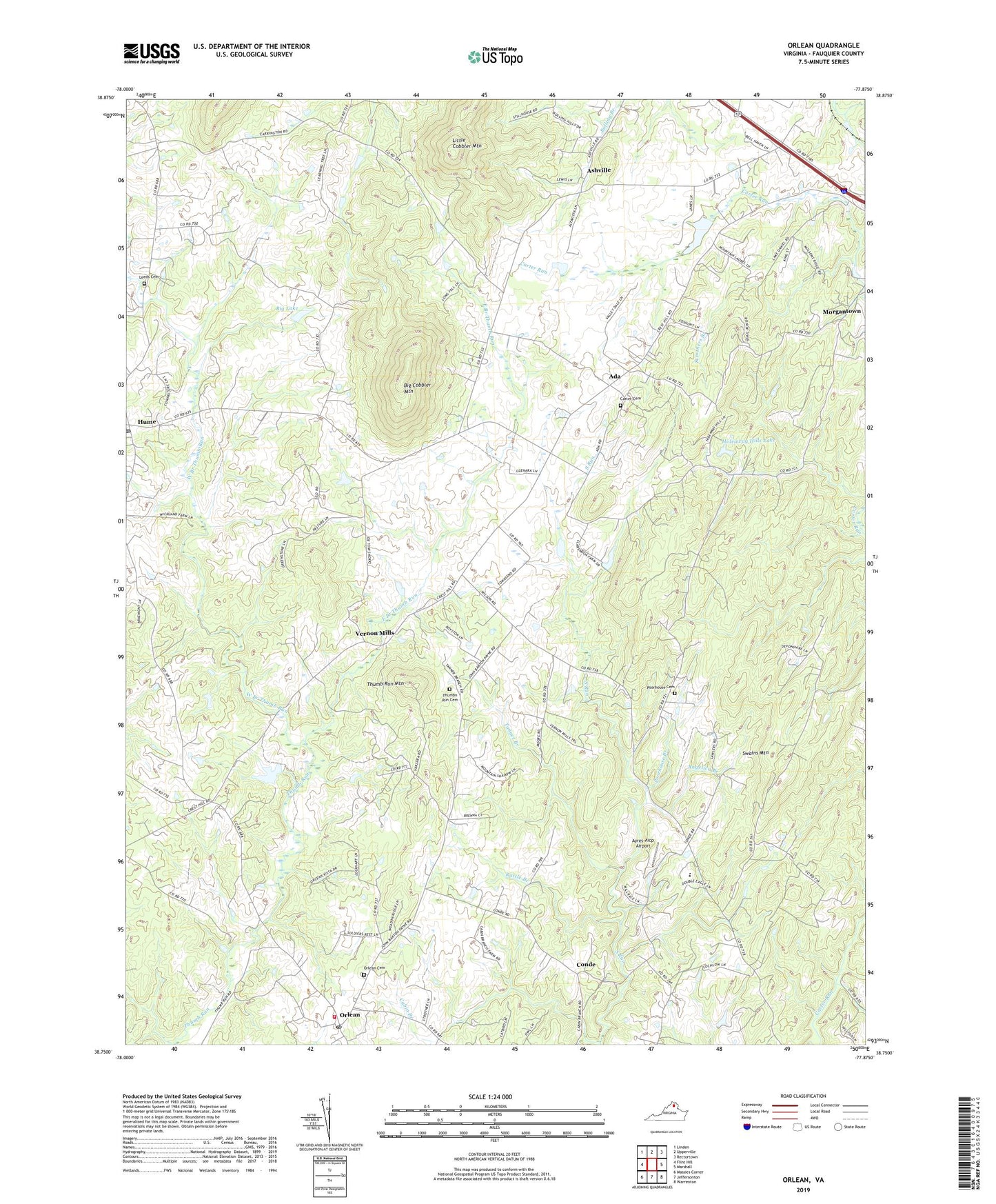
2022 topographic map quadrangle Orlean in the state of Virginia. Scale: 1:24000. Based on the newly updated USGS 7.5' US Topo map series, this map is in the following counties: Fauquier. The map contains contour data, water features, and other items you are used to seeing on USGS maps, but also has updated roads and other features. This is the next generation of topographic maps. Printed on high-quality waterproof paper with UV fade-resistant inks.
Quads adjacent to this one:
West: Flint Hill
Northwest: Linden
North: Upperville
Northeast: Rectortown
East: Marshall
Southeast: Warrenton
South: Jeffersonton
Southwest: Massies Corner
This map covers the same area as the classic USGS quad with code o38077g8.
Contains the following named places: Ada, Angelica Branch, Ashville, Ayres-Aicp Airport, Big Cobbler Mountain, Big Lake, Big Lake Dam, Boot Andersons Corner, Cabin Branch, Carter Cemetery, Clarks Corner, Cobbler Springs Farm, Conde, East Branch Thumb Run, Fresta Valley Christian School, Glendale, Hideaway Hills Dam, Hideaway Hills Lake, Hume, Hume Post Office, Hume United Methodist Church, Jerrys Shop, Leeds Cemetery, Leeds Church, Little Cobbler Mountain, Marshall District, Mellott Dam, Mellott Pond, Morgantown, Morgantown School, Mount Nebo Church, Orlean, Orlean Cemetery, Orlean Church, Orlean Post Office, Orlean Volunteer Fire and Rescue Department Company 11, Poorhouse Branch, Poorhouse Cemetery, Rattle Branch, Runnymeade Farm, Saint Andrew Episcopal Church, South Run Church, Strothers Branch, Swains Mountain, Tanner Branch, Thumb Run Church, Thumb Run Mountain, Thumbn Run Cemetery, Vernon Mills, West Branch Thumb Run, Wilsons Store, ZIP Code: 20115