MyTopo
Beaverdam Virginia US Topo Map
Couldn't load pickup availability
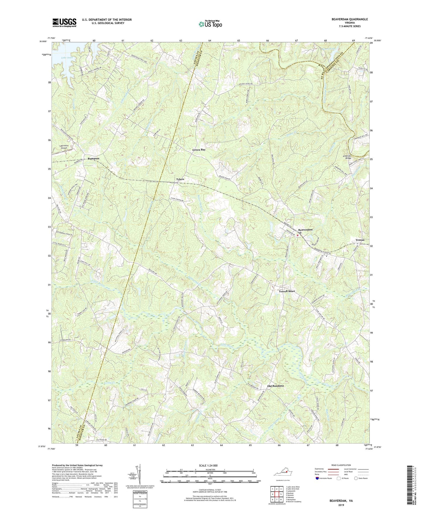
2022 topographic map quadrangle Beaverdam in the state of Virginia. Scale: 1:24000. Based on the newly updated USGS 7.5' US Topo map series, this map is in the following counties: Hanover, Louisa, Caroline, Spotsylvania. The map contains contour data, water features, and other items you are used to seeing on USGS maps, but also has updated roads and other features. This is the next generation of topographic maps. Printed on high-quality waterproof paper with UV fade-resistant inks.
Quads adjacent to this one:
West: Buckner
Northwest: Lake Anna West
North: Lake Anna East
Northeast: Ladysmith
East: Hewlett
Southeast: Hanover Academy
South: Montpelier
Southwest: Dabneys
This map covers the same area as the classic USGS quad with code o37077h6.
Contains the following named places: Aaron Hall School, Anderson Bridge, Anderson Mill, Beaverdam, Beaverdam Church, Beaverdam Depot, Beaverdam Elementary School, Beaverdam Mills, Beaverdam Post Office, Bumpass, Buzzie Creek, Fleming Millpond, Fulcher Millpond, Green Bay, Greenes Corner, Hanover County Fire - EMS Company 2 - Beaverdam Volunteer Fire Station, Harris Store, Hogan Creek, Hollowing Creek, James Dam, James Pond, Jones Swamp, Lake Anna Airport, Lake Anna Rescue, Lazarus Chapel, Locust Creek, Millpond Branch, Mont Air Creek, Old Bandana, Roan Horse Creek, Rouzie Chapel, Saint Thomas Church, Shiloh Church, Snelson, Snelson Creek, Tanyard Creek, Teman, Terrell Store, Trinity Church, Tylers, Union Branch Church, Union Church, Watleg Branch, ZIP Code: 23015