MyTopo
Montpelier Virginia US Topo Map
Couldn't load pickup availability
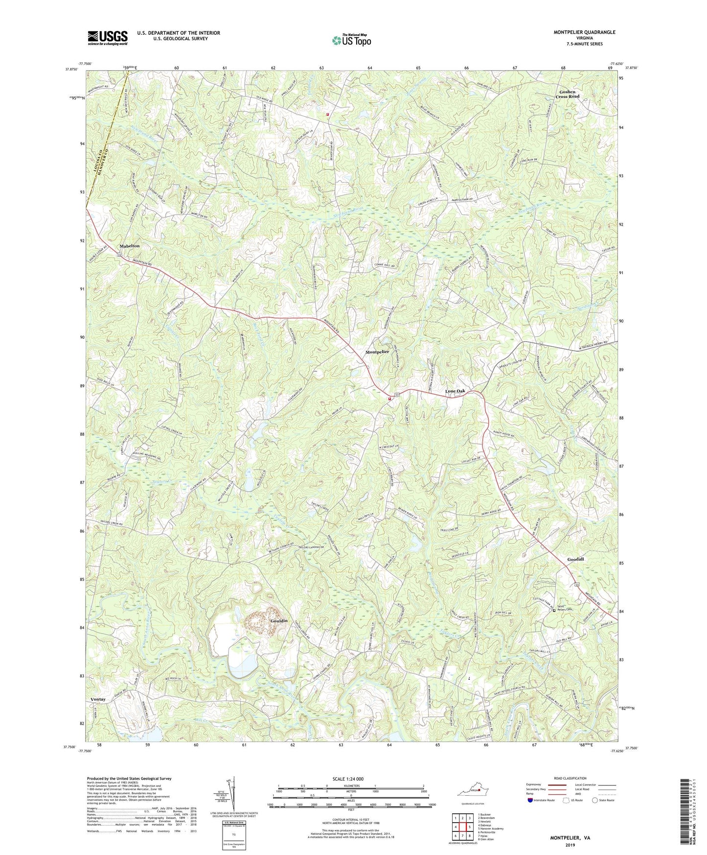
2022 topographic map quadrangle Montpelier in the state of Virginia. Scale: 1:24000. Based on the newly updated USGS 7.5' US Topo map series, this map is in the following counties: Hanover, Louisa. The map contains contour data, water features, and other items you are used to seeing on USGS maps, but also has updated roads and other features. This is the next generation of topographic maps. Printed on high-quality waterproof paper with UV fade-resistant inks.
Quads adjacent to this one:
West: Dabneys
Northwest: Buckner
North: Beaverdam
Northeast: Hewlett
East: Hanover Academy
Southeast: Glen Allen
South: Hylas
Southwest: Perkinsville
This map covers the same area as the classic USGS quad with code o37077g6.
Contains the following named places: Auburn Mills, Bethany Church, Bethany School, Cattail Creek, Chapel Church, Church of Our Savior, Dunns Chapel, Goodall, Goshen Cross Road, Gouldin, Gouldins Mills, Hanover County Fire - EMS Company 15 - West Hanover Volunteer Rescue Squad, Hanover County Fire - EMS Company 8 - Montpelier Volunteer Fire Station, Helltown Store, Jones Corner, Lone Oak, Mabelton, Mill Creek, Montpelier, Montpelier High School, Montpelier Post Office, Moodys Corner, New Kent County Courthouse, Pilgrim Church, Rock Ford Creek, Saint Peters Cemetery, Saint Peters Church, Shop Creek, South Anna District, South Anna Elementary School, South Anna Number 52b Dam, Springfield Church, Springfield Lake, Stone Dam, Taylors Creek, Taylors Creek Mill, The Feldspar Corporation Dam Number One, The Feldspar Corporation Dam Number Two, Wolf Swamp, ZIP Code: 23192