MyTopo
Lake Drummond SE Virginia US Topo Map
Couldn't load pickup availability
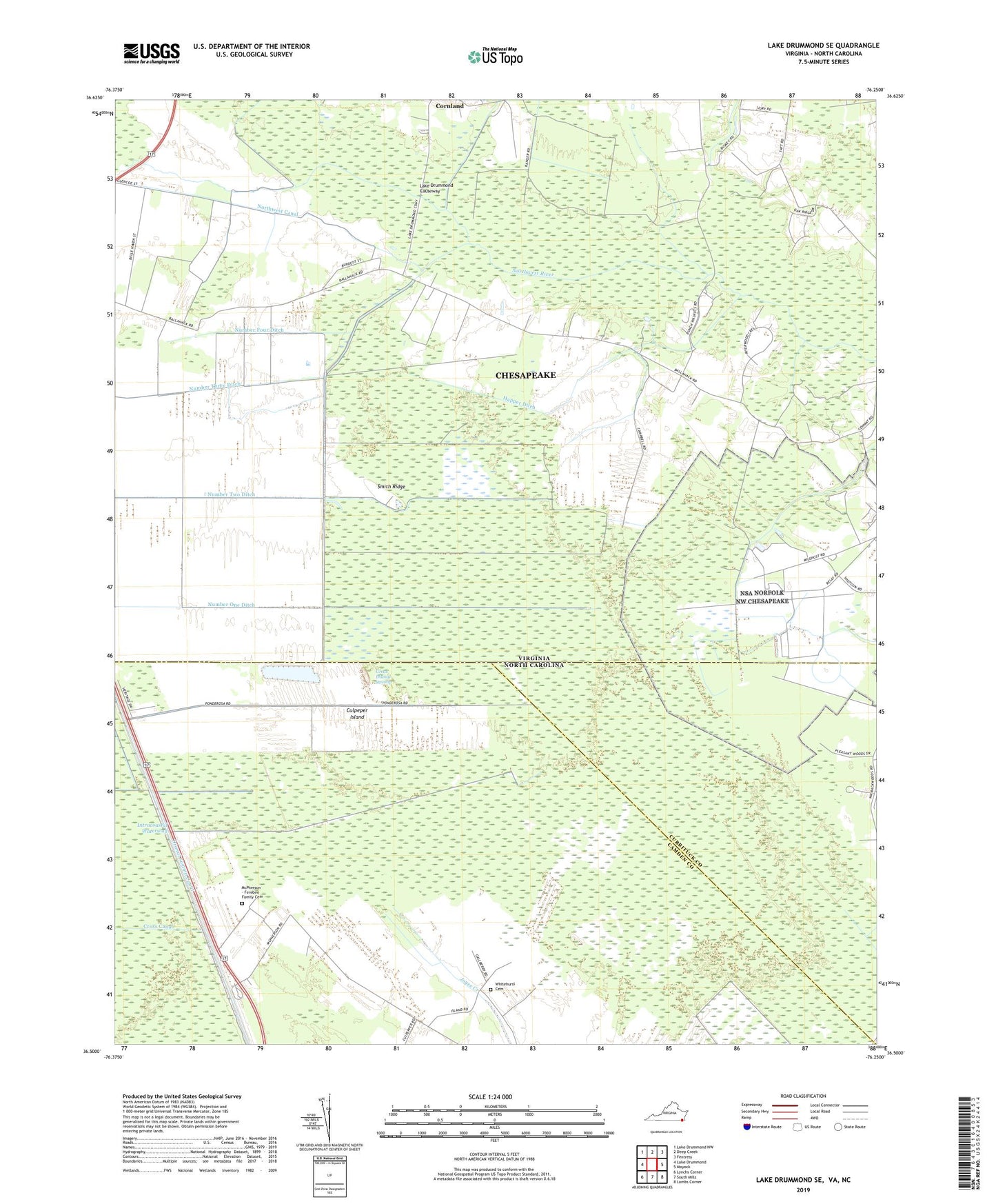
2022 topographic map quadrangle Lake Drummond SE in the states of Virginia, North Carolina. Scale: 1:24000. Based on the newly updated USGS 7.5' US Topo map series, this map is in the following counties: Chesapeake (city), Camden, Currituck. The map contains contour data, water features, and other items you are used to seeing on USGS maps, but also has updated roads and other features. This is the next generation of topographic maps. Printed on high-quality waterproof paper with UV fade-resistant inks.
Quads adjacent to this one:
West: Lake Drummond
Northwest: Lake Drummond NW
North: Deep Creek
Northeast: Fentress
East: Moyock
Southeast: Lambs Corner
South: South Mills
Southwest: Lynchs Corner
This map covers the same area as the classic USGS quad with code o36076e3.
Contains the following named places: Bethel Church, Culpeper Island, Gertie School, Happer Ditch, Lake Drummond Causeway, Lake Drummond Church, McPherson - Ferebee Family Cemetery, Northwest Canal, Northwest Chesapeake Naval Information Operations Command, Number Four Ditch, Number One Ditch, Number Three Ditch, Number Two Ditch, Smith Ridge, Whitehurst Cemetery