MyTopo
Louisa Virginia US Topo Map
Couldn't load pickup availability
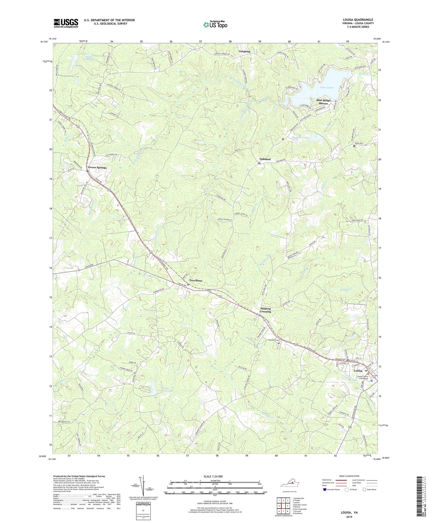
2022 topographic map quadrangle Louisa in the state of Virginia. Scale: 1:24000. Based on the newly updated USGS 7.5' US Topo map series, this map is in the following counties: Louisa. The map contains contour data, water features, and other items you are used to seeing on USGS maps, but also has updated roads and other features. This is the next generation of topographic maps. Printed on high-quality waterproof paper with UV fade-resistant inks.
Quads adjacent to this one:
West: Boswells Tavern
Northwest: Gordonsville
North: Orange
Northeast: Lahore
East: Mineral
Southeast: Pendleton
South: Ferncliff
Southwest: Zion Crossroads
This map covers the same area as the classic USGS quad with code o38078a1.
Contains the following named places: A G Despot School, Bethel Church, Blue Ridge Shores, Blue Ridge Shores Census Designated Place, Bright Hope Church, Cutalong, Ebenezer Church, Forest Hill Church, Fox Branch, Green Springs, Green Springs Depot Post Office, Hillcrest Cemetery, Humphrey Creek, Kents Mill, Lake Louisa, Lake Louisa Dam, Lasley, Lasley Church, Louisa, Louisa County Courthouse, Louisa County Department of Fire and Emergency Services, Louisa County Sheriff's Office, Louisa District, Louisa Post Office, Meyerton Dam, Meyerton Lake, Mildred Crossing, North Fork Hickory Creek, Oak Grove Church, Oakland, Oakland Cemetery, Oakland Post Office, Ponda Roche Dam, Ponda Roche Lake, Small Country Lake, Small Dam, South Fork Hickory Creek, Talleys Store, Taylor Cemetery, Trevilians, Trevilians Elementary School, Trevilians Post Office, Trevilians Volunteer Fire Department Company 6, Trevillians Volunteer Fire / Rescue Department, Union Church, Weyland Church, WLSA-FM (Louisa), ZIP Code: 23093