MyTopo
Boswells Tavern Virginia US Topo Map
Couldn't load pickup availability
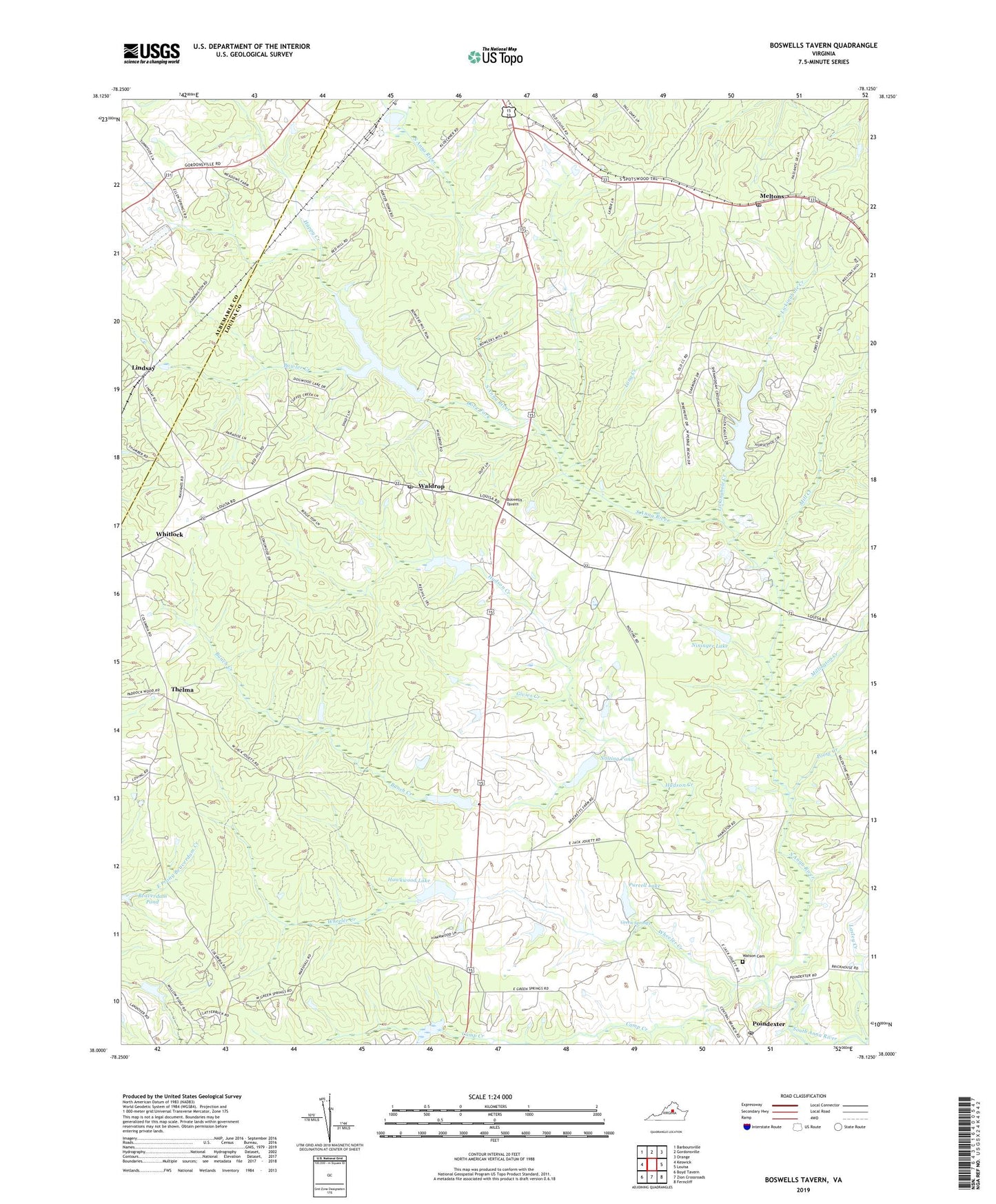
2022 topographic map quadrangle Boswells Tavern in the state of Virginia. Scale: 1:24000. Based on the newly updated USGS 7.5' US Topo map series, this map is in the following counties: Louisa, Albemarle. The map contains contour data, water features, and other items you are used to seeing on USGS maps, but also has updated roads and other features. This is the next generation of topographic maps. Printed on high-quality waterproof paper with UV fade-resistant inks.
Quads adjacent to this one:
West: Keswick
Northwest: Barboursville
North: Gordonsville
Northeast: Orange
East: Louisa
Southeast: Ferncliff
South: Zion Crossroads
Southwest: Boyd Tavern
This map covers the same area as the classic USGS quad with code o38078a2.
Contains the following named places: Bartonville Dam, Bartonville Pond, Berea Church, Blakes Mill, Boswells Tavern, Bowler Creek, Bunch Creek, Camp Creek, Central Branch, Cobham Church, Dove Fork, Free Union Church, Givies Creek, Gordonsville Church, Green Spring District, Green Springs, Green Springs School, Happy Creek, Hawkwood Dam, Hawkwood Lake, Hudson Creek, Huon West Mill, Izac Dam, Izac Lake, Lake Gordonsville, Lake Gordonsville Dam, Lasley Creek, Lickinghole Creek, Lindsay, Logan, Long Creek, Louisa Dragway, Mechanicsville, Mechanicsville Post Office, Medlock, Meltons, Meltons Post Office, Mill Creek, Millington Creek, Nininger Dam, Nininger Lake, Nolting Dam, Nolting Pond, Pleasant Plain Church, Poindexter, Poindexter Post Office, Poore Creek, Purcell Dam, Purcell Lake, Saint Johns Chapel, South Anna Number Five Dam, South Anna Number Seven Dam, Spring Branch, Thelma, Waldrop, Waldrop Post Office, Walkers Mill, Watson Cemetery, Wheeler Creek, Whitlock, Wills Memorial Church, ZIP Code: 22942