MyTopo
Middleburg Virginia US Topo Map
Couldn't load pickup availability
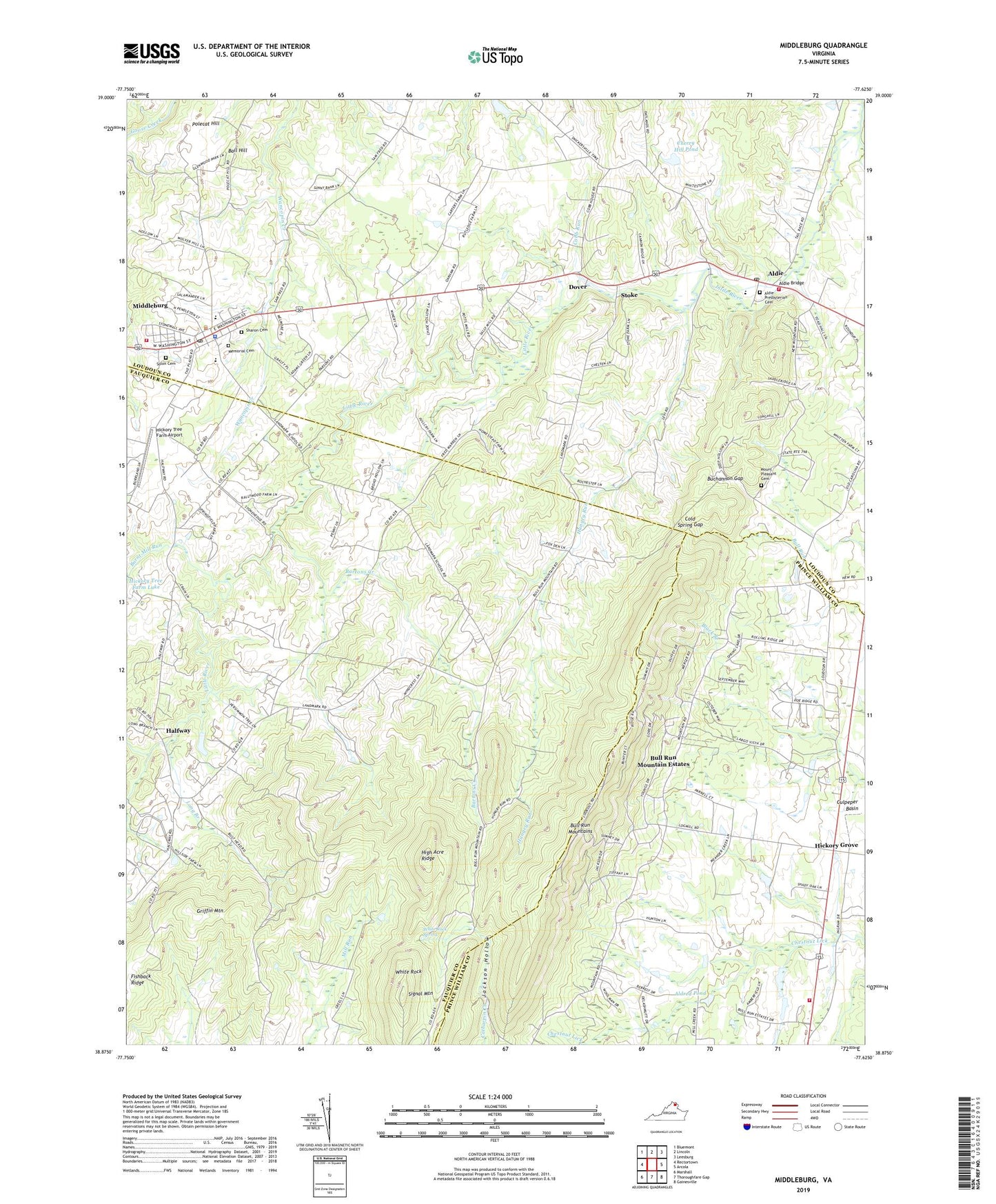
2022 topographic map quadrangle Middleburg in the state of Virginia. Scale: 1:24000. Based on the newly updated USGS 7.5' US Topo map series, this map is in the following counties: Loudoun, Fauquier, Prince William. The map contains contour data, water features, and other items you are used to seeing on USGS maps, but also has updated roads and other features. This is the next generation of topographic maps. Printed on high-quality waterproof paper with UV fade-resistant inks.
Quads adjacent to this one:
West: Rectortown
Northwest: Bluemont
North: Lincoln
Northeast: Leesburg
East: Arcola
Southeast: Gainesville
South: Thoroughfare Gap
Southwest: Marshall
This map covers the same area as the classic USGS quad with code o38077h6.
Contains the following named places: Aldie, Aldie Bridge, Aldie Census Designated Place, Aldie Dam, Aldie Elementary School, Aldie Mill, Aldie Mill Historic Park, Aldie Post Office, Aldie Presbyterian Cemetery, Aldie Presbyterian Church, Aldie United Methodist Church, Aldred Dam, Aldred Pond, Asbury Methodist Church, Ball Hill, Bartons Creek, Bowmantown, Browns Corner, Buchannon Gap, Bull Run Church, Bull Run Mountain Estates, Bull Run Mountain Estates Census Designated Place, Bull Run Mountains, Bull Run School, Burnt Mill Run, Cherry Hill Dam, Cherry Hill Pond, Church of Our Redeemer, Cobb Run, Cold Spring Gap, Dover, Emmanuel Episcopal Church, Emmanuel Episcopal Church Cemetery, Emmanuel Middleburg Memorial Cemetery, Evergreen Country Club, Evergreen Farms, Evergreen Volunteer Fire and Rescue Station 15, Forest Lake Estates, Glenwood Park, Grace Church, Griffin Mountain, Halfway, Hickory Grove, Hickory Grove Church, Hickory Tree Farm Airport, Hickory Tree Farm Dam, High Acre Ridge, Hungry Run, Jackson Hollow Recreation Area, Landmark, Landmark School, Levy, Long Branch, Long Branch Church, Loudoun County Fire and Rescue Aldie Station 7, Loudoun County Fire and Rescue Middleburg Company 3, Memorial Cemetery, Mickie Gordon Memorial Park, Middleburg, Middleburg American Legion Post 295, Middleburg Baptist Church, Middleburg Branch Loudoun County Public Library, Middleburg Community Center, Middleburg Community Charter School, Middleburg Historic District, Middleburg Police Department, Middleburg Post Office, Middleburg United Methodist Church, Mill Creek Estates, Mount Pleasant Baptist Church, Mount Pleasant Baptist Church Cemetery, Mowers Dimension Stone Quarry, National Sporting Library & Museum, New Hope Forest, Oakham Farm, Picketts Corner, Polecat Hill, Saint Stephen the Martyr Church, Sharon Cemetery, Shiloh Baptist Church, Signal Mountain, Skinkertown, Solon Cemetery, Stewartown, Stoke, Sunny Bank, The Hill School, Town of Middleburg, White Rock, White Rock Spring, ZIP Codes: 20117, 20118, 20169, 20198