MyTopo
Patrick Springs Virginia US Topo Map
Couldn't load pickup availability
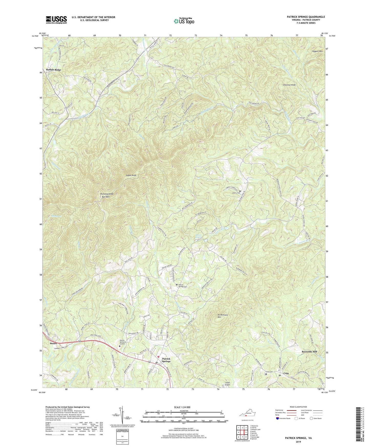
2022 topographic map quadrangle Patrick Springs in the state of Virginia. Scale: 1:24000. Based on the newly updated USGS 7.5' US Topo map series, this map is in the following counties: Patrick. The map contains contour data, water features, and other items you are used to seeing on USGS maps, but also has updated roads and other features. This is the next generation of topographic maps. Printed on high-quality waterproof paper with UV fade-resistant inks.
Quads adjacent to this one:
West: Stuart
Northwest: Woolwine
North: Charity
Northeast: Philpott Lake
East: Sanville
Southeast: Spencer
South: Nettleridge
Southwest: Stuart SE
This map covers the same area as the classic USGS quad with code o36080f2.
Contains the following named places: Atwood, Blue Ridge Mission School, Bowling Springs, Buffalo Ridge, Buffalo Ridge Church, Bull Mountain, Chestnut Knob, Critz, Critz Baptist Church, Critz Cemetery, Critz Post Office, Fairystone Church, Gabes Knob, Harbour School, Hardin Reynolds Memorial School, Jeb Stuart Rescue Squad, Kogers Store, Liberty Cemetery, Liberty Church, Little Spencer Creek, Martin School, Mountain View Church, No Business Mountain, Patrick Memorial Gardens, Patrick Spring Volunteer Fire Department, Patrick Springs, Patrick Springs Cemetery, Patrick Springs Census Designated Place, Patrick Springs Church, Patrick Springs Post Office, Patrick Springs Primary School, Pole Branch, Reynolds Mill, Rhody Creek, Rich Creek, Richwood Knob, Sycamore Church, Townley Creek, Wilson School, Wood School, ZIP Codes: 24133, 24171