MyTopo
Nora Virginia US Topo Map
Couldn't load pickup availability
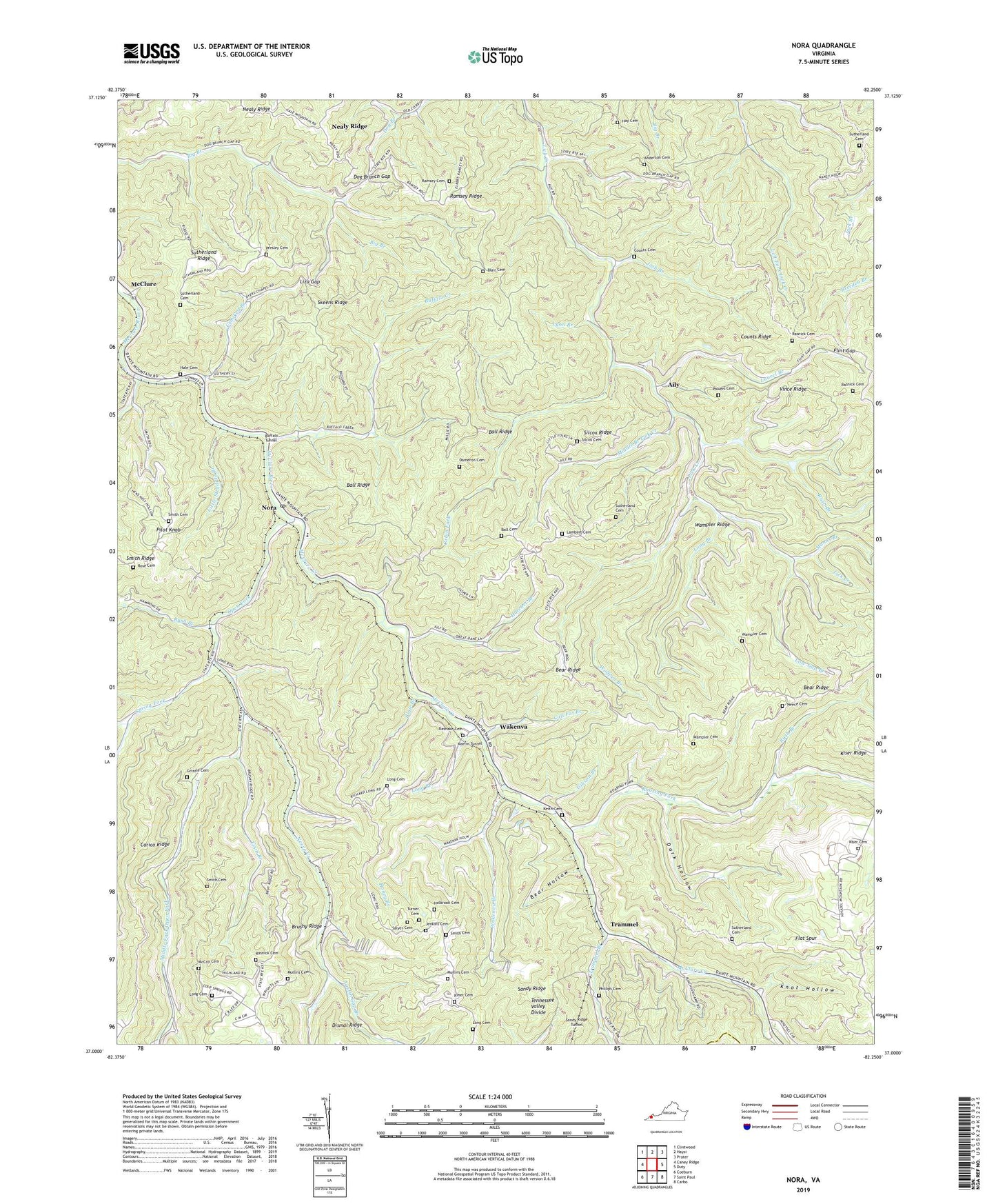
2022 topographic map quadrangle Nora in the state of Virginia. Scale: 1:24000. Based on the newly updated USGS 7.5' US Topo map series, this map is in the following counties: Dickenson, Russell. The map contains contour data, water features, and other items you are used to seeing on USGS maps, but also has updated roads and other features. This is the next generation of topographic maps. Printed on high-quality waterproof paper with UV fade-resistant inks.
Quads adjacent to this one:
West: Caney Ridge
Northwest: Clintwood
North: Haysi
Northeast: Prater
East: Duty
Southeast: Carbo
South: Saint Paul
Southwest: Coeburn
This map covers the same area as the classic USGS quad with code o37082a3.
Contains the following named places: Aily, Anderson Cemetery, Austin Gap Branch, Ball Cemetery, Ball Ridge, Bear Hollow, Bear Ridge, Bear Ridge School, Big Spraddle Branch, Blair Branch, Blair Cemetery, Brushy Ridge, Buffalo Creek, Buffalo Tunnel, Cabin Fork, Call Fat Branch, Carico Ridge, Cold Spring School, Coon Branch, Counts Cemetery, Counts Chapel, Counts Ridge, Cowan Rose Creek, Crooked Branch, Dameron Cemetery, Dark Hollow, Debusk, Delphia Church, Dismal Fork, Dog Branch Gap, Dyers Chapel, Ervinton District, Ervinton Elementary School, Ervinton High School, Fairview School, Flat Spur, Flint Gap, Flint Gap School, Gibson Branch, Grizzle Cemetery, Hale Cemetery, Hatchet Branch, Hatchet School, Hay Cemetery, Holbrook Cemetery, Honey Branch, Ivy Spring School, Jenkins Cemetery, Josh Branch, Keith Cemetery, Kiser Cemetery, Knot Hollow, Lambert Cemetery, Laurel Branch, Little Straddle Branch, Liza Gap, Long Branch, Long Branch School, Long Cemetery, Low Gap Branch, Lynn Branch, Manns Branch, Martin Chapel, Martin Tunnel, McClure Creek, McCown Church, McCoy Cemetery, Middle Branch Church, Middle Branch Lick Creek, Middle Fork Open Fork, Mullins Cemetery, Nealy Ridge, Neece Cemetery, Neece Creek, Nora, Nora Post Office, Open Fork, Open Fork Church, Open Fork School, Phillips Cemetery, Pilot Knob, Pilot Knob School, Powers Cemetery, Presley Cemetery, Ramsey Cemetery, Ramsey Ridge, Ramsey Ridge School, Rasnake Cemetery, Rasnake School, Rasnick Cemetery, Riner Cemetery, Roaring Fork, Rose Cemetery, Rush Branch, Saint Stephens Church, Salyer Cemetery, Silcox Cemetery, Silcox Ridge, Skeens Ridge, Smith Cemetery, Smith School, Spring Branch, Spring Fork, Station Number 2, Stratton, Sutherland Cemetery, Sutherland Ridge, Trammel, Trammel Branch, Trammel School, Turner Cemetery, Vince Ridge, Wakenva, Wakenva Branch, Wakenva School, Wampler Cemetery, Wolfpen Branch, ZIP Codes: 24237, 24272