MyTopo
Buckner Virginia US Topo Map
Couldn't load pickup availability
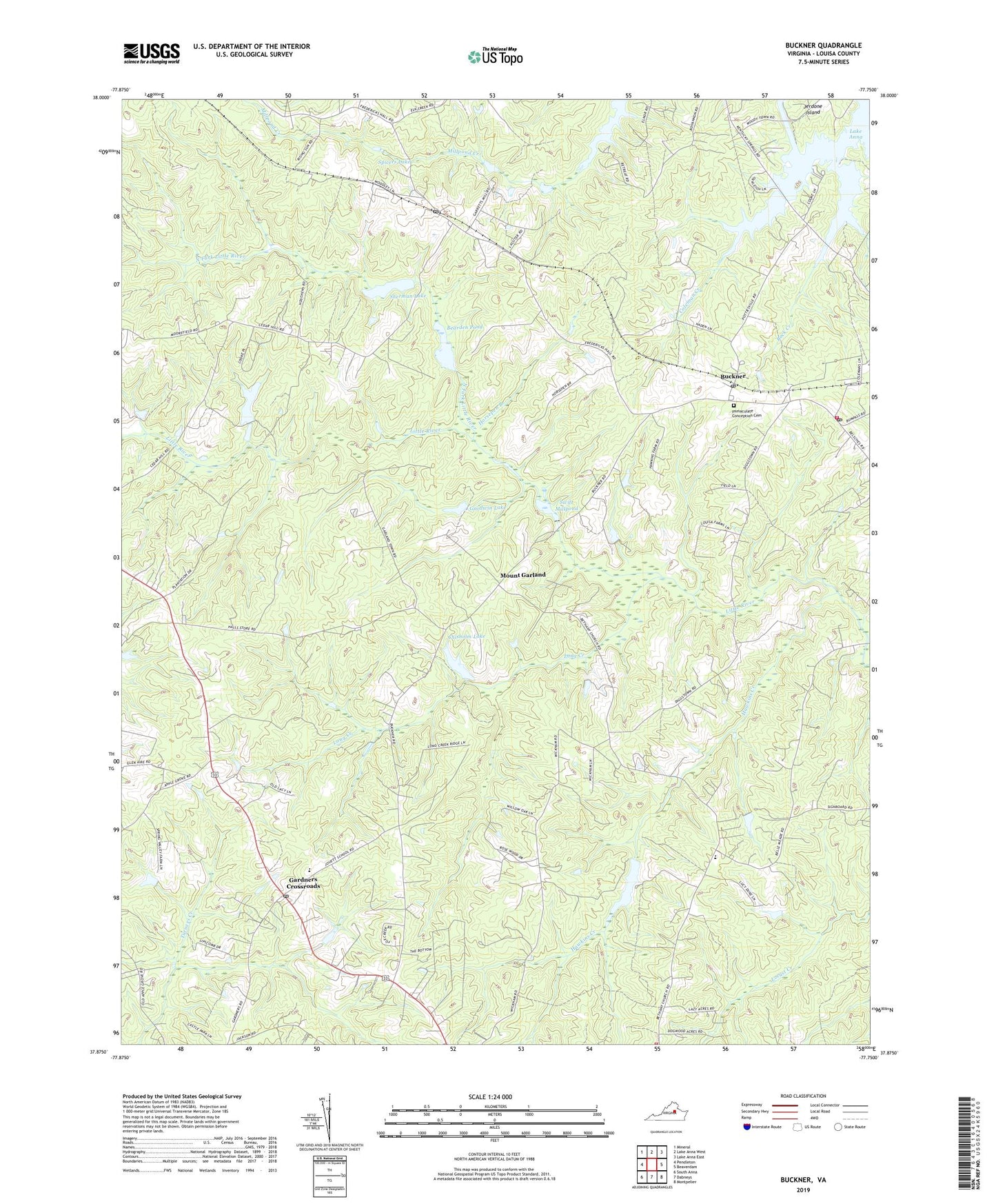
2022 topographic map quadrangle Buckner in the state of Virginia. Scale: 1:24000. Based on the newly updated USGS 7.5' US Topo map series, this map is in the following counties: Louisa. The map contains contour data, water features, and other items you are used to seeing on USGS maps, but also has updated roads and other features. This is the next generation of topographic maps. Printed on high-quality waterproof paper with UV fade-resistant inks.
Quads adjacent to this one:
West: Pendleton
Northwest: Mineral
North: Lake Anna West
Northeast: Lake Anna East
East: Beaverdam
Southeast: Montpelier
South: Dabneys
Southwest: South Anna
This map covers the same area as the classic USGS quad with code o37077h7.
Contains the following named places: Apple Grove Baptist Church, Bearden Pond, Bears Den Dam, Bethany Church, Bethpage Church, Bible Church, Brooks Store, Buckner, Buckner Post Office, Bumpass Post Office, Bumpass Volunteer Fire Department Company 3, Chisholm Dam, Chisholm Lake, Coleman Creek, Cuckoo District, Dam Number 4, Fredericks Hall, Fredericks Hall Post Office, Gardners Crossroads, Gardners Crossroads Post Office, Goodwin Lake, Goodwins Dam, Harts Shop, Hawkins Creek, Horsepen Branch, Immaculate Conception Catholic Church, Immaculate Conception Cemetery, Jackson District, Jouett Elementary School, Little River Church, Little River Number Four Dam, Locust Creek Volunteer Fire Department Company 5, Long Creek, Long Creek Post Office, Longcreek, Mostly Harmless Heliport, Mount Garland, Mount Garland Church, North Fork Little River, Pettit Dam, Piedmont Christian School, Rising Sun Church, Robbies Island, Sherman Lake, Spicers Lake, Swift Millpond, Swifts Dam, Swifts Mill, Threemile Corner, Watchtower Church, West End Volunteer Rescue Squad, Wickham Corner, ZIP Codes: 23024, 23117