MyTopo
Dabneys Virginia US Topo Map
Couldn't load pickup availability
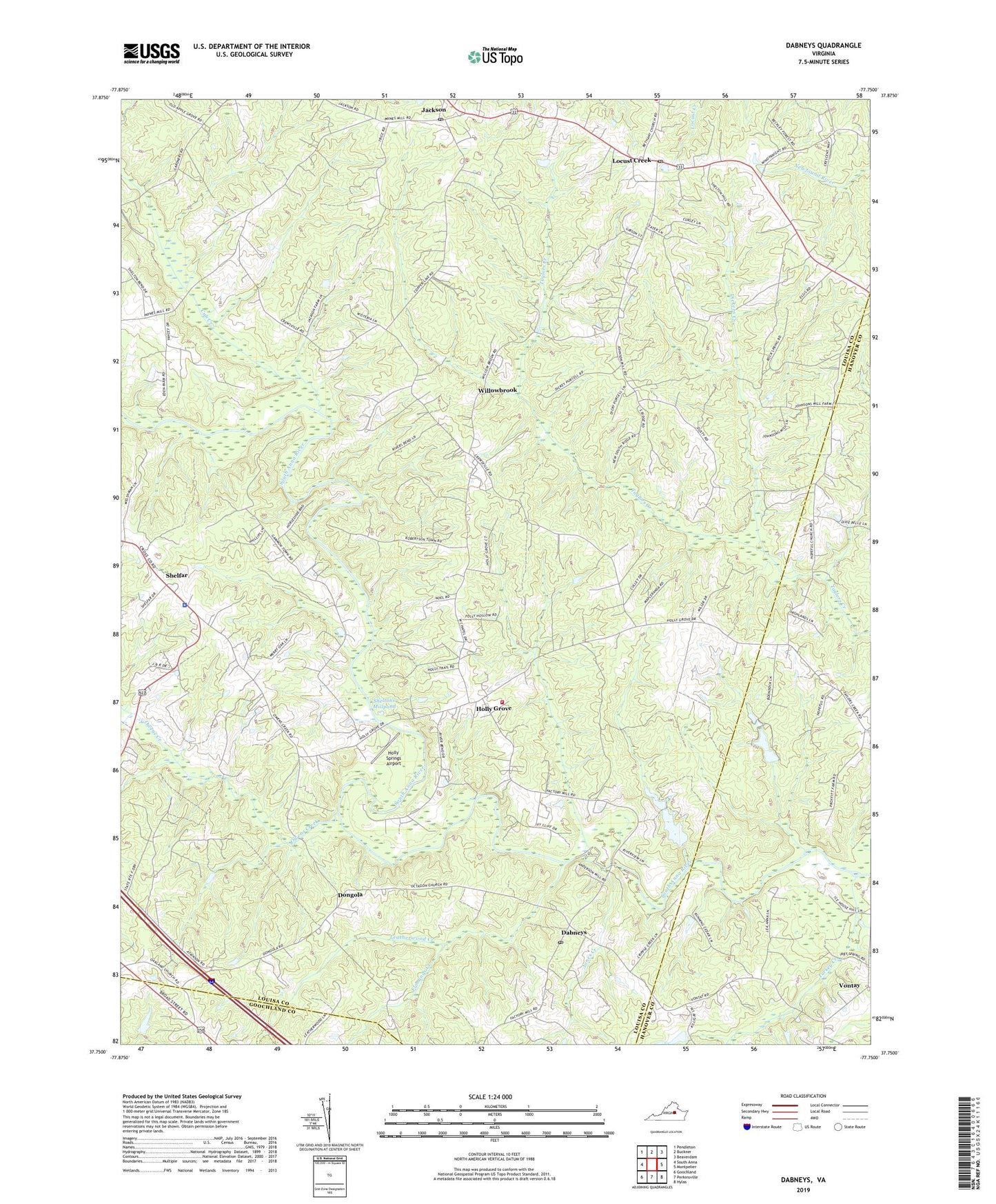
2022 topographic map quadrangle Dabneys in the state of Virginia. Scale: 1:24000. Based on the newly updated USGS 7.5' US Topo map series, this map is in the following counties: Louisa, Hanover, Goochland. The map contains contour data, water features, and other items you are used to seeing on USGS maps, but also has updated roads and other features. This is the next generation of topographic maps. Printed on high-quality waterproof paper with UV fade-resistant inks.
Quads adjacent to this one:
West: South Anna
Northwest: Pendleton
North: Buckner
Northeast: Beaverdam
East: Montpelier
Southeast: Hylas
South: Perkinsville
Southwest: Goochland
This map covers the same area as the classic USGS quad with code o37077g7.
Contains the following named places: Bagby Store, Cavalier Rifle and Pistol Club Dam, Cub Creek, Dabneys, Dabneys Post Office, Dickens Creek, Dongola, Duggins Store, Emmanuel Church, Flemings Creek, Fork Church, Gays, Holly Grove, Holly Grove Church, Holly Grove Volunteer Fire Department Company 4, Holly Grove Volunteer Rescue Squad, Holly Springs Airport, Hopeful Church, Jackson, Jackson Post Office, Jones Creek, Leatherwood Creek, Locust Creek, Locust Creek Post Office, Mount Hope Church, Mount Olivet Church, Mount Zion Church, Mount Zion School, Mountain Road District, Oakland Church, Owens Creek, Saint Marks Church, Salem Church, Shady Grove Church, Shelfar, Sheltons Dam, Sheltons Mill, Sheltons Millpond, Three Square, Turkey Creek, Victory Christian Fellowship, Virginia State Police Division 1 Area 4 Office, Vontay, Willowbrook