MyTopo
Sandy Level Virginia US Topo Map
Couldn't load pickup availability
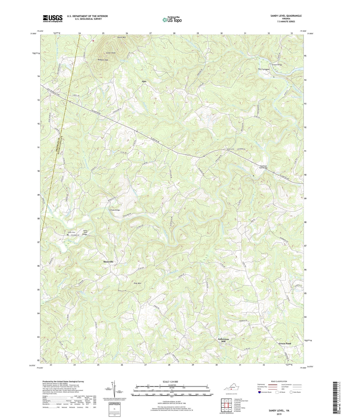
2022 topographic map quadrangle Sandy Level in the state of Virginia. Scale: 1:24000. Based on the newly updated USGS 7.5' US Topo map series, this map is in the following counties: Pittsylvania, Franklin. The map contains contour data, water features, and other items you are used to seeing on USGS maps, but also has updated roads and other features. This is the next generation of topographic maps. Printed on high-quality waterproof paper with UV fade-resistant inks.
Quads adjacent to this one:
West: Penhook
Northwest: Moneta SW
North: Smith Mountain Dam
Northeast: Leesville
East: Pittsville
Southeast: Chatham
South: Callands
Southwest: Mountain Valley
This map covers the same area as the classic USGS quad with code o36079h5.
Contains the following named places: Adkins School, Ajax, Andersons Mill, Buffalo Branch, Burnt Chimney, Burton Dam, Burton Lake, Canada Bridge, Carr Ford, Carter Cemetery, Cedar Creek, Chestnut Ridge School, Cool Branch Rescue Squad - Squad 13, Cool Branch Volunteer Fire Department Company 13, Crooked Run, Dalton School, Davis Ford, Five Forks Church, Five Forks School, Fryingpan Creek, Fuzzys Dam, Giles Mill, Graves Bridge, Greasy Creek, Green Pond, Greenpond Baptist Church, Greer Knob, Hammock Dam, Hammock Farm, Harpen Creek, Jonnikin Creek, Juniper School, Kirby Ford Bridge, Lees Mill, Liberty Church, Liberty School, Lick Fork Cedar Creek, Louis Island Bridge, Mill Creek, Mountain View School, Museville, New Bethel Church, Oak Hill School, Olive Branch School, Pie Creek, Pine Mountain, Potter Creek, Reddies Creek, Reddies Gap, Rising Sun Church, Rocky Creek, Sandy Level, Sandy Level Church, Snow Creek, Stanhope Hurt Bridge, Sunnyside School, The Fryingpan, Tomahawk Creek, Turkeycock Creek, Watson Dam, ZIP Code: 24161