MyTopo
Perkinsville Virginia US Topo Map
Couldn't load pickup availability
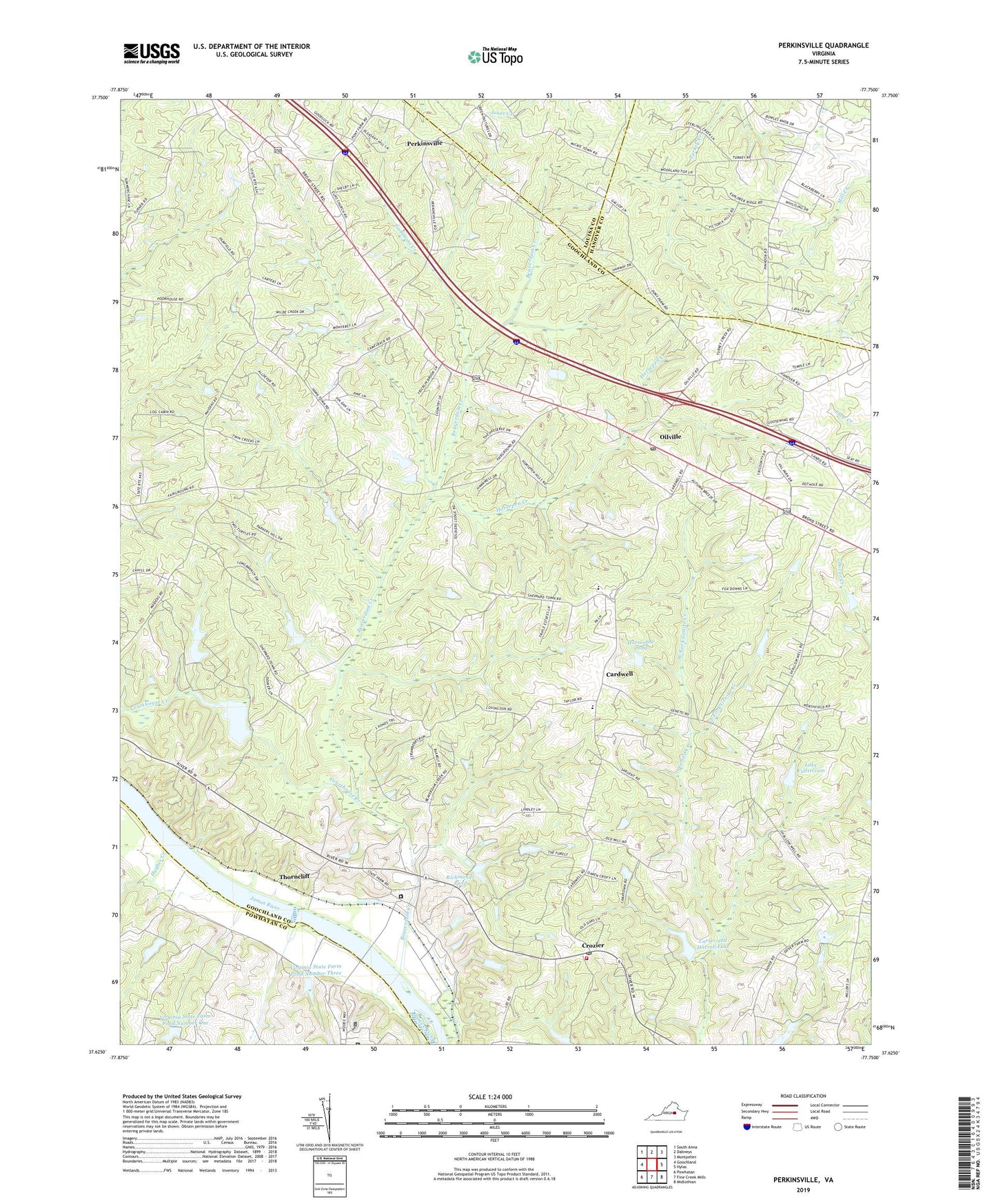
2022 topographic map quadrangle Perkinsville in the state of Virginia. Scale: 1:24000. Based on the newly updated USGS 7.5' US Topo map series, this map is in the following counties: Goochland, Hanover, Powhatan, Louisa. The map contains contour data, water features, and other items you are used to seeing on USGS maps, but also has updated roads and other features. This is the next generation of topographic maps. Printed on high-quality waterproof paper with UV fade-resistant inks.
Quads adjacent to this one:
West: Goochland
Northwest: South Anna
North: Dabneys
Northeast: Montpelier
East: Hylas
Southeast: Midlothian
South: Fine Creek Mills
Southwest: Powhatan
This map covers the same area as the classic USGS quad with code o37077f7.
Contains the following named places: Amber Lake, Bachman Farm Ultralight Airport, Beacon Hill, Beaverdam Creek, Bethel Church, Bowles Dam, Cardwell, Carter and Harrell Dam, Carter and Harrell Lake, Chelsea, Courthouse Creek, Covington, Crosswoods West, Crozier, Crozier Post Office, Deerfield, District 3, East Courthouse Estates, East Fork Genito Creek, Elpis Church, Fair Woods, First Union Church, Fox Downs, Gammons Creek, Gammons Store, Goochland County Volunteer Fire and Rescue Company 2 Crozier, Goochland Industrial Park, Hebron Church, Hillcrest, Horsepen Creek, Horsepen Hills, Horseshoe Pond, Hughes Creek, Hunters Woods, Huntleigh, James River Correctional Center, James River Work Center, Lake Fullstream, Lake Fullstream Dam, Maidens Forest, Mount Bernard Dam, Mount Bernard Lake, Oaklands, Oilville, Oilville Business Park, Oilville Post Office, Old Oaks, Perkinsville, Poplar Forest, Powhatan Correctional Center, R E Lee Boy Scout Camps, Randolph Elementary School, Reynolds Dam, Richmonds Dam, Richmonds Pond, River Cliff, Salem Baptist Church, Salem Christian School, Smokey Hollow, State Farm, Strawberry Run, The Forest, Thorncliff, Three Oaks, Timber Ridge, Virginia State Farm Dam Number One, Virginia State Farm Dam Number Three, Virginia State Farm Pond Number One, Virginia State Farm Pond Number Three, West Fork Genito Creek, Whitehall Acres, ZIP Codes: 23039, 23102, 23129, 23160