MyTopo
Riverdale Virginia US Topo Map
Couldn't load pickup availability
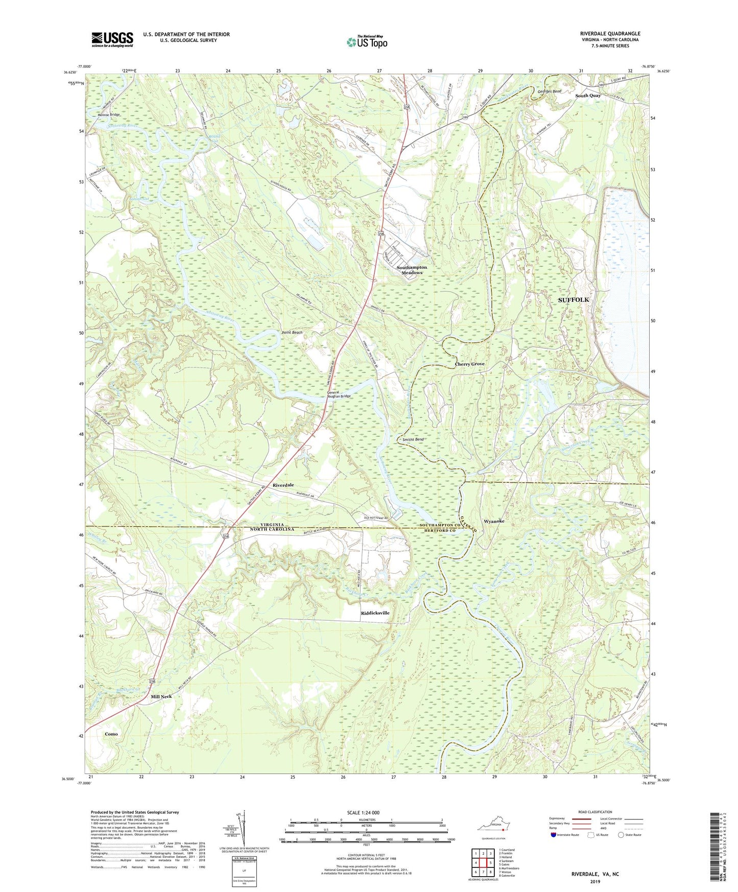
2022 topographic map quadrangle Riverdale in the states of Virginia, North Carolina. Scale: 1:24000. Based on the newly updated USGS 7.5' US Topo map series, this map is in the following counties: Southampton, Hertford, Suffolk (city), Gates. The map contains contour data, water features, and other items you are used to seeing on USGS maps, but also has updated roads and other features. This is the next generation of topographic maps. Printed on high-quality waterproof paper with UV fade-resistant inks.
Quads adjacent to this one:
West: Sunbeam
Northwest: Courtland
North: Franklin
Northeast: Holland
East: Gates
Southeast: Gatesville
South: Winton
Southwest: Murfreesboro
This map covers the same area as the classic USGS quad with code o36076e8.
Contains the following named places: Battle Beach, Beaman Branch, Bethany Church, Blackwater River, Bronco Rod and Gun Club, Buckhorn Creek, Cathole Landing, Cherry Grove, Cobbs Wharf, Cox Landing, C-Pond, C-Pond Dam, Crossville, Diamond Grove Church, Diamond Grove School, D-Pond, D-Pond Dam, Gatlington Landing, General Vaughan Bridge, Georges Bend, Holland Nursery, Jernigan Branch, Macks Wharf, Manning Ferry, Milk Landing, Mill Creek, Mill Creek Landing, Mill Neck, Monroe Bridge, Mount Olive Church, Nottoway River, Point Beach, Riddicks Landing, Riddicksville, Riverdale, Round Gut, Sandy Hill School, Sandy Landing, Simms Gut, Smiths Bend, Smiths Ferry, Somerton Creek, South Quay, Southampton Meadows Census Designated Place, Still Landing, Sweepstakes, Wyanoke