MyTopo
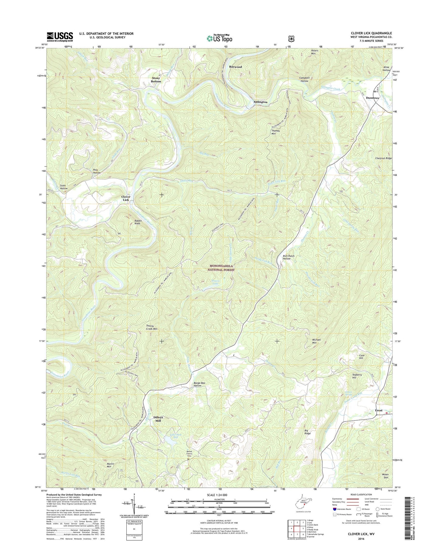
Clover Lick West Virginia US Topo Map
Couldn't load pickup availability
Also explore the Clover Lick Forest Service Topo of this same quad for updated USFS data
2023 topographic map quadrangle Clover Lick in the state of West Virginia. Scale: 1:24000. Based on the newly updated USGS 7.5' US Topo map series, this map is in the following counties: Pocahontas. The map contains contour data, water features, and other items you are used to seeing on USGS maps, but also has updated roads and other features. This is the next generation of topographic maps. Printed on high-quality waterproof paper with UV fade-resistant inks.
Quads adjacent to this one:
West: Edray
Northwest: Mingo
North: Cass
Northeast: Green Bank
East: Paddy Knob
Southeast: Sunrise
South: Minnehaha Springs
Southwest: Marlinton
This map covers the same area as the classic USGS quad with code o38079c8.
Contains the following named places: Alexander Memorial Presbyterian Church, Baxter Presbyterian Church, Bethel Church Cemetery, Bethel School, Big Ridge, Big Run, Booga-Boo Hollow, Buckskin Reservation Boy Scout Camp, Campbell Hollow, Clover Creek, Clover Lick, Clover Lick School, Cold Spring Run, County High School, Cove Hill, Cove Hill School, Dilleys Mill, Dillys Mill Boy Scout Camp Lake Dam, Dunmore, Dunmore Grade School, Dunmore Post Office, Dunmore United Methodist Church, Elklick Run, Frost, Frost School, Frost United Methodist Church, Frost Volunteer Fire Department, Gibson Spring, Glade Run, Hill Top Trail, Kline Hollow, Kronimiller Trail, Lake Sam Hill, Laurel Run, Little Thorny Creek, McLaughlin School, Michael Mountain, Mile Branch, Moore Run, Moses Spring Run, Mount Zion Church, Mount Zion School, Pocahontas County High School, Pole Hollow, Powder Lick Run, Rabbit Knob, Raywood, Raywood School, Rich Patch Hollow, Rimel Wildlife Management Area, Sandy Lick Run, Scale Hollow, Scarlet Oak Trail, Seneca Lake, Seneca State Forest, Seven Mile Campground, Sitlington, Sitlington Creek, Stony Bottom, Stony Bottom School, Sugar Camp Run, Sweet Lick Run, Teaberry Hill, Thomas Creek, Thomas Mountain, Thorney Creek School, Thorny Creek Mountain, Thorny Mountain Fire Lookout Tower, Thorny Mountain Lookout Tower, Woods Run, WVMR-AM (Frost), ZIP Code: 24934