MyTopo
Woolwine Virginia US Topo Map
Couldn't load pickup availability
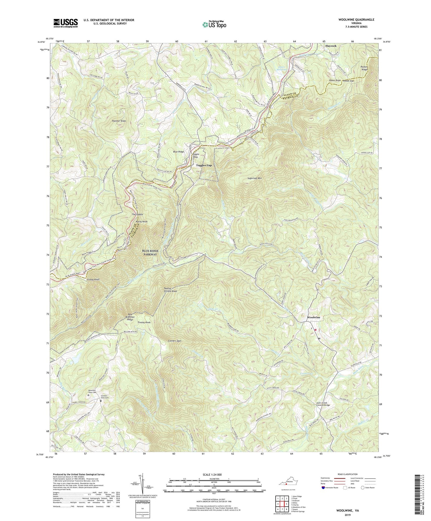
2019 topographic map quadrangle Woolwine in the state of Virginia. Scale: 1:24000. Based on the newly updated USGS 7.5' US Topo map series, this map is in the following counties: Patrick, Floyd. The map contains contour data, water features, and other items you are used to seeing on USGS maps, but also has updated roads and other features. This is the next generation of topographic maps. Printed on high-quality waterproof paper with UV fade-resistant inks.
Quads adjacent to this one:
West: Willis
Northwest: Alum Ridge
North: Floyd
Northeast: Endicott
East: Charity
Southeast: Patrick Springs
South: Stuart
Southwest: Meadows of Dan
Contains the following named places: Braswells Dam, Conners Creek, Conners Spur, Conners View Cemetery, Conners View Church, Dillons Chapel, Fairview Church, Grassy Knoll, Haycock, Jacks Creek, Jacks Creek Church, Jack's Creek Covered Bridge, Jill Creek, Little Creek, Little Rock Castle Creek, Mountain View Cemetery, Mountain View Church, New Brammer Ridge, North Prong Smith River, Panther Knob, Pocket Ridge, Rakes Knob, Rakes Mill Dam, Rakes Millpond, Rocky Knob, Rocky Knob Recreation Area, Smith River Rescue Squad, Sugarloaf Mountain, The Saddle, Thomas Grove Church, Tinsley Knob, Tuggle Gap, Tuggles Gap, Twelve O'Clock Knob, West Liberty Church, Woods Gap, Woolwine, Woolwine Elementary School, Woolwine Post Office, Woolwine United Methodist Church, Woolwine Volunteer Fire Department, ZIP Code: 24185