MyTopo
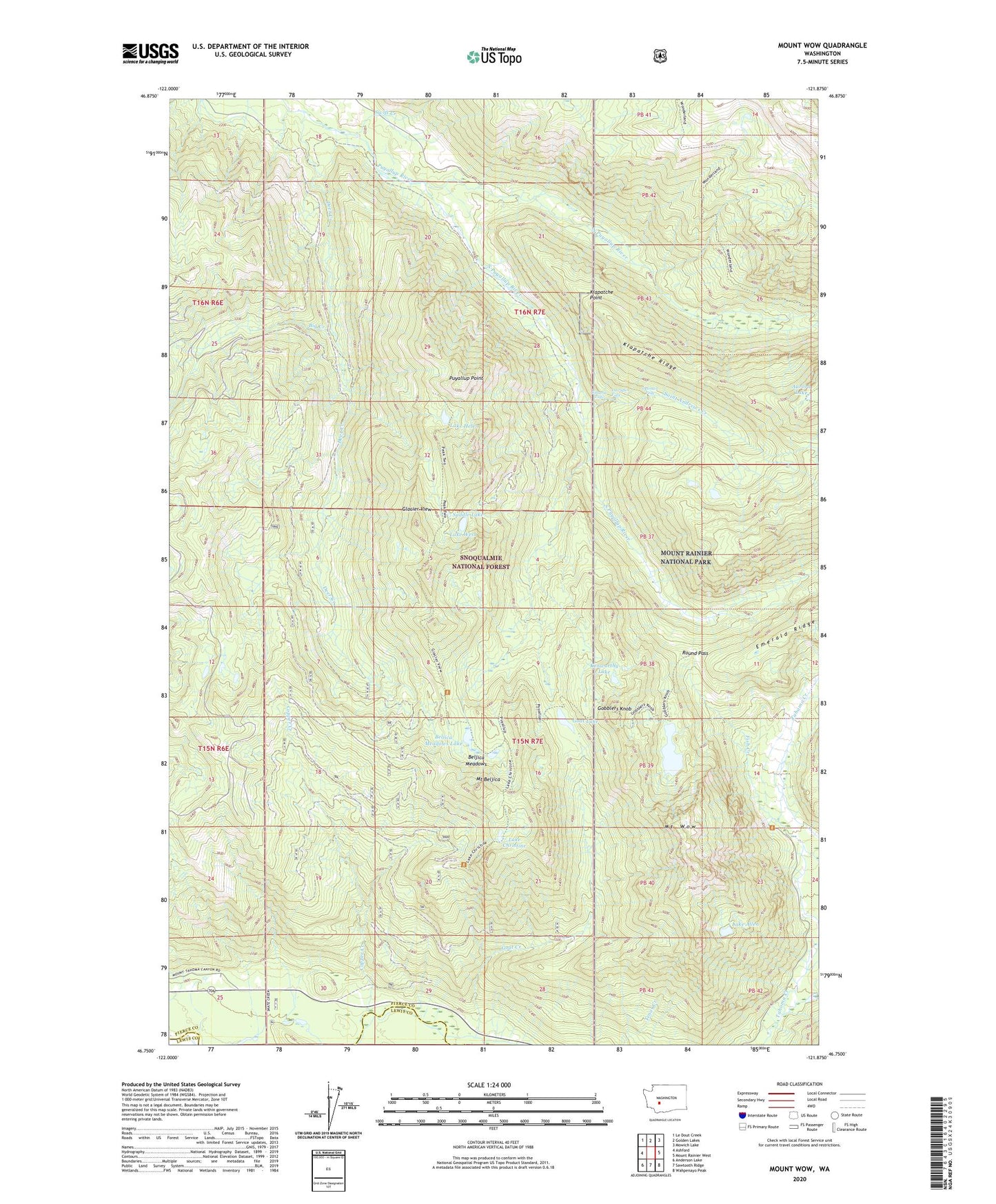
Mount Wow Washington US Topo Map
Couldn't load pickup availability
Also explore the Mount Wow Forest Service Topo of this same quad for updated USFS data
2023 topographic map quadrangle Mount Wow in the state of Washington. Scale: 1:24000. Based on the newly updated USGS 7.5' US Topo map series, this map is in the following counties: Pierce, Lewis. The map contains contour data, water features, and other items you are used to seeing on USGS maps, but also has updated roads and other features. This is the next generation of topographic maps. Printed on high-quality waterproof paper with UV fade-resistant inks.
Quads adjacent to this one:
West: Ashford
Northwest: Le Dout Creek
North: Golden Lakes
Northeast: Mowich Lake
East: Mount Rainier West
Southeast: Wahpenayo Peak
South: Sawtooth Ridge
Southwest: Anderson Lake
This map covers the same area as the classic USGS quad with code o46121g8.
Contains the following named places: Aurora Lake, Beljica Meadows, Beljica Meadows Lake, Big Creek, Copper Creek, Deer Creek, Denman Falls, Ethania Falls, Glacier View, Glacier View Wilderness, Goat Creek, Goat Lake, Gobblers Knob, Kenworthy Lake, Klapatche Point, Klapatche Ridge, Lake Allen, Lake Christine, Lake George, Lake Helen, Lake West, Larrupin Falls, Marine Memorial Airplane Crash Monument, Mount Beljica, Mount Wow, North Puyallup River, Puyallup Point, Round Pass, Saddle Lake, Saint Andrews Creek, South Puyallup River, Swift Creek, Tahoma Vista