MyTopo
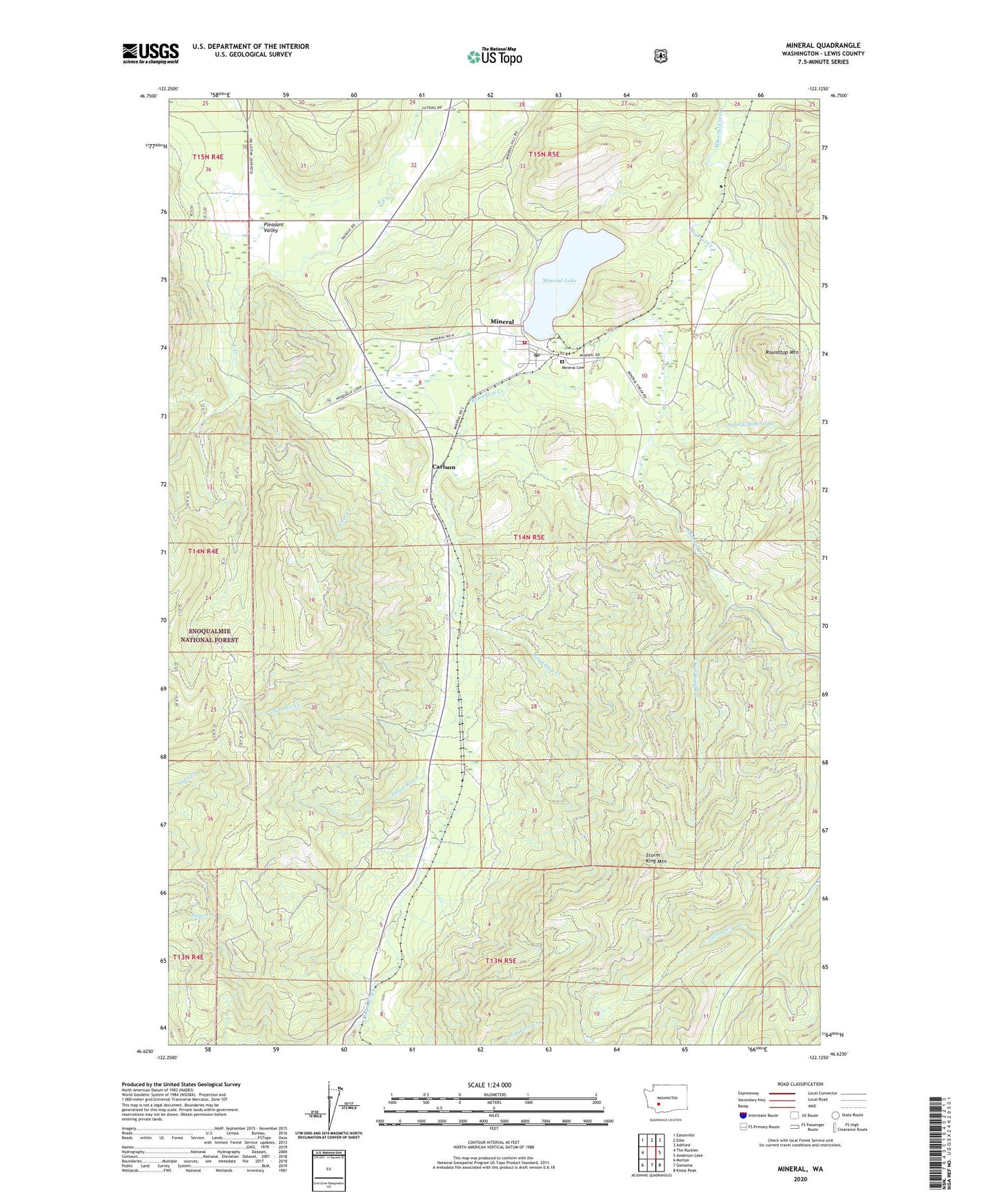
Mineral Washington US Topo Map
Couldn't load pickup availability
Also explore the Mineral Forest Service Topo of this same quad for updated USFS data
2023 topographic map quadrangle Mineral in the state of Washington. Scale: 1:24000. Based on the newly updated USGS 7.5' US Topo map series, this map is in the following counties: Lewis. The map contains contour data, water features, and other items you are used to seeing on USGS maps, but also has updated roads and other features. This is the next generation of topographic maps. Printed on high-quality waterproof paper with UV fade-resistant inks.
Quads adjacent to this one:
West: The Rockies
Northwest: Eatonville
North: Elbe
Northeast: Ashford
East: Anderson Lake
Southeast: Kiona Peak
South: Glenoma
Southwest: Morton
This map covers the same area as the classic USGS quad with code o46122f2.
Contains the following named places: Carlson, Coal Creek, Divide, Lewis County Fire District 9 Mineral Fire Department, Mineral, Mineral Cemetery, Mineral Census Designated Place, Mineral Lake, Mineral Lake Dam, Mineral Landing Strip, Mineral Post Office, North Fork Mineral Creek, Roundtop Creek, Roundtop Mountain, Storm King Lookout, Storm King Mountain, Summit Creek, Washington Creek