MyTopo
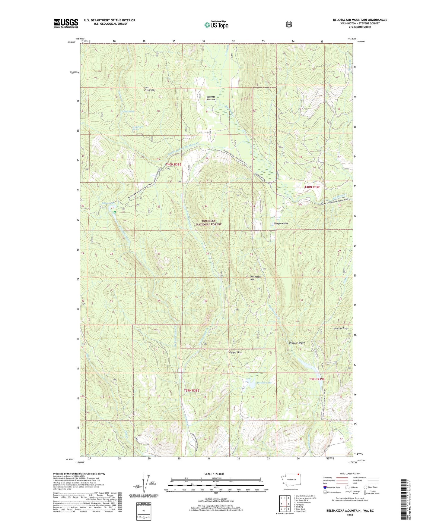
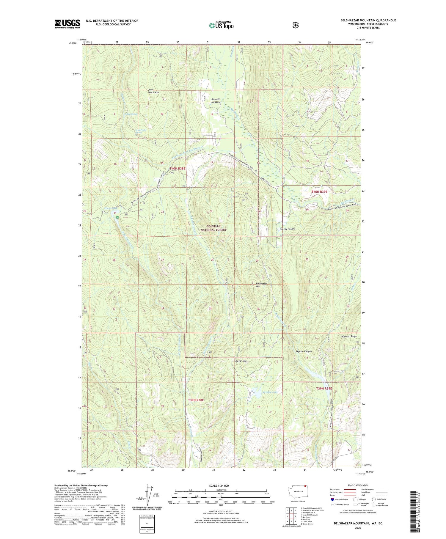
Belshazzar Mountain Washington US Topo Map
Couldn't load pickup availability
Also explore the Belshazzar Mountain Forest Service Topo of this same quad for updated USFS data
2023 topographic map quadrangle Belshazzar Mountain in the state of Washington. Scale: 1:24000. Based on the newly updated USGS 7.5' US Topo map series, this map is in the following counties: Stevens. The map contains contour data, water features, and other items you are used to seeing on USGS maps, but also has updated roads and other features. This is the next generation of topographic maps. Printed on high-quality waterproof paper with UV fade-resistant inks.
Quads adjacent to this one:
West: Churchill Mountain
Northwest: Churchill Mountain OE N
North: Belshazzar Mountain OE N
Northeast: Northport OE N
East: Northport
Southeast: Onion Creek
South: China Bend
Southwest: Bossburg
This map covers the same area as the classic USGS quad with code o48117h8.
Contains the following named places: American Fork Big Sheep Creek, Ansaldo Lake, Belshazzar Mountain, Bennett Meadow, Bullion Mine, Chief Joseph Mine, Corral Creek, Cougar Mountain, East Fork Crown Creek, Elbow Lake, Lead Pencil Mountain, Lead Pencil Spring, Pepoon Canyon, Pepoon Lake, Rose Ranch, Sleepy Hollow, West Fork Crown Creek, Zodiac Creek, Zodiac Spring