MyTopo
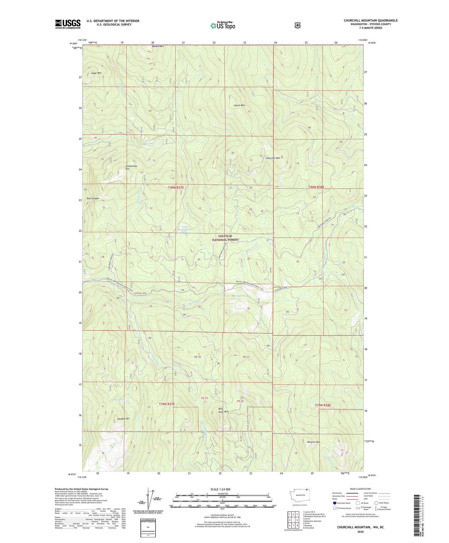
Churchill Mountain Washington US Topo Map
Couldn't load pickup availability
Also explore the Churchill Mountain Forest Service Topo of this same quad for updated USFS data
2023 topographic map quadrangle Churchill Mountain in the state of Washington. Scale: 1:24000. Based on the newly updated USGS 7.5' US Topo map series, this map is in the following counties: Stevens. The map contains contour data, water features, and other items you are used to seeing on USGS maps, but also has updated roads and other features. This is the next generation of topographic maps. Printed on high-quality waterproof paper with UV fade-resistant inks.
Quads adjacent to this one:
West: Laurier
Northwest: Laurier OE N
North: Churchill Mountain OE N
Northeast: Belshazzar Mountain OE N
East: Belshazzar Mountain
Southeast: China Bend
South: Bossburg
Southwest: Orient
This map covers the same area as the classic USGS quad with code o48118h1.
Contains the following named places: Big Iron Mine, Billy Goat Mountain, Bowen Mountain, Camp Creek, Churchill Lookout, Churchill Mine, Churchill Mountain, Contention Hill, Easter Sunday Lake, Easter Sunday Mine, Fisher Creek, Fisher Creek Cabin, Hope Mountain, Horns Mountain, Hungry Hill, Kiel Springs, Lamar Lake, Limestone Creek, Mineral Mountain, White Horse Mine