MyTopo
Blue Goat Mountain Washington US Topo Map
Couldn't load pickup availability
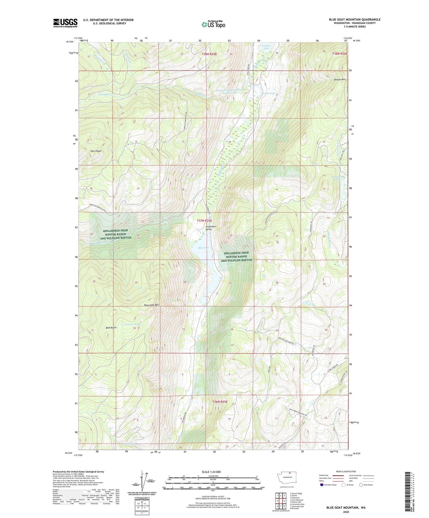
2020 topographic map quadrangle Blue Goat Mountain in the state of Washington. Scale: 1:24000. Based on the newly updated USGS 7.5' US Topo map series, this map is in the following counties: Okanogan. The map contains contour data, water features, and other items you are used to seeing on USGS maps, but also has updated roads and other features. This is the next generation of topographic maps. Printed on high-quality waterproof paper with UV fade-resistant inks.
Quads adjacent to this one:
West: Coxit Mountain
Northwest: Duncan Ridge
North: Loomis
Northeast: Enterprise
East: Aeneas Lake
Southeast: Riverside
South: Conconully East
Southwest: Conconully West
Contains the following named places: Bald Butte, Beeman School, Blue Goat Creek, Blue Goat Mountain, Blue Lake, Blue Lake Dam, Chilson Creek, Conners Lake, Crowder Pond, Forde Lake, Lemanasky Lake, Lemansky Lake Dam, Lower Sinlahekin Impoundment, Reflection Pond, Roylance Dam, Sarsapkin Creek, Sinlahekin Dam Number One, Sinlahekin Dam Number Three, Sinlahekin Dam Number Two, Sinlahekin Deer Winter Range and Wildlife Refuge, Sinlahekin Impoundment Number Two, Sinlahekin State Wildlife Recreation Area, Sinlahekin Wildlife Recreation Area, Twin Peaks, Wickiup Creek