MyTopo
Aeneas Lake Washington US Topo Map
Couldn't load pickup availability
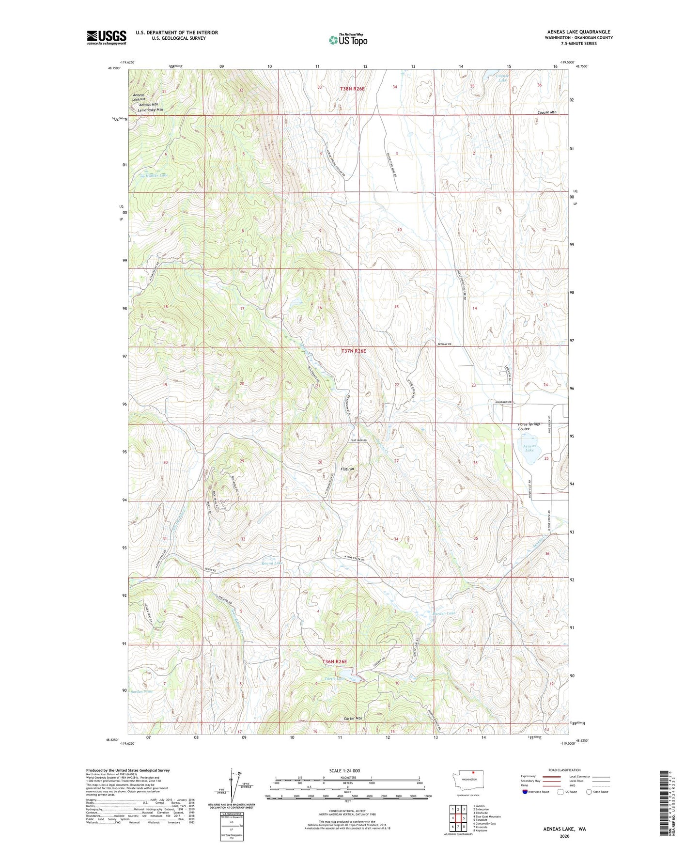
2023 topographic map quadrangle Aeneas Lake in the state of Washington. Scale: 1:24000. Based on the newly updated USGS 7.5' US Topo map series, this map is in the following counties: Okanogan. The map contains contour data, water features, and other items you are used to seeing on USGS maps, but also has updated roads and other features. This is the next generation of topographic maps. Printed on high-quality waterproof paper with UV fade-resistant inks.
Quads adjacent to this one:
West: Blue Goat Mountain
Northwest: Loomis
North: Enterprise
Northeast: Ellisforde
East: Tonasket
Southeast: Keystone
South: Riverside
Southwest: Conconully East
This map covers the same area as the classic USGS quad with code o48119f5.
Contains the following named places: Aeneas Lake, Aeneas Lookout, Aeneas Mountain, Burden Lake, Carter Mountain, Cayuse Lake, Flatiron, Horse Springs Coulee, Hunter Lake, Lemanasky Mountain, Round Lake, Silver Mountain Mine, Tonasket Division, Turtle Lake