MyTopo
Loomis Washington US Topo Map
Couldn't load pickup availability
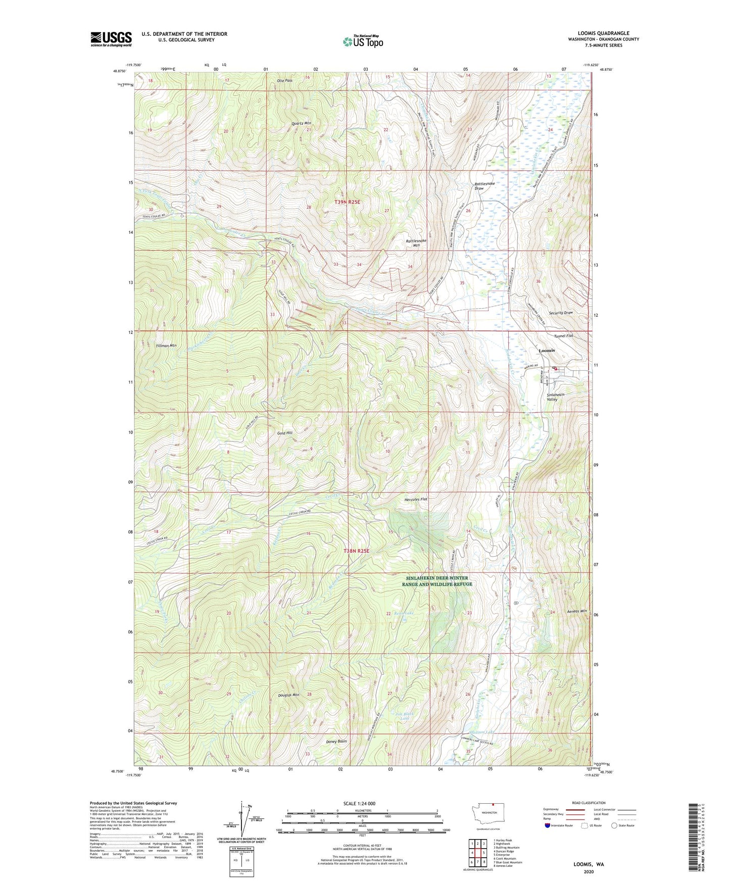
2023 topographic map quadrangle Loomis in the state of Washington. Scale: 1:24000. Based on the newly updated USGS 7.5' US Topo map series, this map is in the following counties: Okanogan. The map contains contour data, water features, and other items you are used to seeing on USGS maps, but also has updated roads and other features. This is the next generation of topographic maps. Printed on high-quality waterproof paper with UV fade-resistant inks.
Quads adjacent to this one:
West: Duncan Ridge
Northwest: Hurley Peak
North: Nighthawk
Northeast: Bullfrog Mountain
East: Enterprise
Southeast: Aeneas Lake
South: Blue Goat Mountain
Southwest: Coxit Mountain
This map covers the same area as the classic USGS quad with code o48119g6.
Contains the following named places: Black Bear Mine, Cecil Creek, Chopaka Creek, Deer Creek, Doney Basin, Douglas Mountain, Gold Hill, Hercules Flat, Highland Fire Camp, Huckleberry Creek, Jim Black Lake, Katasa Creek, Loomis, Loomis Census Designated Place, Loomis Community Church, Loomis Post Office, North Fork Toats Coulee Creek, Okanogan County Fire District 10 Loomis Fire and Aid, Olie Creek, Palmer Mountain Tunnel, Quartz Mountain, Rattlesnake Draw, Rattlesnake Mountain, Redman Creek, Renn Lake, Security Draw, Security Mine, South Fork Junction Campground, South Fork Toats Coulee Creek, Stadium Lake, Three Forks, Toats Coulee Creek, Tunnel Flat, War Eagle Mine