MyTopo
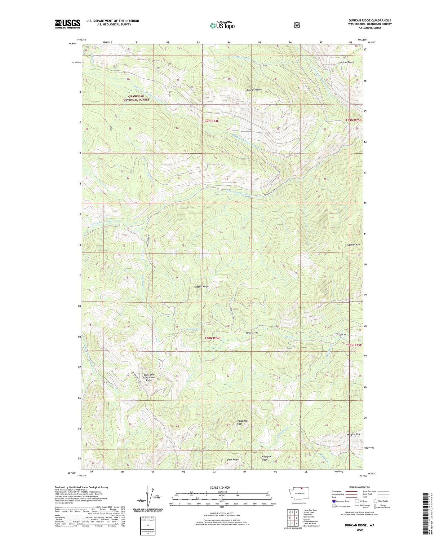
Duncan Ridge Washington US Topo Map
Couldn't load pickup availability
Also explore the Duncan Ridge Forest Service Topo of this same quad for updated USFS data
2023 topographic map quadrangle Duncan Ridge in the state of Washington. Scale: 1:24000. Based on the newly updated USGS 7.5' US Topo map series, this map is in the following counties: Okanogan. The map contains contour data, water features, and other items you are used to seeing on USGS maps, but also has updated roads and other features. This is the next generation of topographic maps. Printed on high-quality waterproof paper with UV fade-resistant inks.
Quads adjacent to this one:
West: Corral Butte
Northwest: Horseshoe Basin
North: Hurley Peak
Northeast: Nighthawk
East: Loomis
Southeast: Blue Goat Mountain
South: Coxit Mountain
Southwest: Tiffany Mountain
This map covers the same area as the classic USGS quad with code o48119g7.
Contains the following named places: Cecil Creek Loading Corral, Chickadee Creek, Chickadee Ridge, Cold Creek, Cougar Creek, Crazy Cow Creek, Daisy Campground, Daisy Creek, Deer Ridge, Duncan James Cabin, Duncan Ridge, Finney Flat, Middle Fork Toats Coulee Creek, Ninemile Creek, North Fork Chickadee Creek, North Fork Ninemile Campground, Parks Creek, Rabbit Creek, Rabbit Ridge, Skull and Crossbones Cabin, Skull and Crossbones Ridge, South Fork Trail, Stump Springs, Tillman Mountain, ZIP Code: 98827