MyTopo
Enterprise Washington US Topo Map
Couldn't load pickup availability
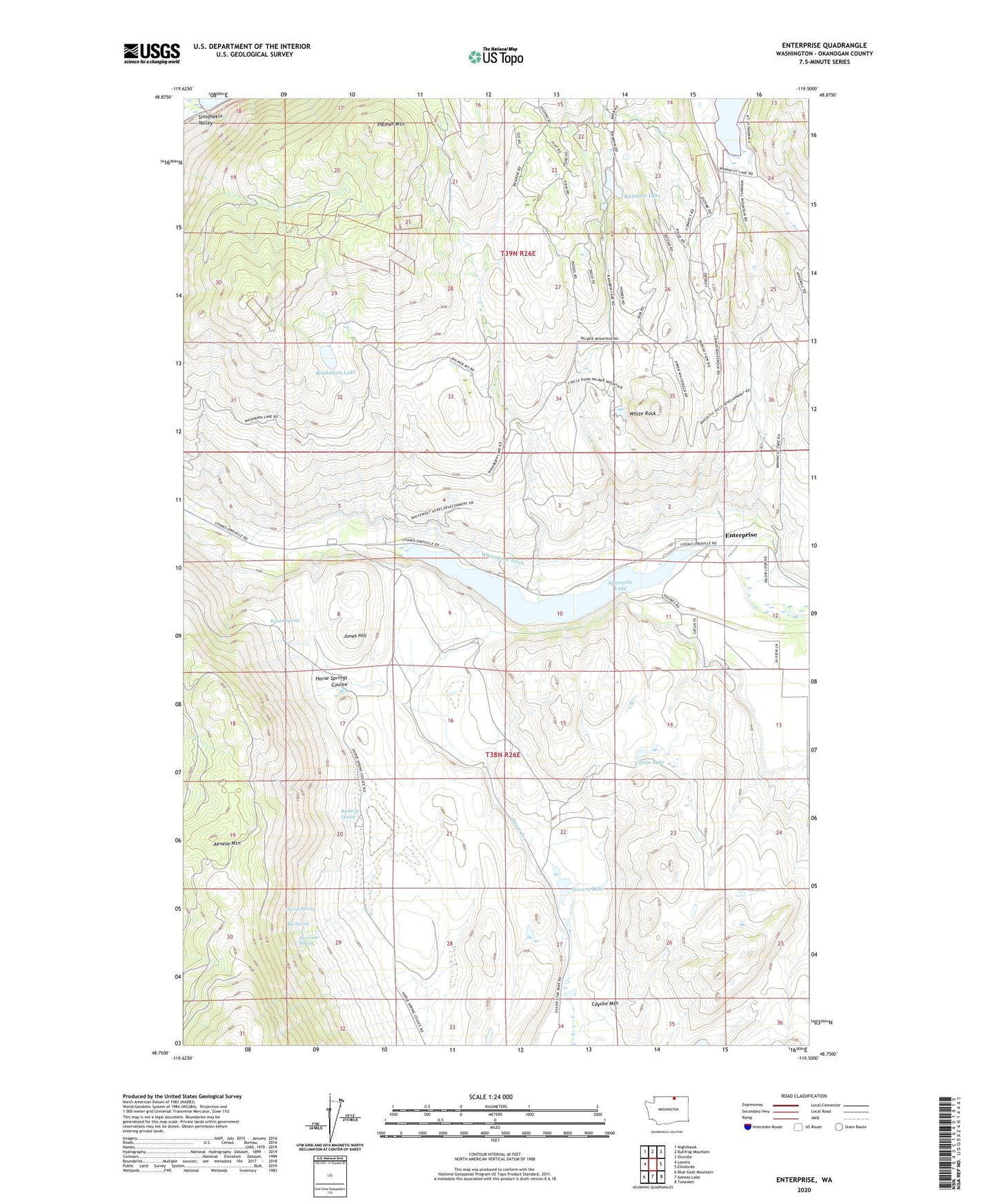
2023 topographic map quadrangle Enterprise in the state of Washington. Scale: 1:24000. Based on the newly updated USGS 7.5' US Topo map series, this map is in the following counties: Okanogan. The map contains contour data, water features, and other items you are used to seeing on USGS maps, but also has updated roads and other features. This is the next generation of topographic maps. Printed on high-quality waterproof paper with UV fade-resistant inks.
Quads adjacent to this one:
West: Loomis
Northwest: Nighthawk
North: Bullfrog Mountain
Northeast: Oroville
East: Ellisforde
Southeast: Tonasket
South: Aeneas Lake
Southwest: Blue Goat Mountain
This map covers the same area as the classic USGS quad with code o48119g5.
Contains the following named places: Alice Mine, Big Spring, Brown Spring, Burbery Spring, Catlin Lake, Cayuse Mountain, Chicago Mine, Copper World Mine, Enterprise, Garret Spring, Hariman Spring, Horse Creek, Horse Spring Coulee Dam, Ivanhoe Mine, John Judge Mine, Jones Hill, Palmer Mountain, Pinnacle Mine, Rainbow Lake, Rainbow Mine, Sonora Point Resort Recreational Vehicle Park, Spectacle Lake, Spectacle Lake Campground, Spectacle Lake Dike Dam, Spectacle Lake Quarry, Spectacle Lake Resort Recreational Vehicle Park, Stevens Lake, Washburn Lake, Wehesville, White Rock, Whitestone Ditch