MyTopo
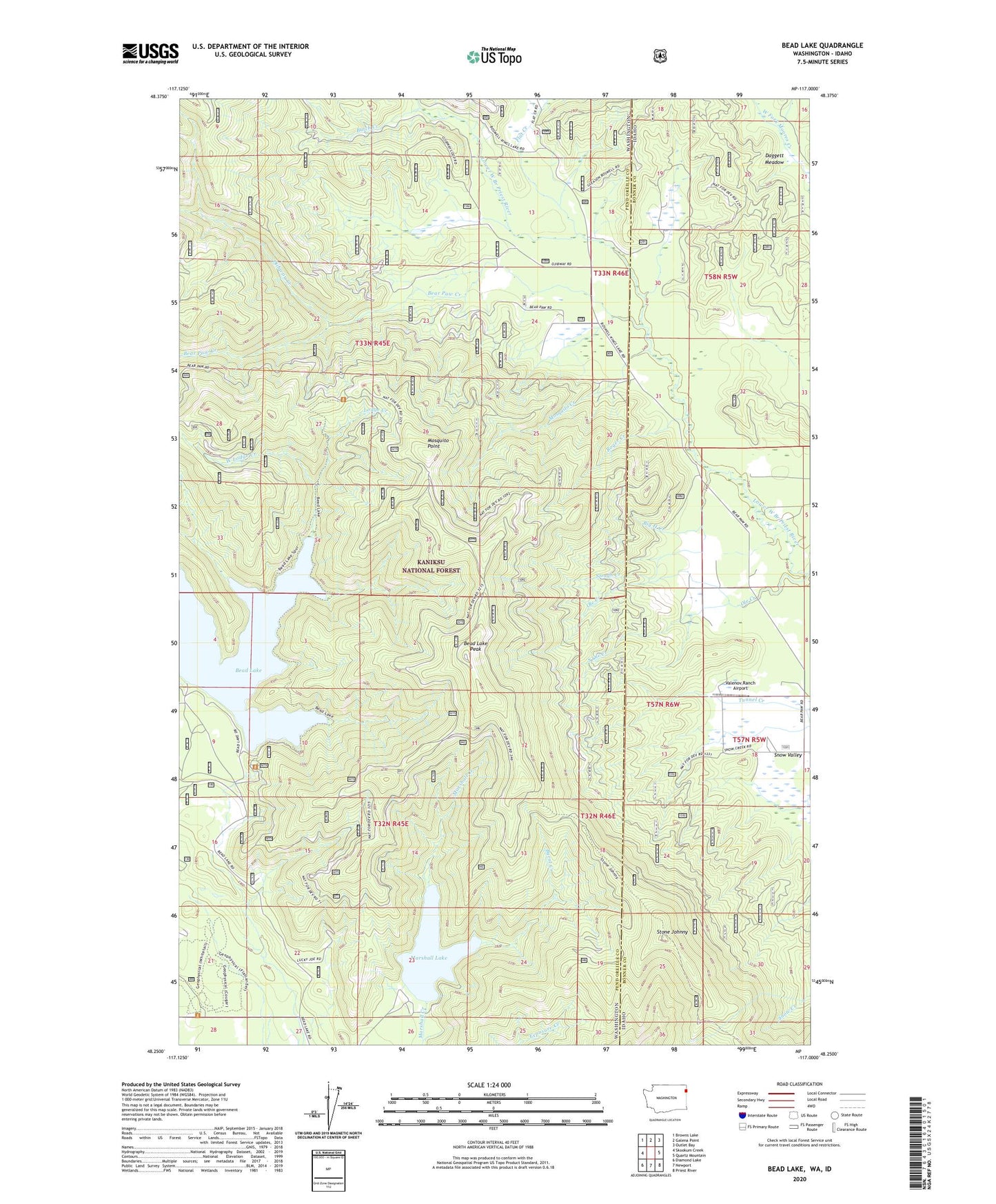
Bead Lake Washington US Topo Map
Couldn't load pickup availability
Also explore the Bead Lake Forest Service Topo of this same quad for updated USFS data
2023 topographic map quadrangle Bead Lake in the states of Washington, Idaho. Scale: 1:24000. Based on the newly updated USGS 7.5' US Topo map series, this map is in the following counties: Pend Oreille, Bonner. The map contains contour data, water features, and other items you are used to seeing on USGS maps, but also has updated roads and other features. This is the next generation of topographic maps. Printed on high-quality waterproof paper with UV fade-resistant inks.
Quads adjacent to this one:
West: Skookum Creek
Northwest: Browns Lake
North: Galena Point
Northeast: Outlet Bay
East: Quartz Mountain
Southeast: Priest River
South: Newport
Southwest: Diamond Lake
This map covers the same area as the classic USGS quad with code o48117c1.
Contains the following named places: Bead Lake, Bead Lake Launch, Bead Lake Peak, Bear Paw Creek, Big H Creek, Burnt Creek, Butch Creek, Daggett Meadow, Flat Creek, Lodge Creek, Lucky Joe Mine, Marshall Lake, Marshall Lake Dam, Mineral Bay Recreational Site, Mosquito Creek, Mosquito Point, Newport Geophysical Observatory, Ojibway Creek, Ole Creek, Roger Creek, Slough Creek, South Ole Creek, Stone Johnny, Stone Johnny Lookout, Valenov Ranch Airport, West Lodge Creek