MyTopo
Tonasket Washington US Topo Map
Couldn't load pickup availability
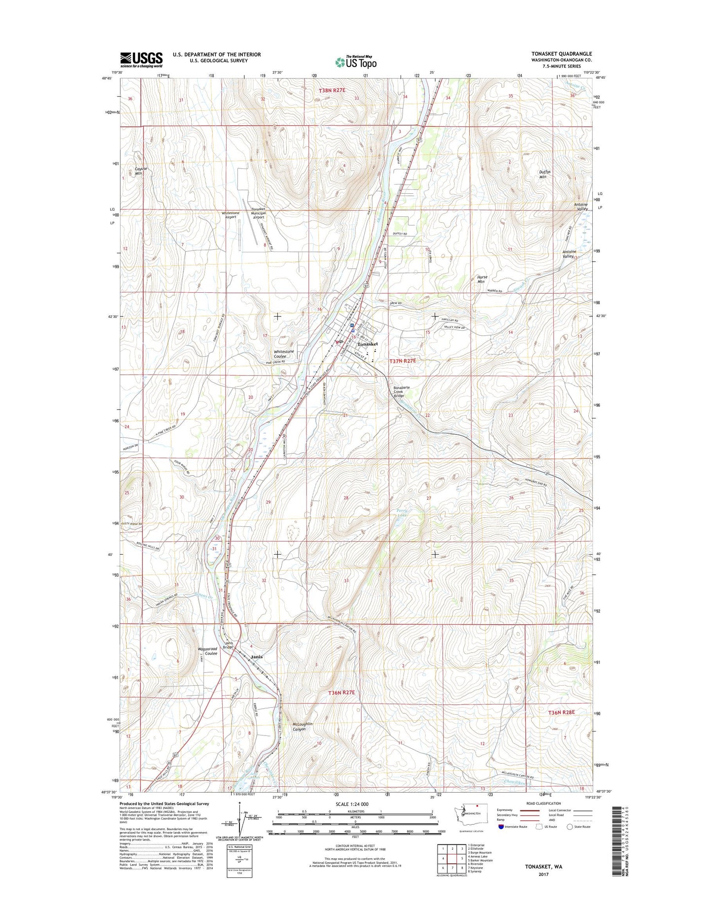
2023 topographic map quadrangle Tonasket in the state of Washington. Scale: 1:24000. Based on the newly updated USGS 7.5' US Topo map series, this map is in the following counties: Okanogan. The map contains contour data, water features, and other items you are used to seeing on USGS maps, but also has updated roads and other features. This is the next generation of topographic maps. Printed on high-quality waterproof paper with UV fade-resistant inks.
Quads adjacent to this one:
West: Aeneas Lake
Northwest: Enterprise
North: Ellisforde
Northeast: Burge Mountain
East: Barker Mountain
Southeast: Synarep
South: Keystone
Southwest: Riverside
This map covers the same area as the classic USGS quad with code o48119f4.
Contains the following named places: Aeneas Creek, Antoine Valley, Bonaparte Creek, Bonaparte Creek Bridge, Chewiliken Creek, City of Tonasket, Duffys Mountain, Hope Lutheran Church, Horse Mountain, Janis, Janis Bridge, Janis Rapids, John's Landing Mobile Home Park, McLoughlin Canyon, North Valley Hospital, Okanogan County Fire District 4 Tonasket Fire Department, Perry Lake, Siwash Creek, Tonasket, Tonasket Adventist Church, Tonasket Community Library, Tonasket Elementary School, Tonasket Emergency Medical Services District, Tonasket Free Methodist Church, Tonasket High School, Tonasket Middle School, Tonasket Municipal Airport, Tonasket Police Department, Tonasket Post Office, Tonasket Sewage Treatment Plant, Tonasket Town Hall, Whitestone Airport, Whitestone Coulee