
MyTopo
Carlsborg Washington US Topo Map
Couldn't load pickup availability
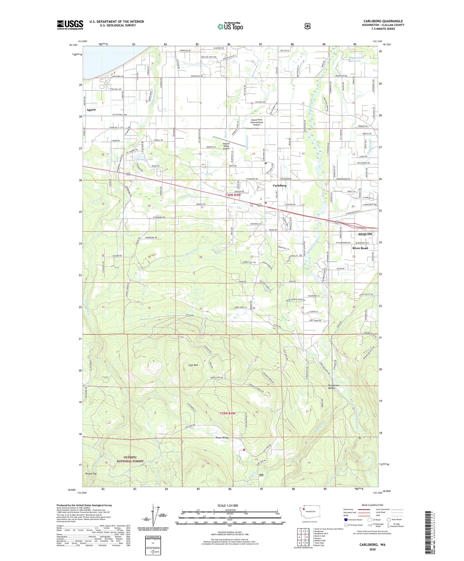
2020 topographic map quadrangle Carlsborg in the state of Washington. Scale: 1:24000. Based on the newly updated USGS 7.5' US Topo map series, this map is in the following counties: Clallam. The map contains contour data, water features, and other items you are used to seeing on USGS maps, but also has updated roads and other features. This is the next generation of topographic maps. Printed on high-quality waterproof paper with UV fade-resistant inks.
Quads adjacent to this one:
West: Morse Creek
North: Dungeness
Northeast: Dungeness OE E
East: Sequim
Southeast: Mount Zion
South: Tyler Peak
Southwest: Maiden Peak
Contains the following named places: Agnew, Agnew Mobile Home Park, Agnew-Carlsborg Division, Avellana Mobile Home Park, Bear Creek, Bibity Bobity Preschool, Calvary Chapel, Canyon Creek, Caraco Creek, Carlsborg, Carlsborg Census Designated Place, Carlsborg Mobile Estates, Carlsborg Post Office, Cedar Grove Mobile Home Park, Clallam County Fire District 3 Station 33 - Carlsborg, Clallam County Fire District 3 Station 36 - Lost Mountain, Cornerstone Baptist Temple, Dungeness Golf Course, Dungeness River Audubon Center at Railroad Bridge Park, Eastern Hills Community Church, Epperson Creek Fish Pond, Epperson Creek Fish Pond Dam, Faith Baptist Church, Grand View International Airport, Green Acres Mobile Estates, Greywolf Elementary School, Haller Quarry, Hurd Creek Hatchery, Kingdom Hall of Jehovahs Witnesses, King's Way Foursquare Church, Lazy Acres Mobile Home Park, Lost Mountain, McCleay School, Olympic Unitarian Universalist Fellowship Church, Owl Creek, Pats Creek, Pederson Creek, Peninsula Evangelical Friends Meetinghouse, Rainbows End Recreational Vehicle Park, Rena, Rex Aldrich Dam Number One, Rex Aldrich Dam Number Two, Rex Aldrich Reservoir, River Road, River Road Census Designated Place, Rock Creek, Sequim Valley Airport, Sequim Valley Church of the Nazarene, Solmar Lake, Solmar Lake Dam, Sunshine Recreational Vehicle Park, Texas Valley


