MyTopo
Mount Zion Washington US Topo Map
Couldn't load pickup availability
Also explore the Mount Zion Forest Service Topo of this same quad for updated USFS data
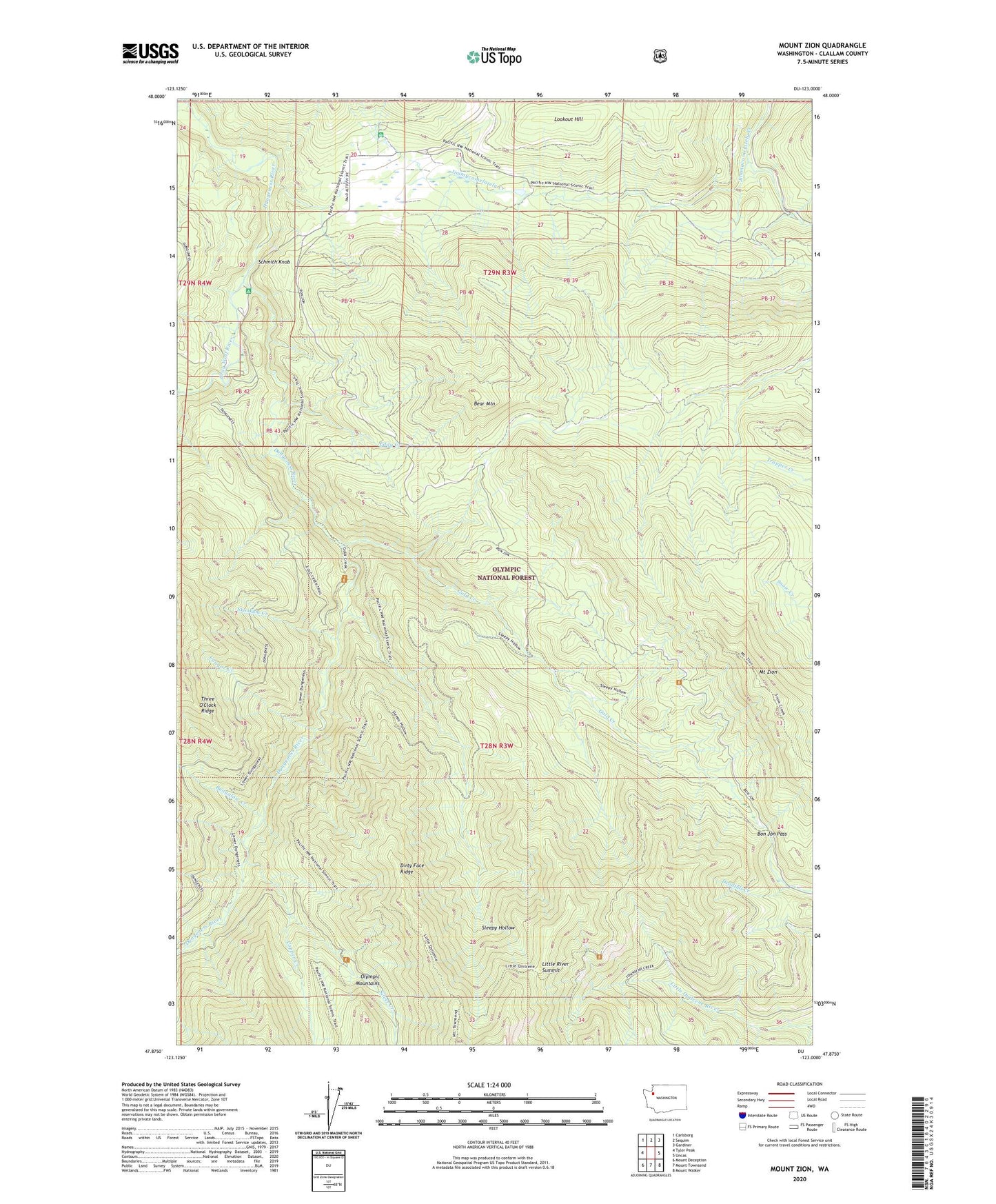
2023 topographic map quadrangle Mount Zion in the state of Washington. Scale: 1:24000. Based on the newly updated USGS 7.5' US Topo map series, this map is in the following counties: Clallam. The map contains contour data, water features, and other items you are used to seeing on USGS maps, but also has updated roads and other features. This is the next generation of topographic maps. Printed on high-quality waterproof paper with UV fade-resistant inks.
Quads adjacent to this one:
West: Tyler Peak
Northwest: Carlsborg
North: Sequim
Northeast: Gardiner
East: Uncas
Southeast: Mount Walker
South: Mount Townsend
Southwest: Mount Deception
This map covers the same area as the classic USGS quad with code o47123h1.
Contains the following named places: Bear Mountain, Bear Mountain Trail, Bon Jon Pass, Bungalow Creek, Clink Trail, Colonel Shelter, Copper Creek, Cougar Creek, Dirty Face Ridge, Dirty Face Trail, Dungeness Forks Campground, East Crossing Campground, Eddy Creek, Elwick Dam, Gold Creek, Gold Creek Shelter, Gorge Campground, Gray Wolf River, Last Water Camp, Little Quilcene Trail, Little River Summit, Louella Guard Station, Mount Zion, Mount Zion Lookout, River Campground, Schmith Knob, Silver Creek, Silver Creek Shelter, Skookum Creek, Sleepy Hollow, Tubal Cain Mine Trail