MyTopo
Cliffdell Washington US Topo Map
Couldn't load pickup availability
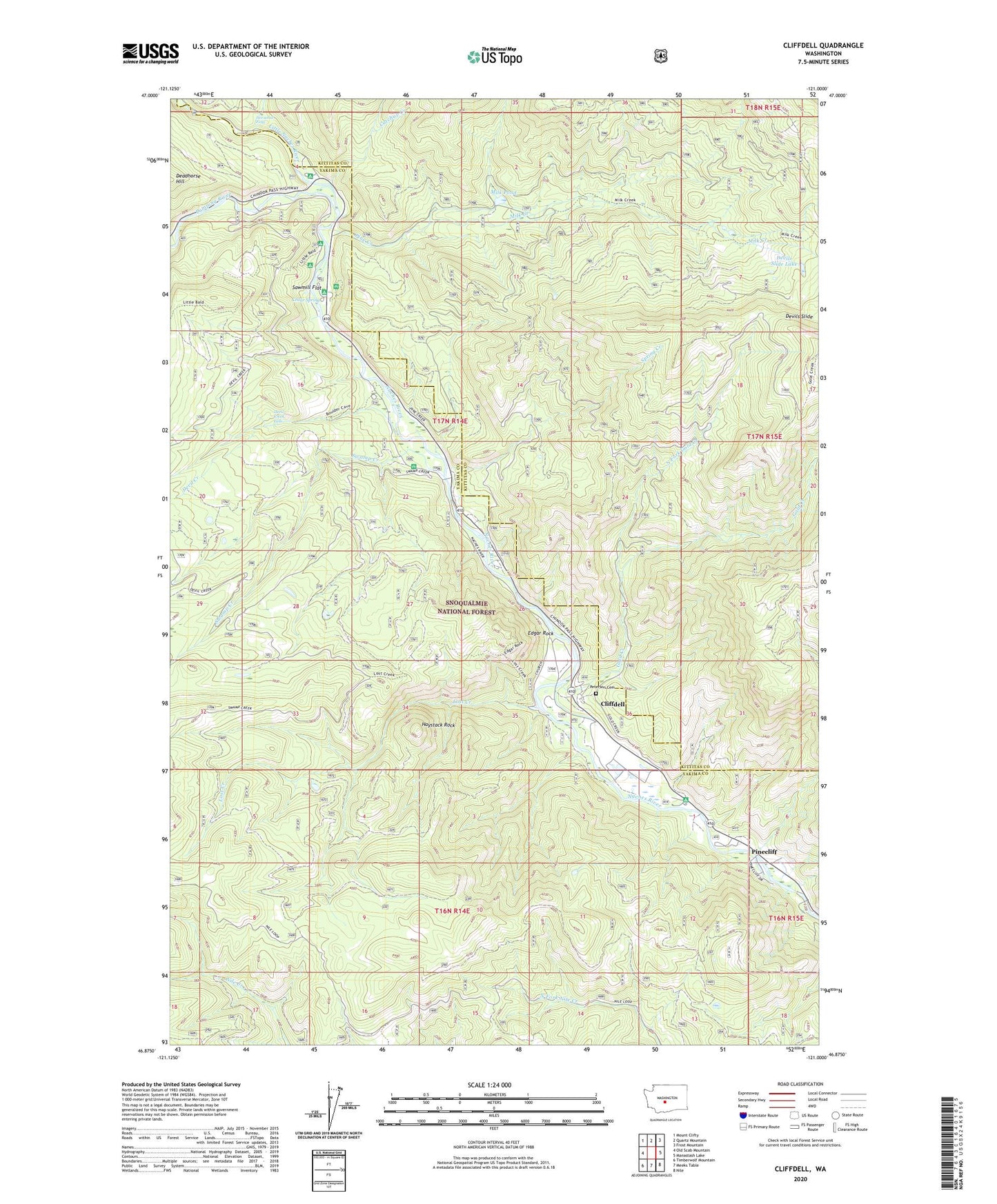
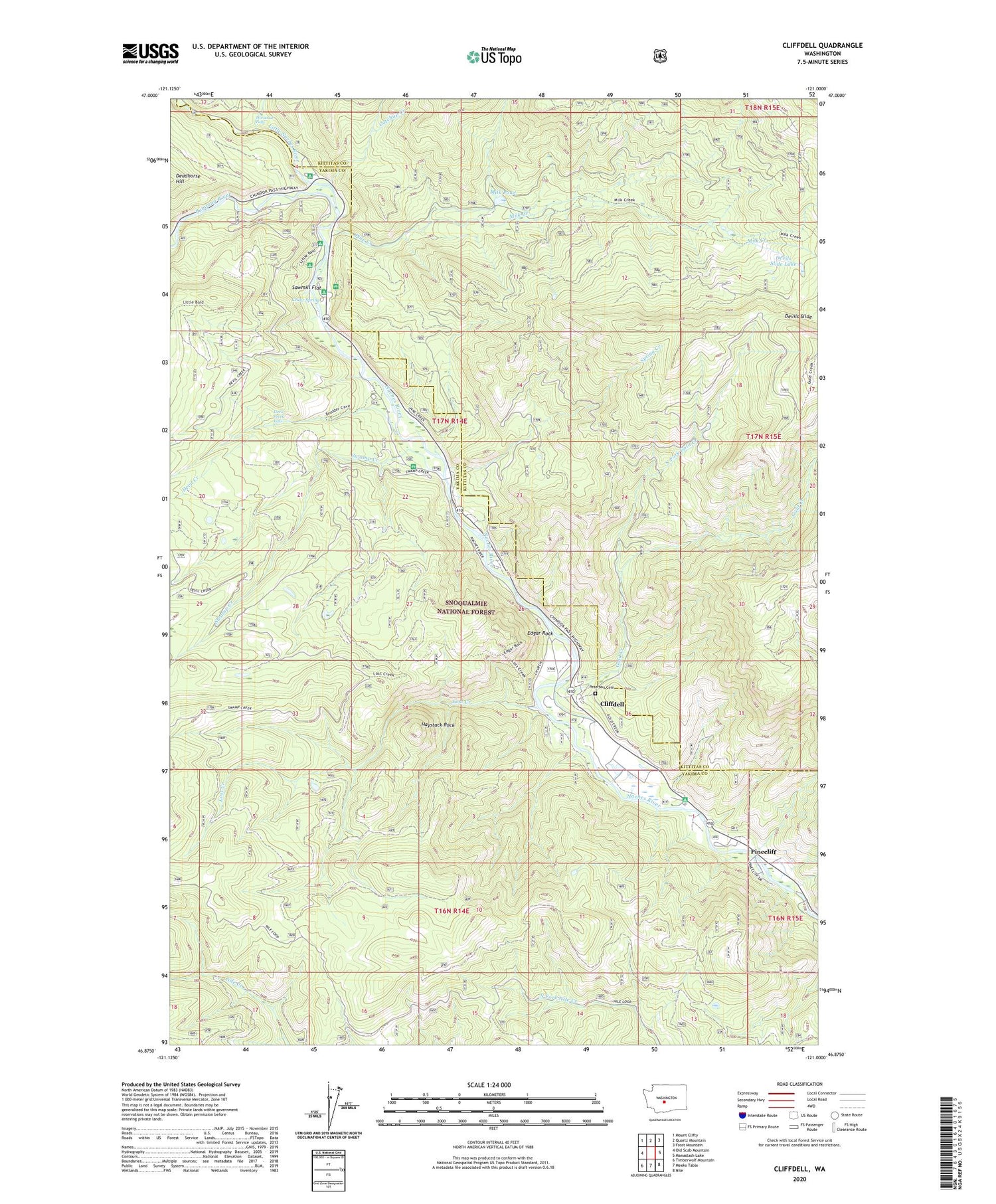
2020 topographic map quadrangle Cliffdell in the state of Washington. Scale: 1:24000. Based on the newly updated USGS 7.5' US Topo map series, this map is in the following counties: Yakima, Kittitas. The map contains contour data, water features, and other items you are used to seeing on USGS maps, but also has updated roads and other features. This is the next generation of topographic maps. Printed on high-quality waterproof paper with UV fade-resistant inks.
Quads adjacent to this one:
West: Old Scab Mountain
Northwest: Mount Clifty
North: Quartz Mountain
Northeast: Frost Mountain
East: Manastash Lake
Southeast: Nile
South: Meeks Table
Southwest: Timberwolf Mountain
Contains the following named places: Boulder Cave Campground, Bumping River, Camp Roganunda, Catchup Creek, Cedar Spring, Chinook Pass Work Center, Christian Camp, Cliffdell, Cliffdell Census Designated Place, Cottonwood Campground, Deadhorse Hill, Devil Creek, Devil Creek Falls, Devils Slide Lake, Edgar Rock, Edgar Rock Lookout Tower, Gold Creek, Halfway Flat Campground, Haystack Rock, Horsetail Falls, Little Naches Campground, Little Naches River, Little Naches Summer Homes, Lost Creek, Milk Creek, Milk Pond, Milk Pond Dam, Milk Pond Picnic Grounds, Mountain Air Camp, Naches Ranger Station, North Fork Gold Creek, Peterson Cemetery, Pine Creek, Pinecliff, Sawmill Flat, Sawmill Flat Campground, Spring Creek, Swamp Creek