MyTopo
Copalis Beach Washington US Topo Map
Couldn't load pickup availability
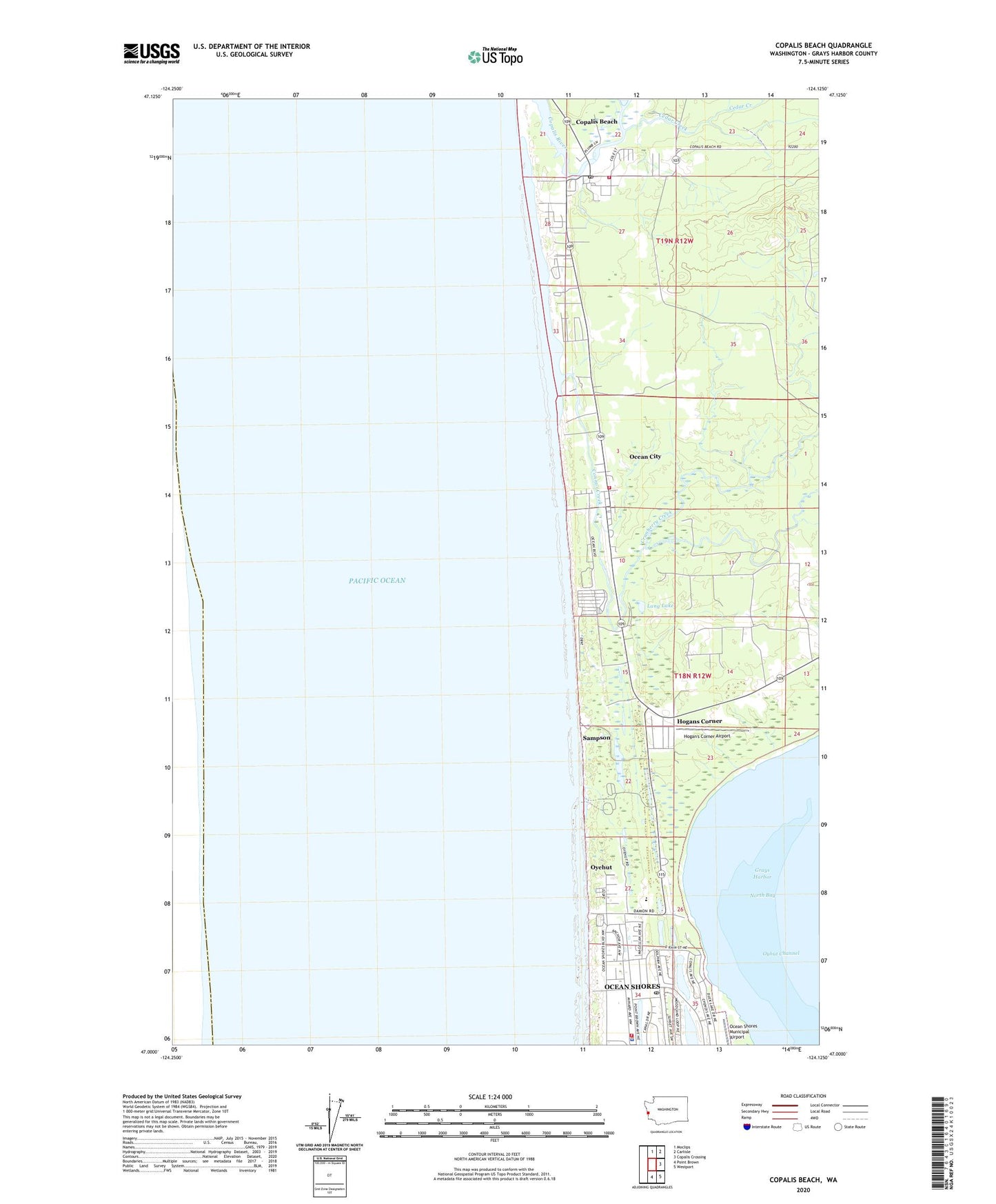
2023 topographic map quadrangle Copalis Beach in the state of Washington. Scale: 1:24000. Based on the newly updated USGS 7.5' US Topo map series, this map is in the following counties: Grays Harbor. The map contains contour data, water features, and other items you are used to seeing on USGS maps, but also has updated roads and other features. This is the next generation of topographic maps. Printed on high-quality waterproof paper with UV fade-resistant inks.
Quads adjacent to this one:
North: Moclips
Northeast: Carlisle
East: Copalis Crossing
Southeast: Westport
South: Point Brown
This map covers the same area as the classic USGS quad with code o47124a2.
Contains the following named places: Cedar Creek, Chance A La Mer State Park, City of Ocean Shores Fire and Emergency Care Department, Connor Creek, Copalis Beach, Copalis Beach Census Designated Place, Copalis Beach Post Office, Cranberry Creek, Galilean Retreat Center, Grays Harbor Fire District 7 Station 1 Copalis Beach, Grays Harbor Fire District 7 Station 2 Ocean Shores, Hogan's Corner Airport, Hogans Corner Census Designated Place, Illahee, Lang Lake, North Beach Junior / Senior High School, North Beach Middle School, North Beach School District 64 Office, Ocean City, Ocean City Census Designated Place, Ocean City State Park, Ocean Shores Baptist Church, Ocean Shores Convention Center, Ocean Shores Division, Ocean Shores Fire Department, Ocean Shores Municipal Airport, Ocean Shores Police Department, Ocean Shores Post Office, Ocean Shores Public Library, Ocean Shores United Methodist Church, Olympic Beaches, Oyehut, Oyehut Census Designated Place, Oyehut-Hogans Corner Census Designated Place, Oyhut Channel, Oyhut State Park, Saint Jerome Church, Sampson, Shores Fellowship Church, ZIP Code: 98535