MyTopo
Point Brown Washington US Topo Map
Couldn't load pickup availability
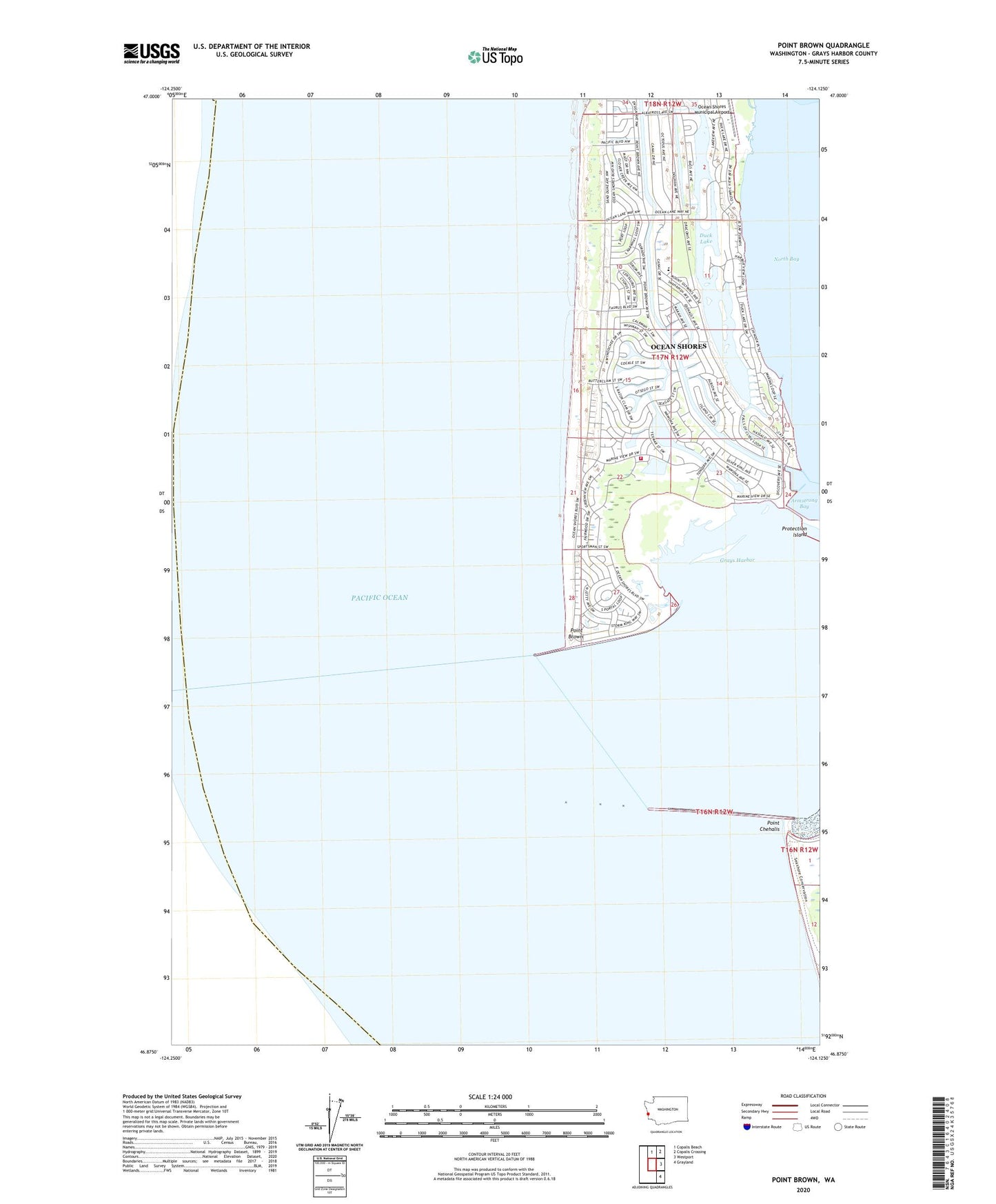
2023 topographic map quadrangle Point Brown in the state of Washington. Scale: 1:24000. Based on the newly updated USGS 7.5' US Topo map series, this map is in the following counties: Grays Harbor. The map contains contour data, water features, and other items you are used to seeing on USGS maps, but also has updated roads and other features. This is the next generation of topographic maps. Printed on high-quality waterproof paper with UV fade-resistant inks.
Quads adjacent to this one:
North: Copalis Beach
Northeast: Copalis Crossing
East: Westport
Southeast: Grayland
This map covers the same area as the classic USGS quad with code o46124h2.
Contains the following named places: City of Ocean Shores, Duck Lake, Elds Island, Faith Community Church, Harbour Pointe Shores Retirement and Assisted Living Center, North Jetty, Ocean Shores, Ocean Shores Elementary School, Ocean Shores Fire and Rescue 74, Ocean Shores Golf Course, Ocean Shores Marina, Ocean Shores Sewage Treatment Plant, Oyhut Wildlife Recreation Area, Point Brown, Point Chehalis, Protection Island, South Jetty, The Church of Jesus Christ of Latter Day Saints, Westhaven State Park, ZIP Code: 98569