MyTopo
Westport Washington US Topo Map
Couldn't load pickup availability
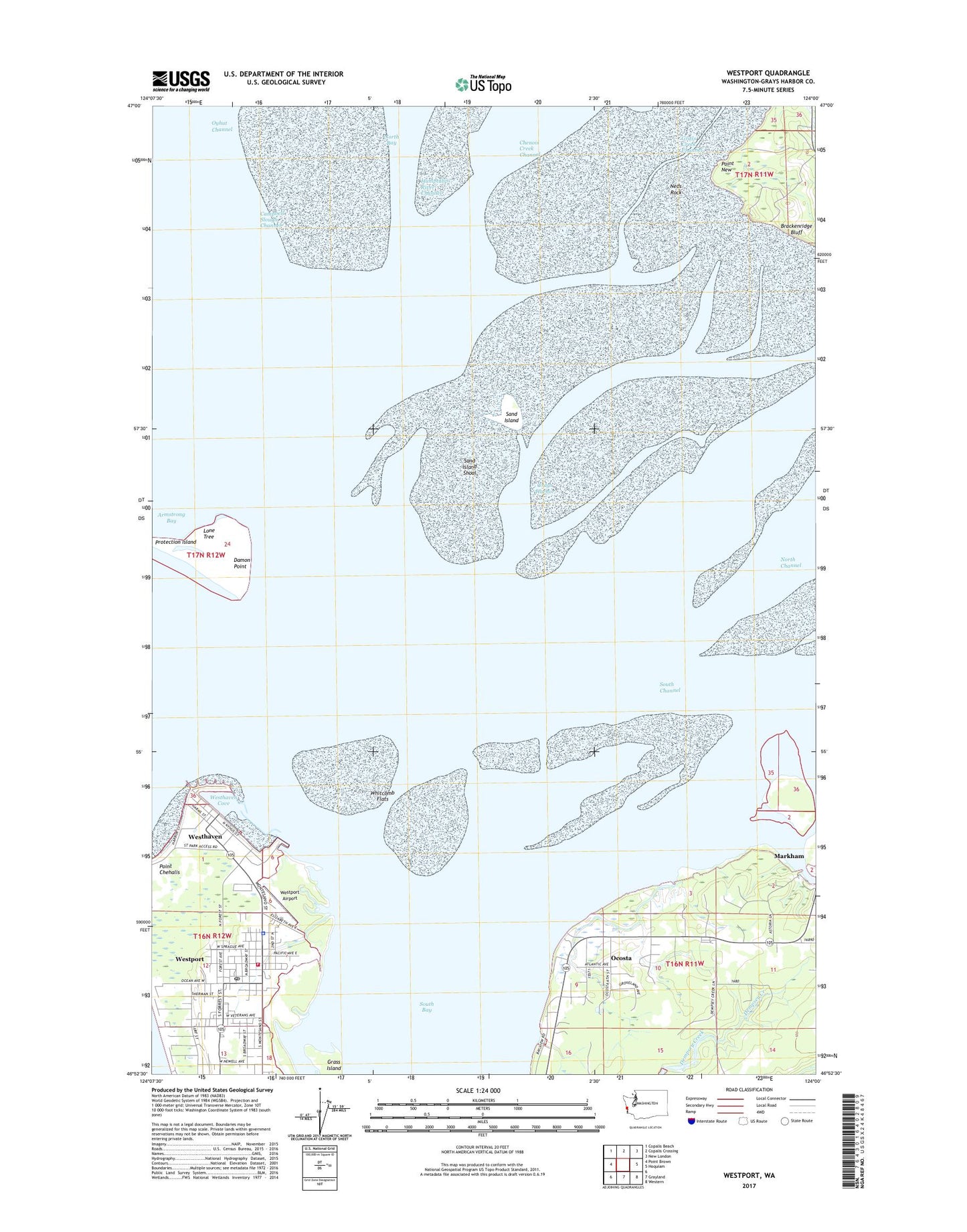
2023 topographic map quadrangle Westport in the state of Washington. Scale: 1:24000. Based on the newly updated USGS 7.5' US Topo map series, this map is in the following counties: Grays Harbor. The map contains contour data, water features, and other items you are used to seeing on USGS maps, but also has updated roads and other features. This is the next generation of topographic maps. Printed on high-quality waterproof paper with UV fade-resistant inks.
Quads adjacent to this one:
West: Point Brown
Northwest: Copalis Beach
North: Copalis Crossing
Northeast: New London
East: Hoquiam
Southeast: Western
South: Grayland
This map covers the same area as the classic USGS quad with code o46124h1.
Contains the following named places: Armstrong Bay, Brackenridge Bluff, Chenois Creek Channel, City of Westport, City of Westport Fire Department, Coast Guard Station Grays Harbor, Damon Point, Goose Island, Grass Creek Channel, Grass Island, Grays Harbor, Grays Harbor CG, Grays Harbor Lighthouse, Hoquiam Radio Range Station, Johns River, Kingdom Hall of Jehovahs Witnesses, Lone Tree, Neds Rock, North Bay, Ocosta, Ocosta Census Designated Place, Point New, Redman Slough, Saint Christopher Episcopal Church, Sand Island, Sand Island Shoal, South Bay, South Beach Ambulance Service, Traitors Islet, Twin Harbor Baptist Church, Westhaven, Westhaven Cove, Westport, Westport Airport, Westport City Hall, Westport Light State Park, Westport Marina, Westport Maritime Museum, Westport Police Department, Westport Post Office, Westport Timberland Library, Westport Wastewater Treatment Plant, Whitcomb Flats, ZIP Code: 98595