MyTopo
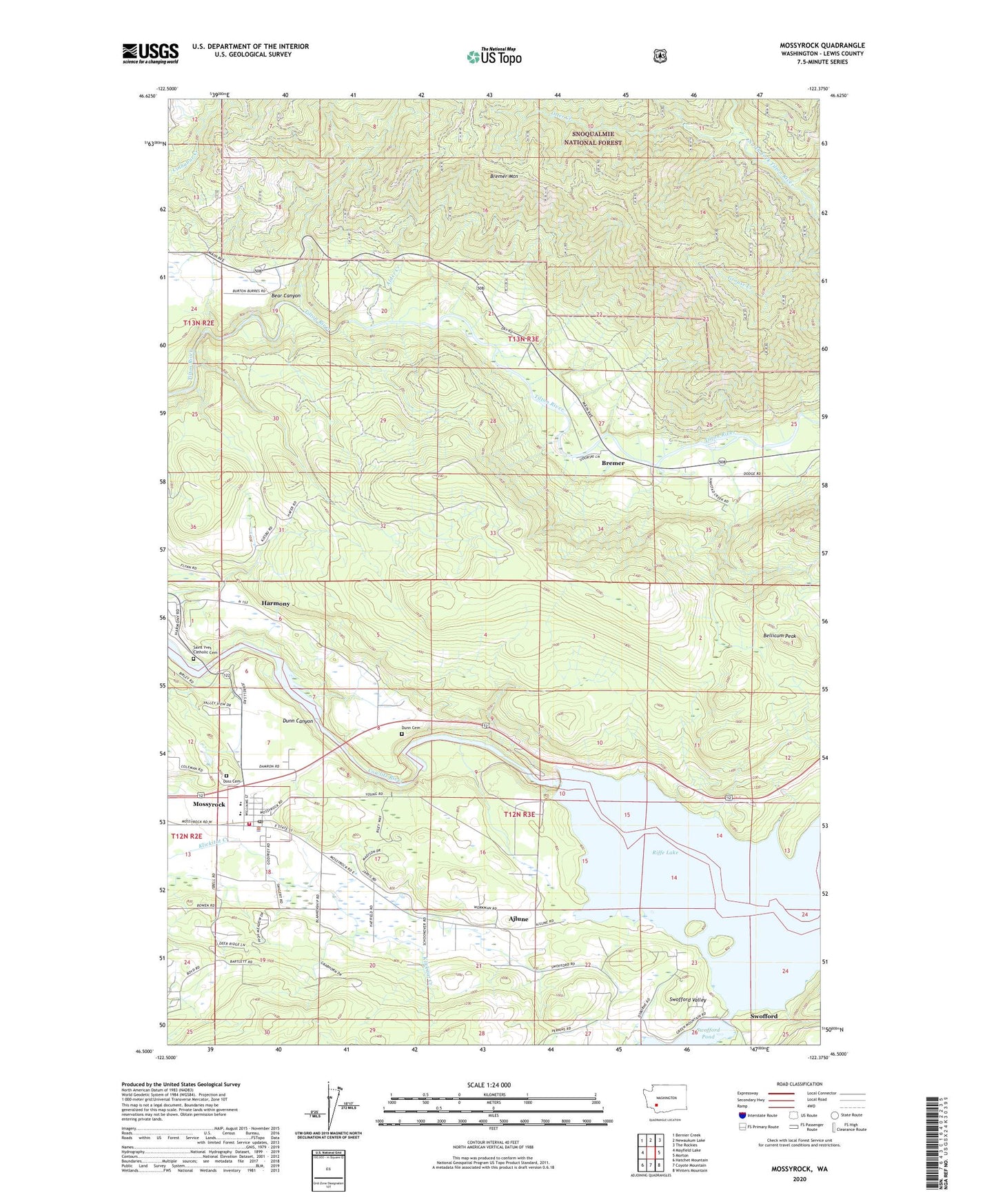
Mossyrock Washington US Topo Map
Couldn't load pickup availability
Also explore the Mossyrock Forest Service Topo of this same quad for updated USFS data
2023 topographic map quadrangle Mossyrock in the state of Washington. Scale: 1:24000. Based on the newly updated USGS 7.5' US Topo map series, this map is in the following counties: Lewis. The map contains contour data, water features, and other items you are used to seeing on USGS maps, but also has updated roads and other features. This is the next generation of topographic maps. Printed on high-quality waterproof paper with UV fade-resistant inks.
Quads adjacent to this one:
West: Mayfield Lake
Northwest: Bernier Creek
North: Newaukum Lake
Northeast: The Rockies
East: Morton
Southeast: Winters Mountain
South: Coyote Mountain
Southwest: Hatchet Mountain
This map covers the same area as the classic USGS quad with code o46122e4.
Contains the following named places: Ajlune, Alder Creek, Bear Canyon, Bear Canyon West Field Airport, Bellicum Peak, Bremer, Bremer Mountain, Brian Dam, City of Mossyrock, Doss Cemetery, Dunn Canyon, Dunn Cemetery, Harmony, Lewis County, Lewis County Fire District 3 Mossyrock Fire Department, Mossyrock, Mossyrock Dam, Mossyrock Elementary School, Mossyrock Junior - Senior High School, Mossyrock Middle School, Mossyrock Park, Mossyrock Police Department, Mossyrock Post Office, Otter Creek, Saint Yves Catholic Cemetery, Sulphur Creek, Swofford, Swofford Valley, Swofford Valley Rearing Pond Dam, Wallanding Creek, ZIP Code: 98585