MyTopo
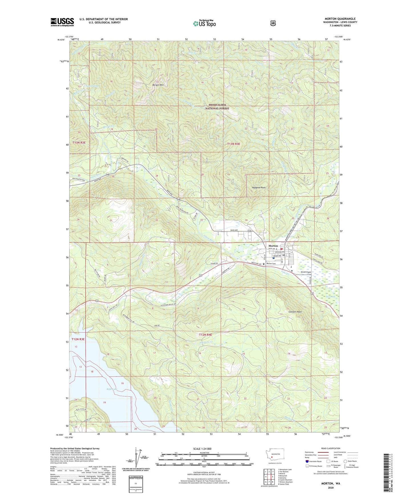
Morton Washington US Topo Map
Couldn't load pickup availability
Also explore the Morton Forest Service Topo of this same quad for updated USFS data
2023 topographic map quadrangle Morton in the state of Washington. Scale: 1:24000. Based on the newly updated USGS 7.5' US Topo map series, this map is in the following counties: Lewis. The map contains contour data, water features, and other items you are used to seeing on USGS maps, but also has updated roads and other features. This is the next generation of topographic maps. Printed on high-quality waterproof paper with UV fade-resistant inks.
Quads adjacent to this one:
West: Mossyrock
Northwest: Newaukum Lake
North: The Rockies
Northeast: Mineral
East: Glenoma
Southeast: Vanson Peak
South: Winters Mountain
Southwest: Coyote Mountain
This map covers the same area as the classic USGS quad with code o46122e3.
Contains the following named places: Beaver Creek, Bergen Mountain, Bromo Creek, City of Morton, Connelly Creek, Coon Creek, Cottlers Rock, Coyote Creek, Fisher Creek, Heller Creek, Highland Creek, Hopgood Rock, Hopkins Hill Viewpoint, Indian Hole Campground, Lake Creek, Lewis County Fire District 4 Morton Fire Department, Morton, Morton Cemetery, Morton Elementary School, Morton General Hospital, Morton Junior - Senior High School, Morton Police Department, Morton Post Office, North Fork Tilton River, Riffe, Simmons Creek, Snow Creek, Strom Field, Tumble Creek, Weasel Spring, ZIP Code: 98356