MyTopo
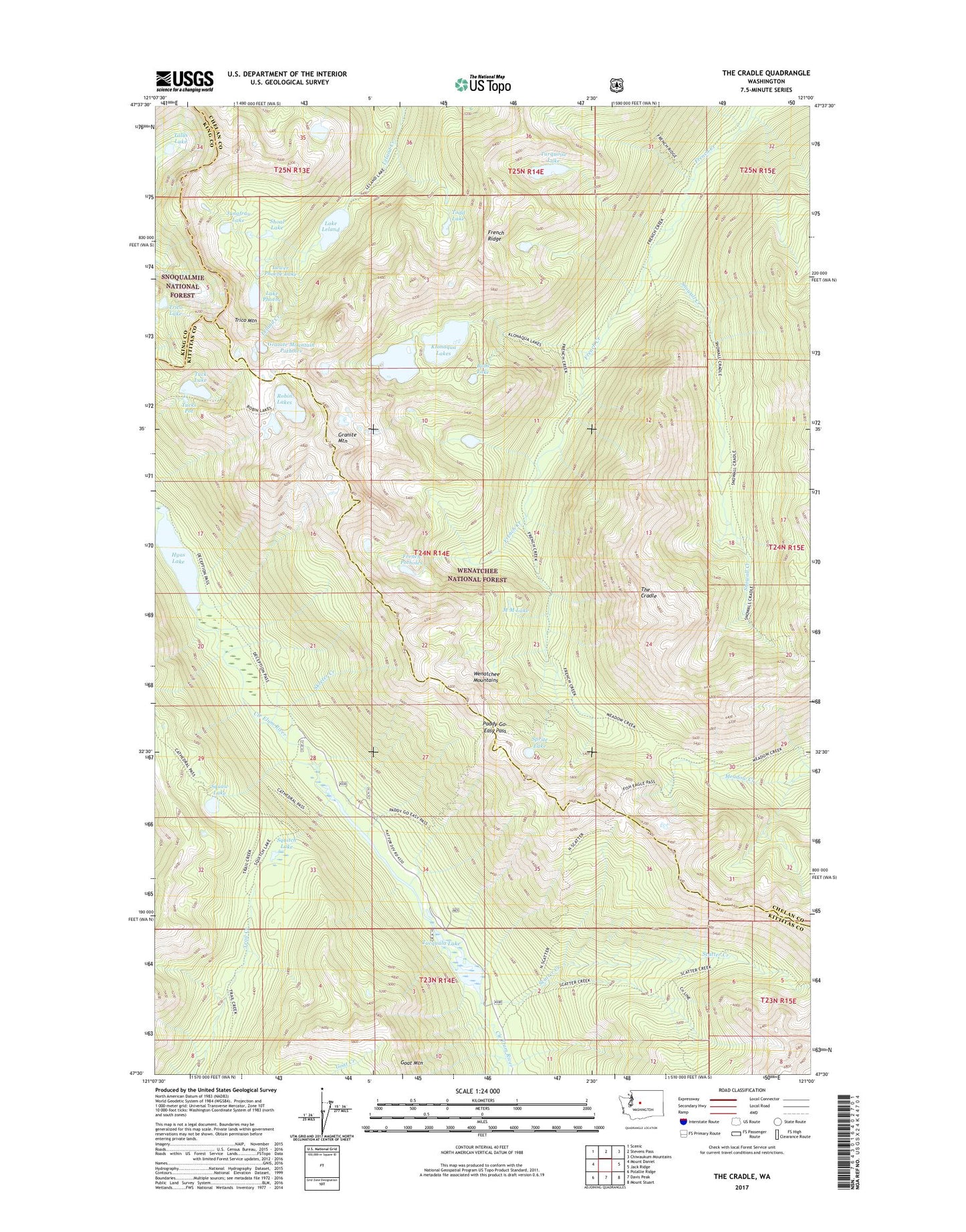
The Cradle Washington US Topo Map
Couldn't load pickup availability
Also explore the The Cradle Forest Service Topo of this same quad for updated USFS data
2023 topographic map quadrangle The Cradle in the state of Washington. Scale: 1:24000. Based on the newly updated USGS 7.5' US Topo map series, this map is in the following counties: Chelan, Kittitas, King. The map contains contour data, water features, and other items you are used to seeing on USGS maps, but also has updated roads and other features. This is the next generation of topographic maps. Printed on high-quality waterproof paper with UV fade-resistant inks.
Quads adjacent to this one:
West: Mount Daniel
Northwest: Scenic
North: Stevens Pass
Northeast: Chiwaukum Mountains
East: Jack Ridge
Southeast: Mount Stuart
South: Davis Peak
Southwest: Polallie Ridge
This map covers the same area as the classic USGS quad with code o47121e1.
Contains the following named places: Bobs Lake, Carrie Lake, Cle Elum Ranger District, Fish Lake Campground, Fish Lake Guard Station, French Potholes, French Ridge, Granite Mountain, Granite Mountain Potholes, Hyas Lake, Jungfrau Lake, Klonaqua Lake Dam, Klonaqua Lakes, Lake Leland, Lake Phoebe, Lower Phoebe Lake, M M Lake, Paddy-Go-Easy Pass, Robin Lakes, Scatter Creek, Scatter Creek Campground, Shoal Lake, Skeeter Creek, Snowall Creek, Sprite Lake, Squaw Lake, Squitch Lake, Talus Lake, The Cradle, Todd Lake, Trico Lake, Trico Mountain, Tuck Lake, Tucks Pot, Tucquala Lake, Tucquala Meadow Campground, Tucquala Meadow Trailhead, Turquoise Lake, Welcome Lake