MyTopo
Teanaway Butte Washington US Topo Map
Couldn't load pickup availability
Also explore the Teanaway Butte Forest Service Topo of this same quad for updated USFS data
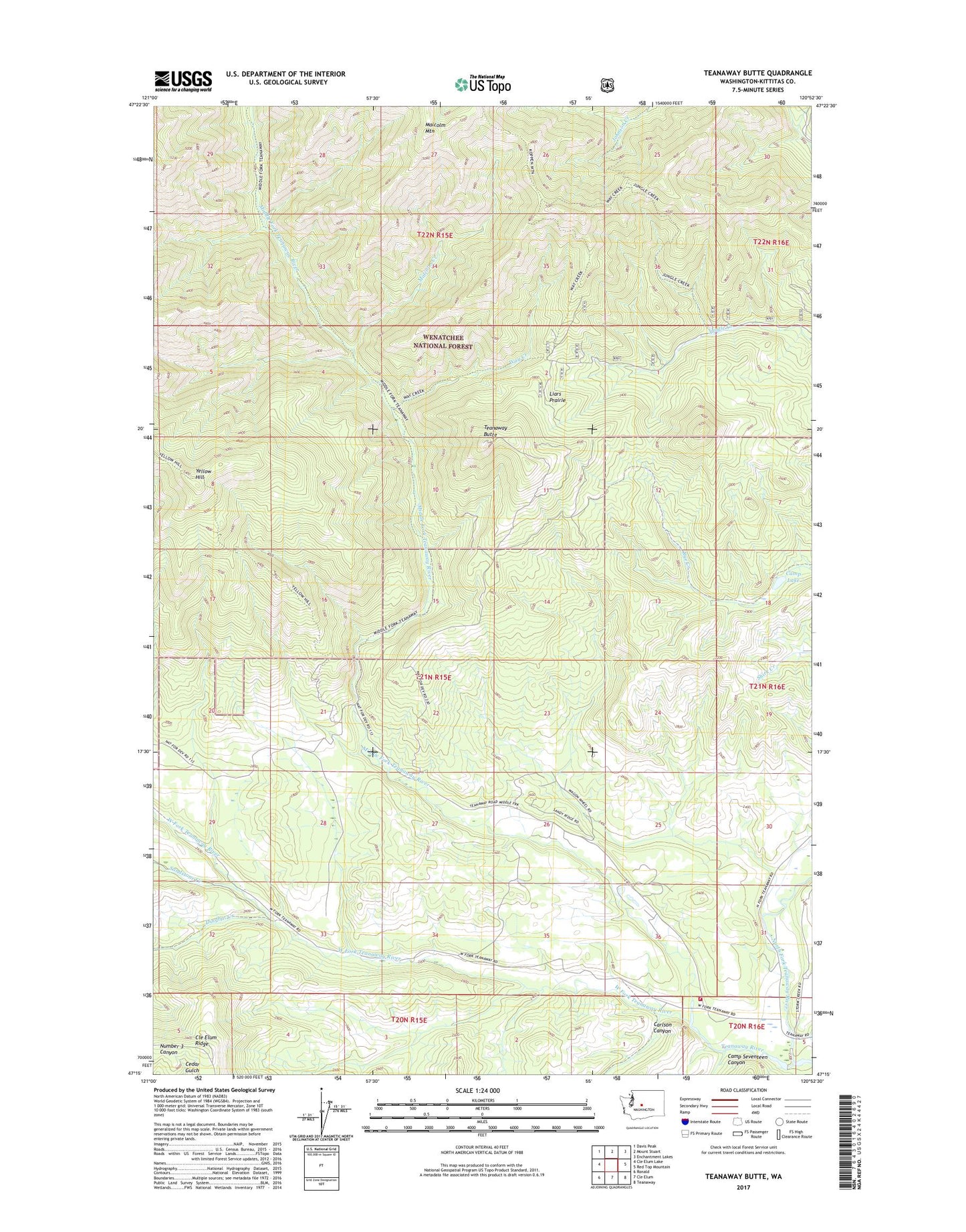
2023 topographic map quadrangle Teanaway Butte in the state of Washington. Scale: 1:24000. Based on the newly updated USGS 7.5' US Topo map series, this map is in the following counties: Kittitas. The map contains contour data, water features, and other items you are used to seeing on USGS maps, but also has updated roads and other features. This is the next generation of topographic maps. Printed on high-quality waterproof paper with UV fade-resistant inks.
Quads adjacent to this one:
West: Cle Elum Lake
Northwest: Davis Peak
North: Mount Stuart
Northeast: Enchantment Lakes
East: Red Top Mountain
Southeast: Teanaway
South: Cle Elum
Southwest: Ronald
This map covers the same area as the classic USGS quad with code o47120c8.
Contains the following named places: Beverly Creek, Bible Rock Camp, Bible Rock Childrens Camp, Camp Lake, Camp Seventeen Canyon, Carlson Canyon, Casland, Cle Elum Ridge, Dingbat Creek, Illahee Camp, Indian Camp Campground, Kittitas County Fire District 7 Station 75, Liars Prairie, Lllahee Camp, Malcolm Creek, Malcolm Mountain, Middle Fork Teanaway River, North Fork Teanaway River, Sandstone Creek, Teanaway Butte, Teanaway Butte Lookout, Teanaway Campground, Way Creek, West Fork Teanaway River, Yellow Hill, ZIP Code: 98922