MyTopo
Jack Ridge Washington US Topo Map
Couldn't load pickup availability
Also explore the Jack Ridge Forest Service Topo of this same quad for updated USFS data
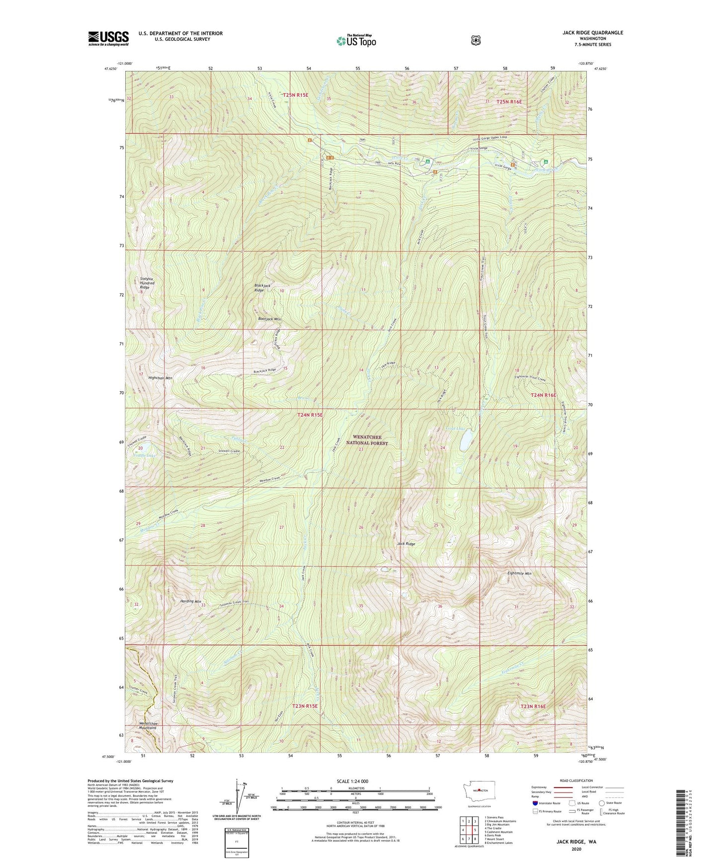
2023 topographic map quadrangle Jack Ridge in the state of Washington. Scale: 1:24000. Based on the newly updated USGS 7.5' US Topo map series, this map is in the following counties: Chelan, Kittitas. The map contains contour data, water features, and other items you are used to seeing on USGS maps, but also has updated roads and other features. This is the next generation of topographic maps. Printed on high-quality waterproof paper with UV fade-resistant inks.
Quads adjacent to this one:
West: The Cradle
Northwest: Stevens Pass
North: Chiwaukum Mountains
Northeast: Big Jim Mountain
East: Cashmere Mountain
Southeast: Enchantment Lakes
South: Mount Stuart
Southwest: Davis Peak
This map covers the same area as the classic USGS quad with code o47120e8.
Contains the following named places: Ben Creek, Black Pine Campground, Black Pine Creek, Blackjack Ridge, Boggy Creek, Bootjack Mountain, Chatter Creek, Chatter Creek Campground, Chatter Guard Station, Cradle Lake, Dunn Creek, Eightmile Mountain, Grindstone Creek, Harding Mountain, Highchair Mountain, Jack Creek, Meadow Camp, Meadow Creek, Pablo Creek, Rock Island Campground, Sixtysix Hundred Ridge, Solomon Creek, Trout Creek, Trout Lake, Trout Lake Campground, Van Epps Mine